- Manitou Beach-Devils Lake, Michigan
-
"Manitou Beach, Michigan" redirects here. For the community in Presque Isle County, see Rogers Township, Michigan.
Manitou Beach-Devils Lake, Michigan — CDP — Location of Manitou Beach-Devils Lake, Michigan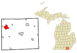
Coordinates: 41°58′32″N 84°17′10″W / 41.97556°N 84.28611°WCoordinates: 41°58′32″N 84°17′10″W / 41.97556°N 84.28611°W Country United States State Michigan Townships Woodstock,
RollinArea – Total 9.7 sq mi (25.2 km2) – Land 7.0 sq mi (18.1 km2) – Water 2.7 sq mi (7.1 km2) Elevation[1] 1,043 ft (318 m) Population (2000) – Total 2,080 – Density 297.3/sq mi (114.8/km2) Time zone Eastern (EST) (UTC-5) – Summer (DST) EDT (UTC-4) ZIP code 49253 Area code(s) 517 FIPS code 26-50830[2] GNIS feature ID 2393118[1] Manitou Beach and Devils Lake are two unincorporated communities in the Irish Hills region of Lenawee County in the U.S. state of Michigan. In order to provide statistical information, the United States Census Bureau has defined Manitou Beach-Devils Lake as a census-designated place (CDP) that includes both communities. The statistical information pertains to the entire CDP, although local understanding of the area making up these communities may vary somewhat from the definition of the CDP. The population of the CDP was 2,080 at the 2000 census.
Devils Lake is at the northern end of Devils Lake on U.S. 223 at 42°00′28″N 84°17′33″W / 42.00778°N 84.2925°W.[3] Manitou Beach is at the southwest end of Devils Lake at 41°58′11″N 84°18′30″W / 41.96972°N 84.30833°W,[4] approximately 2.5 mi (4.0 km) southwest of Devils Lake and about 2 mi (3.2 km) east-southeast of Addison. The CDP also includes the entire shoreline areound Devils Lake and the smaller Round Lake to the southeast.[5] The Manitou Beach post office, with ZIP code 49253, serves most of the area of the CDP except for an area on the southwest north of Manitou Beach Road and south of Bean Creek and a smaller area on the northern end of Devils Lake.[5][6] Both of these areas are served by the Addison ZIP code 49220.[7] The Manitou Beach ZIP code also serves areas beyond the CDP area, including parts of southeast Woodstock Township, southwest Cambridge Township, northeast Rome Township, and central and northeast Rollin Township.[6]
Contents
History
Devil's Lake was a Powtawatamie village until about 1830.[8]
Manitou Beach, first noted by Euro-American settlers in the early 1830s, quickly became a favored resort in southeast Michigan by the turn of the 20th century. It quickly outgrew the comparably sized community of Devils Lake at the north end of the lake. Steam launches ferried tourists from the depot to the hotels and attractions, which included bath houses, a dance pavilion, pleasure craft rental facilities, a water slide, picnic areas and eating establishments. The name 'Manitou Beach' is derived from the Potawatomi name of Devils Lake, "Michemanetue", meaning, "Lake of the (evil) Spirit".
The Manitou Beach post office was established on March 20, 1889, with Columbus F. Becker as the first postmaster. The office was discontinued on December 31, 1892, and reestablished on January 17, 1893.[9] Manitou Beach was also as station on the Cincinnati, Jackson and Mackinaw Railroad (later part of the Cincinnati Northern Railway).[10][11]
Devil's Lake was said to have been named by the Potawatomi leader Meteau (or Mitteau) after his daughter, who was an able swimmer, drowned in the lake and her body was never recovered. Meteau believed her to have been taken by evil spirits. The first white settlers here arrived in 1833. The Devils Lake post office was established on October 19, 1885, with John B. Allen as the first postmaster. The office was discontinued on October 31, 1936.[10][12] The Detroit, Toledo and Milwaukee Railroad had a stop at Devil's Lake.[13][14]
The Manitou Beach region was devastated by an F4 tornado during the Palm Sunday tornado outbreak of April 11, 1965. Most of what was destroyed was rebuilt, including the dance hall and two churches. Over the course of the past four decades, the resort has few reminders of the tornado. A book on the tornado was compiled from 2000 to 2002 by local author Dan Cherry, and published in the summer of 2004.
Other books published on the lake resort include Lake Reflections by Margaret Brighton and the Lakes Preservation League (1996), Ho! For Devils Lake by Barbara Page Roys (1998), and Along the Trails of Michemanetue, released by Cherry in 2009.
In 2010, the community of Manitou Beach continues to draw vacationers, and because of its popularity, one by one the small seasonal cottages are being replaced by large, year-around homes.
The Devils Lake Drive-In-Church, a drive-in movie theater, closed its doors after 58 seasons due to the death of its operator.
The Manitou Beach Inn, a long-time staple of the business community, was destroyed by fire January 3, 2010.[15]
Geography
According to the United States Census Bureau, the CDP has a total area of 9.7 square miles (25.2 km²), of which, 7.0 square miles (18.1 km²) of it is land and 2.7 square miles (7.1 km²) of it (28.13%) is water.
Demographics
As of the census[2] of 2000, there were 2,080 people, 898 households, and 600 families residing in the CDP. The population density was 297.3 per square mile (114.7/km²). There were 1,732 housing units at an average density of 247.5 per square mile (95.5/km²). The racial makeup of the CDP was 98.08% White, 0.19% African American, 0.14% Native American, 0.14% Asian, 0.19% from other races, and 1.25% from two or more races. Hispanic or Latino of any race were 1.25% of the population.
There were 898 households out of which 25.1% had children under the age of 18 living with them, 56.7% were married couples living together, 6.1% had a female householder with no husband present, and 33.1% were non-families. 28.2% of all households were made up of individuals and 10.4% had someone living alone who was 65 years of age or older. The average household size was 2.32 and the average family size was 2.81.
In the CDP the population was spread out with 22.0% under the age of 18, 5.9% from 18 to 24, 27.5% from 25 to 44, 30.5% from 45 to 64, and 14.1% who were 65 years of age or older. The median age was 42 years. For every 100 females there were 102.1 males. For every 100 females age 18 and over, there were 99.0 males.
The median income for a household in the CDP was $37,938, and the median income for a family was $63,810. Males had a median income of $39,375 versus $29,167 for females. The per capita income for the CDP was $24,561. About 4.3% of families and 6.8% of the population were below the poverty line, including 2.6% of those under age 18 and 12.9% of those age 65 or over.
References
- ^ a b U.S. Geological Survey Geographic Names Information System: Manitou Beach-Devils Lake, Michigan
- ^ a b "American FactFinder". United States Census Bureau. http://factfinder.census.gov. Retrieved 2008-01-31.
- ^ U.S. Geological Survey Geographic Names Information System: Devils Lake, Michigan
- ^ U.S. Geological Survey Geographic Names Information System: Manitou Beach, Michigan
- ^ a b Manitou Beach-Devils Lake CDP, Michigan - Reference Map - American FactFinder, U.S. Census Bureau, 2000 census
- ^ a b 49253 5-Digit ZCTA, 492 3-Digit ZCTA - Reference Map - American FactFinder, U.S. Census Bureau, 2000 census
- ^ 49220 5-Digit ZCTA, 492 3-Digit ZCTA - Reference Map - American FactFinder, U.S. Census Bureau, 2000 census
- ^ Helen Hornbeck Tanner. Atlas of Great Lakes Indian History. (Norman: University of Oklahoma Press, 1987) p. 134.
- ^ U.S. Geological Survey Geographic Names Information System: Manitou Beach Post Office
- ^ a b Romig, Walter (1986) [1973]. Michigan Place Names. Detroit, Michigan: Wayne State University Press. ISBN 0-8143-1838-X.
- ^ Manitou Beach, Michigan Station, Michigan's Internet Railroad History Museum
- ^ U.S. Geological Survey Geographic Names Information System: Devils Lake Post Office (historical)
- ^ Detroit, Toledo and Milwaukee Railroad Map circa. 1916, Michigan's Internet Railroad History Museum
- ^ Detroit, Toledo & Milwaukee Railroad, Michigan's Internet Railroad History Museum
- ^ http://www.lenconnect.com/features/x370509933/Fire-destroys-Manitou-Beach-business
External links
- Lenawee County government site
- Lakes Preservation League website
- Complete text of History of Lenawee County published in 1909 by the Western Historical Society
- Rollin Township government site
Municipalities and communities of Lenawee County, Michigan Cities 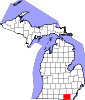
Villages Addison | Blissfield | Britton | Cement City‡ | Clayton | Clinton | Deerfield | Onsted
Charter
townshipsGeneral law
townshipsUnincorporated
communitiesJasper | Manitou Beach-Devils Lake | Springville | Tipton | Weston
Footnotes ‡This populated place also has portions in an adjacent county or counties
Categories:- Unincorporated communities in Lenawee County, Michigan
- Census-designated places in Michigan


Wikimedia Foundation. 2010.