- Leyden, Massachusetts
Infobox Settlement
official_name = Leyden, Massachusetts
nickname =
motto =
imagesize =
image_caption = Frizzell Hill, looking west towards the town center
image_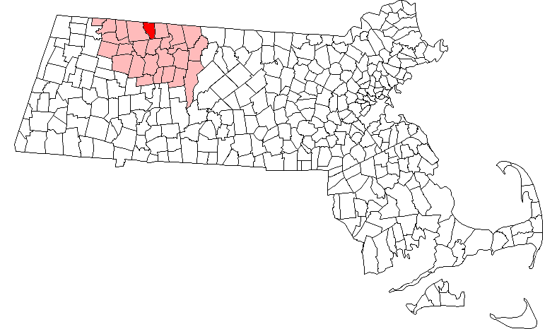
mapsize = 250px
map_caption = Location in Franklin County in Massachusetts
mapsize1 =
map_caption1 =
subdivision_type = Country
subdivision_name =United States
subdivision_type1 = State
subdivision_name1 =Massachusetts
subdivision_type2 = County
subdivision_name2 = Franklin
established_title = Settled
established_date = 1738
established_title2 = Incorporated
established_date2 = 1809
established_title3 =
established_date3 =
government_type =Open town meeting
leader_title =
leader_name =
leader_title1 =
leader_name1 =
area_magnitude =
area_total_km2 = 46.6
area_total_sq_mi = 18.0
area_land_km2 = 46.6
area_land_sq_mi = 18.0
area_water_km2 = 0.0
area_water_sq_mi = 0.0
population_as_of = 2000
settlement_type = Town
population_total = 772
population_density_km2 = 16.6
population_density_sq_mi = 42.9
elevation_m = 283
timezone = Eastern
utc_offset = -5
timezone_DST = Eastern
utc_offset_DST = -4
elevation_ft = 928
latd = 42 |latm = 41 |lats = 54 |latNS = N
longd = 72 |longm = 37 |longs = 39 |longEW = W
website = http://www.townofleyden.com/
postal_code_type = ZIP code
postal_code = 01337
area_code = 413
blank_name = FIPS code
blank_info = 25-35285
blank1_name = GNIS feature ID
blank1_info = 0618169
footnotes =Leyden is a town in Franklin County,
Massachusetts ,United States . The population was 772 at the 2000 census. It is part of theSpringfield, Massachusetts Metropolitan Statistical Area.History
Leyden was first settled in 1737 as part of "Fall Town," which also included Bernardston and Colrain. The town was set off from Bernardstown in 1784, but it was not incorporated until
February 22 ,1809 . The town was named for the town ofLeiden , Netherlands, refuge of thePilgrims before coming to the New World. Leyden had several small industries in the eighteenth century, including grist mills, wood product mills, and dairying, but today the largest industry is maple sugar production. The town also has a reservoir which supplies the town of Greenfield. [ [http://www.co.franklin.ma.us/leyden.html Town of Leyden - Franklin County Chamber of Commerce] ]Geography
According to the
United States Census Bureau , the town has a total area of 18.0square mile s (46.6km² ), of which, 18.0 square miles (46.6 km²) of it is land and 0.06% is water. Leyden lies on the northern Massachusetts border, south of Windham County,Vermont . The town is bordered by Guilford,Vermont to the north, Bernardston to the east, Greenfield to the south, and Colrain to the west. The town center lies nine miles north of Greenfield, 47 miles north of Springfield, and 96 miles west-northwest of Boston.Leyden lies along the eastern edge of
the Berkshires , with the town mostly lying along the valleys of the Green River (which also forms the western border) and the branches of the Glen Brook. The majority of the town away from the brooks is forested, and the town has a small state forest and a wildlife management area within its borders. The confluence of the main and east branches of Glen Brook is dammed to form the Greenfield Reservoir, before the book flows southward into Greenfield and meets the Green River.Leyden is one of only a handful of towns in Massachusetts which does not have any state routes (nearly half of which are the island towns on
Nantucket ,Martha's Vineyard and theElizabeth Islands ). There are state routes, U.S. routes and interstates in the neighboring towns, withInterstate 91 passing to the south and east of town. The nearest bus service is in Greenfield, with the nearest passenger train service in Springfield and Pittsfield, and the nearest small air service in Turners Falls. The nearest national air service is atBradley International Airport in Windsor Locks,Connecticut .Demographics
As of the
census GR|2 of 2000, there were 772 people, 277 households, and 219 families residing in the town. By population, Leyden ranked 22nd out of the 26 towns in Franklin County, and 333rd out of 351 cities and towns in Massachusetts. Thepopulation density was 42.9 people per square mile (16.6/km²), which ranked 18th in the county and 316th in the Commonwealth. There were 306 housing units at an average density of 17.0/sq mi (6.6/km²). The racial makeup of the town was 98.45% White, 0.39% African American, 0.26% Native American, 0.13% Asian, and 0.78% from two or more races. Hispanic or Latino of any race were 0.26% of the population.There were 277 households out of which 37.5% had children under the age of 18 living with them, 68.2% were married couples living together, 6.1% had a female householder with no husband present, and 20.6% were non-families. 16.2% of all households were made up of individuals and 4.7% had someone living alone who was 65 years of age or older. The average household size was 2.78 and the average family size was 3.08.
In the town the population was spread out with 26.9% under the age of 18, 6.1% from 18 to 24, 28.5% from 25 to 44, 30.7% from 45 to 64, and 7.8% who were 65 years of age or older. The median age was 40 years. For every 100 females there were 102.1 males. For every 100 females age 18 and over, there were 102.2 males.
The median income for a household in the town was $50,385, and the median income for a family was $53,750. Males had a median income of $40,192 versus $29,659 for females. The
per capita income for the town was $26,076. About 3.4% of families and 4.7% of the population were below thepoverty line , including 7.7% of those under age 18 and 3.0% of those age 65 or over.Government
Leyden employs the
open town meeting form of government, and is led by aboard of selectmen and an administrative assistant. Leyden has its own police and fire departments, as well as a library connected to the regional library network and a post office. The nearest hospital, Franklin Medical Center, is in neighboring Greenfield, as are most of the nearest state services.On the state level, Leyden is represented in the
Massachusetts House of Representatives by the Second Berkshire district, which covers central Berkshire County, as well as portions of Hampshire and Franklin Counties. In theMassachusetts Senate , the town is represented by the Hampshire and Franklin district, which includes most of eastern Franklin County and much of eastern Hampshire County. [ [http://www.mass.gov/legis/city_town.htm List of Massachusetts Legislators by City and Town] ] The town is patrolled by the Second (Shelburne Falls) Station of Troop "B" of theMassachusetts State Police . [ [http://www.mass.gov/?pageID=eopsterminal&L=5&L0=Home&L1=Law+Enforcement+%26+Criminal+Justice&L2=Law+Enforcement&L3=State+Police+Troops&L4=Troop+B&sid=Eeops&b=terminalcontent&f=msp_divisions_field_services_troops_troop_b_msp_field_troop_b_station_b2&csid=Eeops Station B-2, SP Shelburne Falls] ]On the national level, Leyden is represented in the
United States House of Representatives as part ofMassachusetts's 1st congressional district , and has been represented byJohn Olver of Amherst since June 1991. Massachusetts is represented in theUnited States Senate by senior SenatorTed Kennedy and junior SenatorJohn Kerry .Education
Leyden is a member of the Pioneer Valley Regional School District, which includes several northern border towns to the east. The district is essentially operated in two portions; the towns each have their own semi-independent elementary schools, with students attending Pioneer Valley Regional High School in Northfield from seventh through twelfth grades. Students in Leyden attend the Pearl E. Rhodes Elementary School from pre-kindergarten through sixth grade. There are private, parochial and charter schools in Greenfield and other nearby communities, with the most prominent private school being
Northfield Mount Hermon School in nearby Gill.The nearest community college,
Greenfield Community College , is located in Greenfield. The nearest state college isMassachusetts College of Liberal Arts in North Adams, and the nearest state university is theUniversity of Massachusetts Amherst . The nearest private colleges, including members of the Five Colleges and Seven Sisters, are located southeast in the Northampton area.Notable Residents
*
John Leonard Riddell (1807-1865), noted scientist, author and politician, invented the binocular microscope [Ibid. 1.] and was melter and refiner at theNew Orleans Mint during theAmerican Civil War .
*Henry Kirke Brown (1814-1886), American sculptor, most notably for the equestrian statues ofWinfield Scott in Scott Cirlce,Washington, D.C. andGeorge Washington at Union Square inNew York City .References
Wikimedia Foundation. 2010.