- West Tisbury, Massachusetts
Infobox Settlement
official_name = West Tisbury, Massachusetts
nickname =
motto =
imagesize =
image_caption =
image_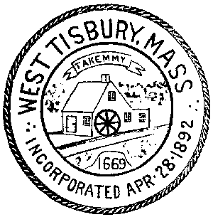
mapsize = 250px
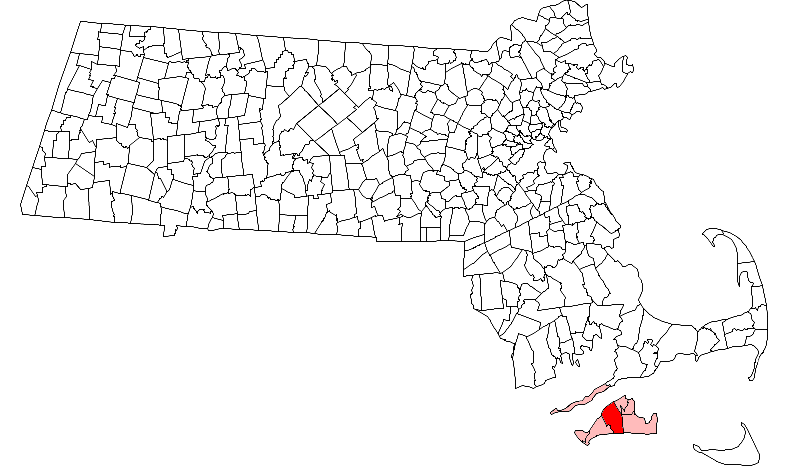
map_caption = Location in Dukes County in Massachusetts
mapsize1 =
map_caption1 =
subdivision_type = Country
subdivision_name =United States
subdivision_type1 = State
subdivision_name1 =Massachusetts
subdivision_type2 = County
subdivision_name2 = Dukes
established_title = Settled
established_date = 1669
established_title2 = Incorporated
established_date2 = 1892
established_title3 =
established_date3 =
government_type =Open town meeting
leader_title =
leader_name =
leader_title1 =
leader_name1 =
area_magnitude =
area_total_km2 = 108.1
area_total_sq_mi = 41.7
area_land_km2 = 64.8
area_land_sq_mi = 25.0
area_water_km2 = 43.3
area_water_sq_mi = 16.7
population_as_of = 2000
settlement_type = Town
population_total = 2467
population_density_km2 = 38.1
population_density_sq_mi = 98.6
elevation_m = 11
elevation_ft = 37
timezone = Eastern
utc_offset = -5
timezone_DST = Eastern
utc_offset_DST = -4
latd = 41 |latm = 22 |lats = 52 |latNS = N
longd = 70 |longm = 40 |longs = 30 |longEW = W
website = http://www.town.west-tisbury.ma.us/
postal_code_type = ZIP code
postal_code = 02575
area_code = 508 / 774
blank_name = FIPS code
blank_info = 25-78235
blank1_name = GNIS feature ID
blank1_info = 0618291
footnotes =West Tisbury is a town located on
Martha's Vineyard in Dukes County,Massachusetts ,United States . The population was 2,467 at the 2000 census. Along with Chilmark and Aquinnah, West Tisbury forms "Up-Island" Martha's Vineyard. The town has been called the "Athens" of the island. [http://www.mvgazette.com/travel/towns/history_west_tisbury.php] [http://www.somoco.com/where/sub1/about_the_vineyard.html]History
West Tisbury was first settled by English settlers in 1669 as part of the town of Tisbury. The town was officially incorporated in 1892, the last town on Martha's Vineyard to be incorporated. Despite its separation from Tisbury, the original settlement of the town is still located in West Tisbury. Historically, it has been the agricultural heartland of the island. Up through the 1980's West Tisbury was one of the quickest growing communities on the island, mainly due to the large influx of hippies. This influx is still evident today as the town maintains a far-left leaning.
Geography
According to the
United States Census Bureau , the town has a total area of 41.7square mile s (108.1km² ), of which, 25.0 square miles (64.8 km²) of it is land and 16.7 square miles (43.3 km²) of it (40.08%) is water. Statistically, West Tisbury ranks 123rd out of 351 communities in the Commonwealth in terms of land area, and is the second largest town (behind Edgartown) on the Vineyard. West Tisbury is bordered byVineyard Sound to the northwest, Tisbury to the northeast, Edgartown to the east, theAtlantic Ocean to the south, and Chilmark to the west, and includes the regions known asLambert's Cove andMakonikey . The town also shares a common corner with Oak Bluffs, where the two towns meet with Tisbury and Edgartown.Tisbury is mostly rural, with more forestation to the north and east and most of the town's agrarian areas around the brooks that feed into Tisbury Great Pond and its surrounding ponds. The Sound side of town also has several ponds; none are nearly the size of the Atlantic side ones. There are several refuges and reservations around town, the largest being the Long Point Wildlife Refuge just east of Tisbury Great Pond. The town is also home to approximately half of the Manuel F. Correllus State Forest, which dominates the center of the island.
Just south of the forest lies
Martha's Vineyard Airport , which the town shares with Edgartown (although the facilities are mostly in West Tisbury). The airport provides regional service to airports on the mainland and at Nantucket.Demographics
As of the
census GR|2 of 2000, there were 2,467 people, 1,034 households, and 668 families residing in the town. Thepopulation density was 98.6 people per square mile (38.1/km²). There were 1,849 housing units at an average density of 73.9/sq mi (28.5/km²). The racial makeup of the town was 96.23% White, 0.69% African American, 0.20% Native American, 0.36% Asian, 0.28% Pacific Islander, 0.49% from other races, and 1.74% from two or more races. Hispanic or Latino of any race were 0.69% of the population.There were 1,034 households out of which 35.1% had children under the age of 18 living with them, 49.4% were married couples living together, 11.3% had a female householder with no husband present, and 35.3% were non-families. 26.9% of all households were made up of individuals and 7.1% had someone living alone who was 65 years of age or older. The average household size was 2.38 and the average family size was 2.89.
In the town the population was spread out with 25.7% under the age of 18, 4.4% from 18 to 24, 27.4% from 25 to 44, 32.4% from 45 to 64, and 10.1% who were 65 years of age or older. The median age was 41 years. For every 100 females there were 97.7 males. For every 100 females age 18 and over, there were 93.3 males.
The median income for a household in the town was $54,077, and the median income for a family was $59,514. Males had a median income of $42,813 versus $29,907 for females. The
per capita income for the town was $31,021. About 1.6% of families and 2.4% of the population were below thepoverty line , including 1.9% of those under age 18 and 1.2% of those age 65 or over.Statistically, West Tisbury ranks 281st in terms of population, and 282nd in terms of population density in the state. It has the fourth-largest population and population density on the island, and the smallest of the populations in the thousands. (Aquinnah and Chilmark's populations number in the hundreds, and Gosnold, at 86, is the smallest community in the Commonwealth.)
Government
On the national level, West Tisbury is a part of
Massachusetts's 10th congressional district , and is currently represented byBill Delahunt . The state's senior (Class I) member of theUnited States Senate , re-elected in 2006, isTed Kennedy . The junior (Class II) Senator, up for re-election in 2008, isJohn Kerry .On the state level, West Tisbury is represented in the
Massachusetts House of Representatives as a part of the Barnstable, Dukes and Nantucket district, which includes all of Martha's Vineyard and Nantucket, as well as a portion of Falmouth. The town is represented in theMassachusetts Senate as a portion of the Cape and Islands district, which includes all of Martha's Vineyard, Nantucket and most of Barnstable County (with the exception of Bourne, Sandwich, Falmouth and a portion of Barnstable. [ [http://www.mass.gov/legis/citytown.htm Index of Legislative Representatives by City and Town] ] . All of Dukes County is patrolled by the Fifth (Oak Bluffs) Barracks of Troop D of theMassachusetts State Police . [ [http://www.mass.gov/?pageID=eopsterminal&L=5&L0=Home&L1=Law+Enforcement+%26+Criminal+Justice&L2=Law+Enforcement&L3=State+Police+Troops&L4=Troop+D&sid=Eeops&b=terminalcontent&f=msp_divisions_field_services_troops_troop_d_msp_field_troop_d_station_d5&csid=Eeops Station D-5, SP Oak Bluffs] ]West Tisbury is governed on the local level by the
open town meeting form of government, and is led by aboard of selectmen . The police station is located behind the town hall, and the town has two fire stations, located near the forest and in North Tisbury. The post office is located north of North Tisbury, and the West Tisbury Free Public Library is located just north of the town center.Education
West Tisbury is a part of the Martha's Vineyard Regional School District. The West Tisbury Elementary School serves the town's approximately 275 students from pre-kindergarten through eighth grade. The town's high school students attend
Martha's Vineyard Regional High School , located in Oak Bluffs. West Tisbury is also home to the Martha's Vineyard Public Charter School, which offers K-12 education.Points of interest
*
Polly Hill Arboretum
* [http://www.mvpreservation.org/grange.html|The Grange Hall]
* [http://www.mvol.com/virtualtours/Up-Island/36/109/enter.html|Alley's General Store]
* Waskosim's Rock
* Split Rockee also
* [http://www.mvpcs.org Martha's VIneyard Public Charter School]
References
Wikimedia Foundation. 2010.