- Nostang
-
Nostang
Lostenk
 NostangLocation within Brittany region
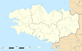 Nostang
Administration Country France Region Brittany Department Morbihan Arrondissement Lorient Canton Port-Louis Intercommunality Blavet Bellevue Océan Mayor Jean-Pierre Gourden
(2008—2014)Statistics Elevation 0–53 m (0–174 ft) Land area1 15.71 km2 (6.07 sq mi) Population2 1,088 (1999) - Density 69 /km2 (180 /sq mi) INSEE/Postal code 56148/ 56690 1 French Land Register data, which excludes lakes, ponds, glaciers > 1 km² (0.386 sq mi or 247 acres) and river estuaries. 2 Population without double counting: residents of multiple communes (e.g., students and military personnel) only counted once. Coordinates: 47°45′02″N 3°11′11″W / 47.7505555556°N 3.18638888889°W
Nostang (Breton: Lostenk) is a commune in the Morbihan department of Brittany in north-western France.
Contents
Demographics
Inhabitants of Nostang are called in French Nostangais.
See also
References
External links
- French Ministry of Culture list for Nostang (French)
- Map of Nostang on Michelin (English)
Categories:- Communes of Morbihan
- Morbihan geography stubs


Wikimedia Foundation. 2010.