- Middletown, Maryland
-
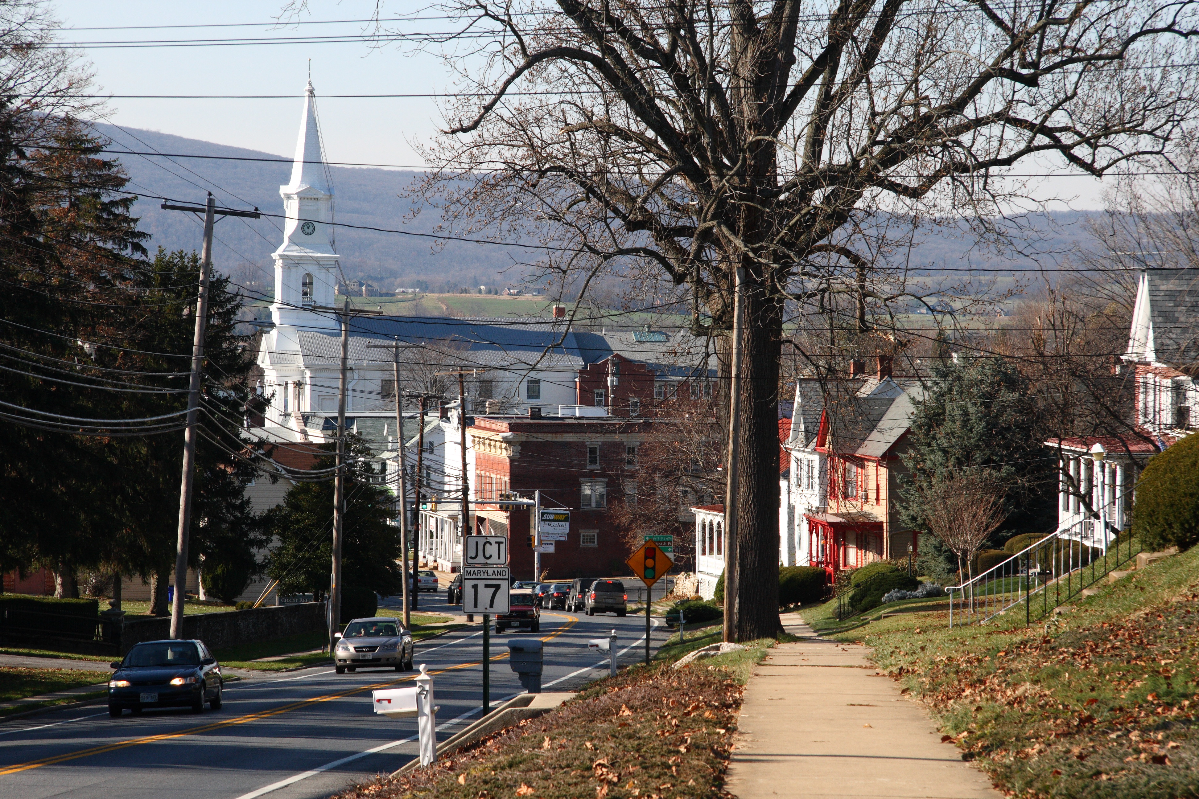
Middletown, Maryland — Town — Main Street, Middletown Location of Middletown, Maryland
Coordinates: 39°26′28″N 77°32′38″W / 39.44111°N 77.54389°WCoordinates: 39°26′28″N 77°32′38″W / 39.44111°N 77.54389°W Country United States State Maryland County Frederick Area - Total 1.7 sq mi (4.4 km2) - Land 1.7 sq mi (4.4 km2) - Water 0.0 sq mi (0.0 km2) Elevation 564 ft (172 m) Population (2000) - Total 2,668 - Density 1,577.3/sq mi (609.0/km2) Time zone Eastern (EST) (UTC-5) - Summer (DST) EDT (UTC-4) ZIP code 21769 Area code(s) 301 FIPS code 24-52425 GNIS feature ID 0585831 Middletown is a town in Frederick County, Maryland, United States. The population was 2,668 at the 2000 census. Middletown is a small, rural community steeped in American history. Located in the beautiful Middletown Valley that stretches between the Catoctin Mountains on the east and South Mountain on the west, the town reportedly gained its name from its location midway between those ranges.
Contents
History
A young Lieutenant George Washington, while surveying the South Mountain area, reported that the valley to the east was one of the most beautiful places he had ever seen. Later, as a Colonel in 1755, he was to accompany General Braddock on the old Indian Trail that ran through the valley on his way to Fort Cumberland.
The early German and English settlers started to arrive in the valley in the 1730s. Among them was Michael Jesserong, who paid £66 for 50 acres (200,000 m2). He named his property Middletown and sold the first lots there in 1767, the date officially marked as that of the town’s founding.
The history of Middletown is a mirror on the nation’s development. Main Street spread to the west with construction of the National Pike through the town in 1806; the telegraph lines from Frederick to Hagerstown were routed through Middletown in 1854; and in 1896, car 11 of the Frederick Middletown Railway made its first run to Middletown. During the Civil War, both armies passed through the town to the battles of South Mountain and Antietam. In the aftermath of those battles, Middletown opened its churches and homes to care for the wounded.
Geography
Middletown is located at 39°26′28″N 77°32′38″W / 39.44111°N 77.54389°W (39.441155, -77.543761)[1].
According to the United States Census Bureau, the town has a total area of 1.7 square miles (4.4 km2), all of it land.
Demographics
As of the census[2] of 2000, there were 2,668 people, 960 households, and 728 families residing in the town. The population density was 1,577.3 people per square mile (609.5/km²). There were 981 housing units at an average density of 580.0 per square mile (224.1/km²). The racial makeup of the town was 96.89% White, 1.46% African American, 0.07% Native American, 0.34% Asian, 0.22% from other races, and 1.01% from two or more races. Hispanic or Latino of any race were 0.82% of the population.
There were 960 households out of which 44.6% had children under the age of 18 living with them, 63.6% were married couples living together, 8.6% had a female householder with no husband present, and 24.1% were non-families. 18.9% of all households were made up of individuals and 8.9% had someone living alone who was 65 years of age or older. The average household size was 2.78 and the average family size was 3.21.
In the town the population was spread out with 32.0% under the age of 18, 5.4% from 18 to 24, 29.9% from 25 to 44, 21.7% from 45 to 64, and 11.0% who were 65 years of age or older. The median age was 36 years. For every 100 females there were 91.8 males. For every 100 females age 18 and over, there were 87.6 males.
The median income for a household in the town was $67,266, and the median income for a family was $80,115. Males had a median income of $48,864 versus $31,602 for females. The per capita income for the town was $25,759. About 1.8% of families and 3.0% of the population were below the poverty line, including 2.1% of those under age 18 and 8.5% of those age 65 or over.
References
- ^ "US Gazetteer files: 2010, 2000, and 1990". United States Census Bureau. 2011-02-12. http://www.census.gov/geo/www/gazetteer/gazette.html. Retrieved 2011-04-23.
- ^ "American FactFinder". United States Census Bureau. http://factfinder.census.gov. Retrieved 2008-01-31.
External links
Municipalities and communities of Frederick County, Maryland Cities 
Towns Burkittsville | Emmitsburg | Middletown | Mount Airy‡ | Myersville | New Market | Thurmont | Walkersville | Woodsboro
Village CDPs Other
communitiesAdamstown | Buckeystown | Catoctin Furnace | Creagerstown | Fairhaven | Fairview | Graceham | Ijamsville | Jefferson | Johnsville | Knoxville | Ladiesburg | Lewistown | Libertytown | Lake Linganore | Monrovia | New London | New Midway | Point of Rocks | Rocky Ridge | Sabillasville | Sherwood Forest | Spoolsville | Sunny Side | Tuscarora | Unionville | Urbana | Wolfsville
Footnotes ‡This populated place also has portions in an adjacent county or counties
Categories:- Towns in Maryland
- Populated places in Frederick County, Maryland


Wikimedia Foundation. 2010.