- Walkersville, Maryland
Infobox Settlement
official_name = Walkersville, Maryland
settlement_type =Town
nickname =
motto =
imagesize =
image_caption =
image_
imagesize =
image_caption =
image_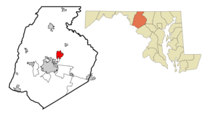
mapsize = 250x200px
map_caption = Location of Walkersville, Maryland
mapsize1 =
map_caption1 =subdivision_type = Country
subdivision_name =United States
subdivision_type1 = State
subdivision_name1 =Maryland
subdivision_type2 = County
subdivision_name2 = Frederick
government_footnotes =
government_type =
leader_title =
leader_name =
leader_title1 =
leader_name1 =
established_title =
established_date =unit_pref = Imperial
area_footnotes =area_magnitude =
area_total_km2 = 11.2
area_land_km2 = 11.2
area_water_km2 = 0.0
area_total_sq_mi = 4.3
area_land_sq_mi = 4.3
area_water_sq_mi = 0.0population_as_of = 2000
population_footnotes =
population_total = 5192
population_density_km2 = 463.3
population_density_sq_mi = 1200.0timezone = Eastern (EST)
utc_offset = -5
timezone_DST = EDT
utc_offset_DST = -4
elevation_footnotes =
elevation_m = 94
elevation_ft = 308
latd = 39 |latm = 29 |lats = 5 |latNS = N
longd = 77 |longm = 20 |longs = 56 |longEW = Wpostal_code_type =
ZIP code
postal_code = 21793
area_code = 301
blank_name = FIPS code
blank_info = 24-81275
blank1_name = GNIS feature ID
blank1_info = 0588023
website =
footnotes =Walkersville is a town in Frederick County,
Maryland ,United States . The population was 5,192 at the 2000 census.Geography
Walkersville is located at coor dms|39|29|5|N|77|20|56|W|city (39.484846, -77.348943)GR|1.
According to the
United States Census Bureau , the town has a total area of 4.3square mile s (11.2km² ).Nearly all of it is land. Only 0.23% is water.Demographics
As of the
census GR|2 of 2000, there were 5,192 people, 1,750 households, and 1,412 families residing in the town. Thepopulation density was 1,200.0 people per square mile (463.0/km²). There were 1,793 housing units at an average density of 414.4/sq mi (159.9/km²). The racial makeup of the town was 95.11% White, 1.95% African American, 0.08% Native American, 1.19% Asian, 0.48% from other races, and 1.19% from two or more races. Hispanic or Latino of any race were 1.64% of the population.There were 1,750 households out of which 46.4% had children under the age of 18 living with them, 67.4% were married couples living together, 9.9% had a female householder with no husband present, and 19.3% were non-families. 15.3% of all households were made up of individuals and 6.2% had someone living alone who was 65 years of age or older. The average household size was 2.90 and the average family size was 3.23.
In the town the population was spread out with 30.5% under the age of 18, 7.3% from 18 to 24, 28.4% from 25 to 44, 23.1% from 45 to 64, and 10.7% who were 65 years of age or older. The median age was 36 years. For every 100 females there were 91.7 males. For every 100 females age 18 and over, there were 87.8 males.
The median income for a household in the town was $65,581, and the median income for a family was $69,476. Males had a median income of $47,309 versus $31,817 for females. The
per capita income for the town was $24,103. About 2.1% of families and 2.4% of the population were below thepoverty line , including 2.3% of those under age 18 and 4.0% of those age 65 or over.Community
There are four
schools in the town of Walkersville: Glade Elementary, Walkersville Elementary, Walkersville Middle, and Walkersville High. The mascot of Glade Elementary is the jaguar. The mascot of the other schools is the Walkersville lion and the rival school are the Middletown Knights. There is also an Adult Education center on W. Frederick St., across from the middle school.Some activities in Walkersville are participating in the Glade Valley Athletic Association (GVAA) where kids 5-16 can participate in field hockey, baseball, soccer, basketball, football, lacrosse, and volleyball.
Walkersville has a
fire hall , where various activities are held, including cookouts, auctions, and the annual Volunteer Fire Company Carnival which occurs over the week of July 4.Town meetings are held at the Town Hall on the first and third Wednesdays of each month.
The town also includes a variety of shops, including
Safeway ,Bloom ,Sheetz ,Olde Towne Jewelers , and various others. Fast food establishments includes aMcDonald's ,Pizza Hut , and Subway.Walkersville is served by
TransIt , the Frederick County bus system.In May 2008, Walkersville commissioners passed Resolution 2008-4 becoming the second town in Maryland to adopt English as the town's official language. [http://www.walkersville-md.com/meetings/Mtgmin052808.htm]
References
External links
Wikimedia Foundation. 2010.