- Searsmont, Maine
Infobox Settlement
official_name = Searsmont, Maine
settlement_type = Town
nickname =
motto =
imagesize =
image_caption =
image_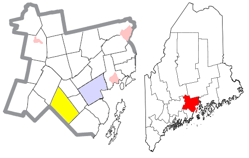
mapsize = 250px
map_caption = Location of Searsmont (in yellow) in Waldo County and the state of Maine
mapsize1 =
map_caption1 =subdivision_type = Country
subdivision_name =United States
subdivision_type1 = State
subdivision_name1 =Maine
subdivision_type2 = County
subdivision_name2 = Waldo
government_footnotes =
government_type =
leader_title =
leader_name =
leader_title1 =
leader_name1 =
established_title =
established_date =unit_pref = Imperial
area_footnotes =area_magnitude =
area_total_km2 = 101.5
area_land_km2 = 97.9
area_water_km2 = 3.7
area_total_sq_mi = 39.2
area_land_sq_mi = 37.8
area_water_sq_mi = 1.4population_as_of = 2000
population_footnotes =
population_total = 1174
population_density_km2 = 12.0
population_density_sq_mi = 31.1timezone = Eastern (EST)
utc_offset = -5
timezone_DST = EDT
utc_offset_DST = -4
elevation_footnotes =
elevation_m = 63
elevation_ft = 207
latd = 44 |latm = 22 |lats = 10 |latNS = N
longd = 69 |longm = 11 |longs = 18 |longEW = Wpostal_code_type =
ZIP code
postal_code = 04973
area_code = 207
blank_name = FIPS code
blank_info = 23-66565
blank1_name = GNIS feature ID
blank1_info = 0582715
website =
footnotes =Searsmont is a town in Waldo County,
Maine ,United States . The population was 1,174 at the 2000 census.Geography
According to the
United States Census Bureau , the town has a total area of 39.2square mile s (101.5km² ), of which, 37.8 square miles (97.9 km²) of it is land and 1.4 square miles (3.7 km²) of it (3.60%) is water.Demographics
As of the
census GR|2 of 2000, there were 1,174 people, 478 households, and 319 families residing in the town. Thepopulation density was 31.1 people per square mile (12.0/km²). There were 617 housing units at an average density of 16.3/sq mi (6.3/km²). The racial makeup of the town was 98.55% White, 0.77% Native American, 0.09% Asian, 0.09% from other races, and 0.51% from two or more races. Hispanic or Latino of any race were 0.68% of the population.There were 478 households out of which 29.9% had children under the age of 18 living with them, 54.8% were married couples living together, 8.2% had a female householder with no husband present, and 33.1% were non-families. 23.8% of all households were made up of individuals and 6.5% had someone living alone who was 65 years of age or older. The average household size was 2.46 and the average family size was 2.91.
In the town the population was spread out with 24.9% under the age of 18, 6.1% from 18 to 24, 31.9% from 25 to 44, 26.3% from 45 to 64, and 10.7% who were 65 years of age or older. The median age was 38 years. For every 100 females there were 100.7 males. For every 100 females age 18 and over, there were 97.8 males.
The median income for a household in the town was $36,708, and the median income for a family was $40,000. Males had a median income of $28,088 versus $24,750 for females. The
per capita income for the town was $18,118. About 7.0% of families and 8.4% of the population were below thepoverty line , including 3.9% of those under age 18 and 14.5% of those age 65 or over.Brief History
Ben Ames Williams called it Fraternity Village, the Indians called it Quantabacook, and we know our community today as Searsmont. Located in south-central Waldo County on the banks of the St. George River, Searsmont lies at the junction of several well-marked Indian trails. The town spreads over approximately 40 square miles.
Settled around 1780, Searsmont was named after David Sears of Boston, a proprietor of many lands in the area. Searsmont was known for its white pine timber and water resources. The first lumber mills were built before 1800 in North Searsmont.
Today, Searsmont continues its lumbering heritage with two mills in town.
Searsmont's community center houses the town office, the library, the historical society, a community meeting room, a youth room, and storage facilities.
References in popular culture
Searsmont is the home of Victoria Pratt in the popular NBC science fiction drama "Heroes".
References
Wikimedia Foundation. 2010.