- Dennistown, Maine
-
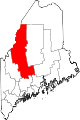
Dennistown, Maine — Plantation — Location within the state of Maine
 Dennistown, Maine
Coordinates: 45°40′50″N 70°18′49″W / 45.68056°N 70.31361°W Country United States State Maine County Somerset Area – Total 40.6 sq mi (105.1 km2) – Land 38.8 sq mi (100.4 km2) – Water 1.8 sq mi (4.7 km2) Elevation 1,453 ft (443 m) Population (2000) – Total 30 – Density 0.8/sq mi (0.3/km2) Time zone Eastern (EST) (UTC-5) – Summer (DST) EDT (UTC-4) ZIP code 04945 Area code(s) 207 FIPS code 23-17285 GNIS feature ID 0582439 Dennistown is a plantation in Somerset County, Maine, United States. The population was 30 at the 2000 census.
Geography
According to the United States Census Bureau, the plantation has a total area of 40.6 square miles (105 km2), of which, 38.8 square miles (100 km2) of it is land and 1.8 square miles (4.7 km2) of it (4.46%) is water.
Demographics
As of the census[1] of 2000, there were 30 people, 10 households, and 9 families residing in the plantation. The population density was 0.8 people per square mile (0.3/km²). There were 38 housing units at an average density of 1.0 per square mile (0.4/km²). The racial makeup of the plantation was 100.00% White.
There were 10 households out of which 30.0% had children under the age of 18 living with them, 80.0% were married couples living together, 10.0% had a female householder with no husband present, and 10.0% were non-families. 10.0% of all households were made up of individuals and none had someone living alone who was 65 years of age or older. The average household size was 3.00 and the average family size was 3.11.
In the plantation the population was spread out with 23.3% under the age of 18, 6.7% from 18 to 24, 23.3% from 25 to 44, 40.0% from 45 to 64, and 6.7% who were 65 years of age or older. The median age was 40 years. For every 100 females there were 130.8 males. For every 100 females age 18 and over, there were 109.1 males.
The median income for a household in the plantation was $85,889, and the median income for a family was $85,889. Males had a median income of $56,250 versus $38,750 for females. The per capita income for the plantation was $28,085. None of the population and none of the families were below the poverty line.
References
- ^ "American FactFinder". United States Census Bureau. http://factfinder.census.gov. Retrieved 2008-01-31.
Municipalities and communities of Somerset County, Maine Towns Anson | Athens | Bingham | Cambridge | Canaan | Caratunk | Cornville | Detroit | Embden | Fairfield | Harmony | Hartland | Jackman | Madison | Mercer | Moose River | Moscow | New Portland | Norridgewock | Palmyra | Pittsfield | Ripley | St. Albans | Skowhegan | Smithfield | Solon | Starks
Plantations Brighton Plantation | Dennistown | Highland Plantation | Pleasant Ridge Plantation | The Forks | West Forks
Unorganized
territoriesCDPs Anson | Bingham | Fairfield | Hartland | Madison | Norridgewock | Pittsfield | Skowhegan
Other
villagesFlagstaff | North Anson | Rockwood
Coordinates: 45°40′37″N 70°16′59″W / 45.67694°N 70.28306°W
Categories:- Plantations in Somerset County, Maine


Wikimedia Foundation. 2010.