Dongqiao

Dongqiao

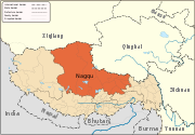
Dongqiao is a village in the Tibet Autonomous Region of China in northern Tibet north of Lhasa. It lies at an altitude of 4652 metres (15,265 feet). The village has a population of about 155 people.

It lies approximately 14.6 miles west of Sima.

See also

  • List of towns and villages in Tibet

External links and references

Coordinates: 31°56′N 90°47′E / 31.933°N 90.783°E / 31.933; 90.783


Wikimedia Foundation. 2010.

Игры ⚽ Нужно решить контрольную?

Look at other dictionaries:

  • Dongqiao — 1 Original name in latin Dongqiao Name in other language Dongqiao, Dongqiao Zhen, Tung ch iao, Tung ch’iao, dong qiao, dong qiao zhen State code CN Continent/City Asia/Shanghai longitude 31.19322 latitude 112.83118 altitude 109 Population 0 Date… …   Cities with a population over 1000 database

  • Zhongxiang — (Traditional Chinese: 鐘祥, Simplified Chinese: 钟祥) is a county level city of Jingmen, Hubei province of the People s Republic of China.Zhongxiang is a famous historic and cultural cities in China. History Zhongxiang is one of the cradles of the… …   Wikipedia

  • Nagqu Prefecture — in Tibet Autonomous Region Nagqu Prefecture (also Naqu or Nagchu); Tibetan: ནག་ཆུ་ས་ཁུལ་; Wylie: Nag chu Sa khul; simplified Chinese: 那曲地区; pinyin: Nàqū Dìqū) is the largest prefecture of the Tibet Autonomous Region …   Wikipedia

  • 1939–1940 Winter Offensive — Warbox conflict=1939 40 Winter Offensive partof=Second Sino Japanese War date=Late Nov. 1, 1939 to Late March 1940 place=Vicinities of Anhui, Guangdong, Hubei, Henan, Hunan, Jiangxi, Shanxi, Shandong, Suiyuan result= Japanese Victory… …   Wikipedia

  • Arza —   Township   …   Wikipedia

  • Nyainrong County —   County   Tibetan transcription(s)  – Tibetan  – Wylie transliteration  – pronunciation in …   Wikipedia

  • Nyima County —   County   Tibetan transcription(s)    Tibetan    Wylie transliteration    pronunciation in IPA …   Wikipedia

  • List of towns and villages in the Tibet Autonomous Region — A comprehensive A Z List of cities, towns and villages in the Tibet Autonomous Region of western China. [http://encarta.msn.com/mediacenter 10.3.9.29 1 33317/Tibet.html Maps Alamdo Chalukong] A*Alamdo *Alhar *Arza *AsogB*Baga *Bagar *Baicang… …   Wikipedia

  • Cêgnê — Cegne is a village in the Tibet Autonomous Region of China. See also List of towns and villages in Tibet Coordinates: 32°22′N 93°39′E /  …   Wikipedia

  • Chacang — (Chinese: 查仓; Pinyin: Chácāng) is a township in Xainza County, Tibet Autonomous Region of the People s Republic of China. It lies at an altitude of 4,942 metres (16,214 ft). The township has a population of about 33. See also List of towns… …   Wikipedia

Share the article and excerpts

Direct link
Do a right-click on the link above
and select “Copy Link”