- Arza
-
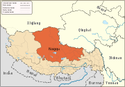
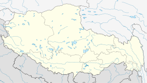
Arza — Township — Location within Tibet Coordinates: 30°38′40″N 93°13′51″E / 30.64444°N 93.23083°E Country People's Republic of China Region Tibet Prefecture Nagqu Prefecture County Lhari County Elevation 5,239 m (17,191 ft) Population - Major Nationalities Tibetan - Regional dialect Tibetan language Time zone +8 Arza (Chinese: 阿扎; Pinyin: Āzhā) is a small populated town and township, east of Lhasa in the Tibet Autonomous Region of the People's Republic of China. It belongs to Lhari County (Jiali Xian) of the Nagqu Prefecture. It contains solar panels.
References

Towns and villages Arza · Bagar · Bangkor · Biru · Baqên · Bilung · Bungona'og · Cêgnê · Chacang · Chalükong · Charing · Chawola · Chêcang · Codoi · Coyang · Dartang · Dawatang · Doijiang · Doima · Dongqiao · Doqemo · Ganda · Garong · Garco · Gorqu · Jagbung · Jangco · Jangmai · Jamda · Lamado · Maindu · Ngukang · Nyainrong · Nyewo · Parta · Poinsog · Punzom · Ragxi · Qagze · Qigêgyizhungma · Sato · Shela · Sima · Sogba · Tanggo · Tumain · Xagquka · Zala · Zaindainxoi · Zhasa · Zamar · ZaindainxoiGeography Siling LakeCategories:- Populated places in the Nagqu Prefecture
- Township-level divisions of Tibet
- Nagqu Prefecture geography stubs
Wikimedia Foundation. 2010.

