- Maxey, Cambridgeshire
-
Coordinates: 52°39′47″N 0°20′17″W / 52.663°N 0.338°W
Maxey
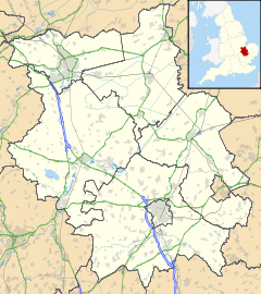
 Maxey shown within Cambridgeshire
OS grid reference TF125085 Unitary authority Peterborough Ceremonial county Cambridgeshire Region East Country England Sovereign state United Kingdom EU Parliament East of England List of places: UK • England • Cambridgeshire Maxey is a village in the City of Peterborough in England located between Peterborough & Stamford and southwest of The Deepings - it is home to nearly 700 residents.
The main focal points are the one remaining Public House (Blue Bell), the Church (St. Peters) & the Village Hall. Each provides a range of social functions throughout the year. There are a surprising number of businesses based in the village, including a few working farms.
Contents
Surname
If your family has an uninterrupted bloodline, and no one decided to change their name by deed poll or similar, then you can be reasonably certain that anyone with the surname Maxey (or close derivative, i.e. Maxcy) has their ancestral origins in the village/environs of Maxey. Maxey Website
History
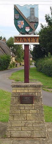
Built away from the church because of the plague[citation needed]
Once part of the Soke of Peterborough in Northamptonshire, Maxey can trace its 'modern' roots back over 1,000 years. However, archaeological excavation of the area has provided ample evidence of continuous occupation for over 4,000 years. Lolham Bridges, on the outskirts of Maxey between Helpston and Bainton, were originally built in the Roman era.[1]
Rescue archaeology before gravel workings began revealed details of a large Henge in Maxey[2] Discovered from Aerial Photographs in 1956 by Dr. J.K.St. Joseph and last excavated by Francis Pryor in 1979-81 the henge was 126 metres in diameter, one of the largest known. It was part of an entire landscape[3] of neolithic features, including a cursus and barrows. Along with the large and mysterious ritual village at nearby Etton this collection of sites has featured in Mr Pryor's writing about large scale ritual landscapes[4]
The village web site has a detailed account of life in Maxey between the 9th and 12th centuries[5]
Businesses
- Shaw's Coaches, Maxey. Bus services and coach outings
- Blue Bell Public House
- M.C Vehicle Engineers
See also
- Glen Maxey
- Marlon Maxey
- Samuel B. Maxey
- Macksey
- Maxie
References
- ^ Lolham Bridges Hidden Heritage (retrieved 19 December 2009)
- ^ "National Monuments record for Maxey Henge". http://www.pastscape.org.uk/hob.aspx?hob_id=1030942.
- ^ "National Monuments record for Maxey Complex". http://www.pastscape.org.uk/hob.aspx?hob_id=350120.
- ^ Pryor, Francis. Seahenge: A Quest for Life and Death in Bronze Age Britain.. Harper Collins. ISBN ISBN 0-00-710192-9., An archaeological autobiography
- ^ "Maxey 1000AD". http://www.maxey.co.uk/ad1000.htm. from the village web site
External links
Categories:- Villages in Cambridgeshire
- Geography of Peterborough
- Civil parishes in Cambridgeshire
Wikimedia Foundation. 2010.


