- Moorland, Iowa
-
Moorland, Iowa — City — Location of Moorland, Iowa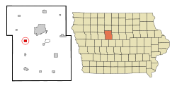
Coordinates: 42°26′32″N 94°17′37″W / 42.44222°N 94.29361°WCoordinates: 42°26′32″N 94°17′37″W / 42.44222°N 94.29361°W Country  United States
State  Iowa
IowaCounty Webster Area – Total 1.0 sq mi (2.6 km2) – Land 1.0 sq mi (2.6 km2) – Water 0.0 sq mi (0.0 km2) Elevation 1,152 ft (351 m) Population (2000) – Total 197 – Density 197.1/sq mi (76.1/km2) Time zone Central (CST) (UTC-6) – Summer (DST) CDT (UTC-5) ZIP code 50566 Area code(s) 515 FIPS code 19-53895 GNIS feature ID 0459218 Moorland is a city in Webster County, Iowa, United States. The population was 197 at the 2000 census.
Geography
Moorland is located at 42°26′32″N 94°17′37″W / 42.44222°N 94.29361°W (42.442108, -94.293661)[1].
According to the United States Census Bureau, the city has a total area of 1.0 square mile (2.6 km2), all of it land.
Demographics
As of the census[2] of 2000, there were 197 people, 81 households, and 57 families residing in the city. The population density was 197.1 people per square mile (76.1/km²). There were 83 housing units at an average density of 83.0 per square mile (32.0/km²). The racial makeup of the city was 98.48% White, 0.51% from other races, and 1.02% from two or more races. Hispanic or Latino of any race were 2.03% of the population.
There were 81 households out of which 30.9% had children under the age of 18 living with them, 58.0% were married couples living together, 7.4% had a female householder with no husband present, and 29.6% were non-families. 27.2% of all households were made up of individuals and 11.1% had someone living alone who was 65 years of age or older. The average household size was 2.43 and the average family size was 2.84.
In the city the population was spread out with 25.9% under the age of 18, 9.1% from 18 to 24, 24.4% from 25 to 44, 27.4% from 45 to 64, and 13.2% who were 65 years of age or older. The median age was 39 years. For every 100 females there were 93.1 males. For every 100 females age 18 and over, there were 94.7 males.
The median income for a household in the city was $43,750, and the median income for a family was $51,875. Males had a median income of $32,188 versus $25,417 for females. The per capita income for the city was $16,051. About 3.7% of families and 6.6% of the population were below the poverty line, including 9.8% of those under the age of eighteen and 8.3% of those sixty five or over.
References
- ^ "US Gazetteer files: 2010, 2000, and 1990". United States Census Bureau. 2011-02-12. http://www.census.gov/geo/www/gazetteer/gazette.html. Retrieved 2011-04-23.
- ^ "American FactFinder". United States Census Bureau. http://factfinder.census.gov. Retrieved 2008-01-31.
Municipalities and communities of Webster County, Iowa Cities 
Townships Badger | Burnside | Clay | Colfax | Cooper | Dayton | Deer Creek | Douglas | Elkhorn | Fulton | Gowrie | Hardin | Jackson | Johnson | Lost Grove | Newark | Otho | Pleasant Valley | Roland | Sumner | Washington | Webster | Yell
CDP Communities Burnside | Lanyon | Lena | Lundgren | Palm Grove | Roelyn | Slifer
Footnotes ‡This populated place also has portions in an adjacent county or counties
Categories:- Cities in Iowa
- Populated places in Webster County, Iowa

Wikimedia Foundation. 2010.