- Odebolt, Iowa
-
Odebolt, Iowa — City — Location of Odebolt, Iowa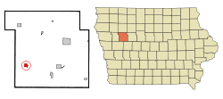
Coordinates: 42°18′37″N 95°15′5″W / 42.31028°N 95.25139°WCoordinates: 42°18′37″N 95°15′5″W / 42.31028°N 95.25139°W Country  United States
State  Iowa
IowaCounty Sac Area – Total 1.0 sq mi (2.7 km2) – Land 1.0 sq mi (2.7 km2) – Water 0.0 sq mi (0.0 km2) Elevation 1,362 ft (415 m) Population (2000) – Total 1,153 – Density 1,102.7/sq mi (425.8/km2) Time zone Central (CST) (UTC-6) – Summer (DST) CDT (UTC-5) ZIP code 51458 Area code(s) 712 FIPS code 19-58575 GNIS feature ID 0459799 Odebolt is a city in Sac County, Iowa, United States. The population was 1,153 at the 2000 census.
Contents
History
While the etymology of Odebolt's unusual name is unquestioned — being named after the Odebolt Creek — the etymology of the creek's name is disputed. It has been ascribed to a story of a French fur trapper and to multiple stories of a bolt falling in the creek.[1] The trapper's name was reportedly Odebeau, and his name corrupted.[2]
Geography
Odebolt is located at 42°18′37″N 95°15′5″W / 42.31028°N 95.25139°W (42.310416, -95.251354)[3]. Odebolt Creek arises near here, flows through Ida Grove, then into the Maple River.
Demographics
As of the census[4] of 2000, there were 1,153 people, 467 households, and 296 families residing in the city. The population density was 1,102.7 people per square mile (424.0/km²). There were 518 housing units at an average density of 495.4 per square mile (190.5/km²). The racial makeup of the city was 99.22% white.
There were 467 households out of which 27.4% had children under the age of 18 living with them, 56.1% were married couples living together, 5.4% had a female householder with no husband present, and 36.6% were non-families. 34.7% of all households were made up of individuals and 23.1% had someone living alone who was 65 years of age or older. The average household size was 2.30 and the average family size was 2.99.
In the city the population was spread out with 23.4% under the age of 18, 4.9% from 18 to 24, 22.8% from 25 to 44, 18.8% from 45 to 64, and 30.0% who were 65 years of age or older. The median age was 44 years. For every 100 females there were 87.5 males. For every 100 females age 18 and over, there were 82.4 males.
The median income for a household in the city was $30,208, and the median income for a family was $40,917. Males had a median income of $30,000 versus $18,438 for females. The per capita income for the city was $15,971. About 7.6% of families and 9.5% of the population were below the poverty line, including 14.9% of those under age 18 and 10.3% of those age 65 or over.
References
- ^ Eriksson, Erik McKinley (December 1929). "The Name of Odebolt". The Palimpsest. http://www.rootsweb.com/~iaohms/odeboltname1.html. Retrieved 2007-08-29.
- ^ Gannett, Henry, 1846-1914 (1905). The Origin of Certain Place Names in the United States. Washington, D.C.: Government Printing Office. p. 229.
- ^ "US Gazetteer files: 2010, 2000, and 1990". United States Census Bureau. 2011-02-12. http://www.census.gov/geo/www/gazetteer/gazette.html. Retrieved 2011-04-23.
- ^ "American FactFinder". United States Census Bureau. http://factfinder.census.gov. Retrieved 2008-01-31.
External links
- City of Odebolt
- City-Data Comprehensive statistical data and more about Odebolt
Municipalities and communities of Sac County, Iowa Cities 
Footnotes ‡This populated place also has portions in an adjacent county or counties
Categories:- Populated places in Sac County, Iowa
- Cities in Iowa

Wikimedia Foundation. 2010.