- Clarkson, Mississauga
-
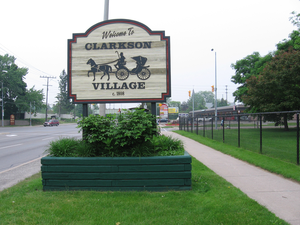
Clarkson — Unincorporated community — Clarkson Village, looking eastward at the corner of Lakeshore Road West and Clarkson Road South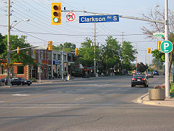 Clarkson Village welcome sign, at Lakeshore Road West and Inverhouse Drive.
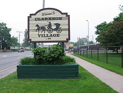
Coordinates: 43°31′9″N 79°38′2″W / 43.51917°N 79.63389°W Country Canada Province Ontario Regional municipality Peel City Mississauga Established 1808 Time zone Eastern (UTC-5) - Summer (DST) Eastern (UTC-4) Forward sortation area L5J Area code(s) 905 and 289 NTS Map 030M12 GNBC Code FAREC Clarkson Village is a community in the city of Mississauga, Ontario, Canada. The community is located in the southwest corner of Mississauga, along the banks of Lake Ontario. It is bordered by Lake Ontario to the south, Oakville to the west, Erindale and Erin Mills to the north, and Lorne Park to the east.
Contents
History
In 1808, fifteen year old Warren Clarkson and his brother Joshua left their home in Albany, New York to seek their fortune in Canada. They had been invited to come work for a friend of the family who had bought land near Lake Ontario. Warren liked the area very much and decided to stay. He worked hard so that someday he would be able to own property. When he was twenty-six he had saved enough money to buy land and build a home. Warren married and began to raise a family. As the years went by Warren bought more land. He built the community's first store along the stagecoach trail. Fifteen years later the town council named this trail Clarkson Road.
A post office was opened in the family store and William Clarkson, Warren's son became the postmaster. For the next forty five years a member of the Clarkson family would run the post office. Clarkson community never grew very large. It had a few houses and shops along Clarkson Road, a railway station, a school, and a church. Less than one hundred people lived in this quiet community.
In 1856, Captain Edward Sutherland (1794-1885) moved to Clarkson with his seven children. A widower, he purchased "Bush's Inn," a former inn and coach house that was the halfway point between Hamilton, Ontario and Toronto (this building, a private residence, still stands on Clarkson Road South). Here, he is said to have introduced both strawberry and raspberry cultivation to the area. Clarkson eventually became the "Strawberry Capital of Ontario," and commercial fruit farming expanded in the area through the rest of the 19th and into the early 20th century. In 1915, a sign was erected at the Clarkson railway station declaring "Through this station passes more strawberries than any other station in Ontario." The Sutherlands later became connected by marriage to the Harrises of Benares (see "Sites of Interest" below).
The Party Line newspaper published out of Clarkson/Lorne Park, starting in 1951.
Today
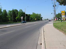 Looking west from Clarkson Village, towards the intersection of Lakeshore and Southdown Roads
Although the community and the surrounding area consists mostly of a mix of upper and middle class homes, some of the last major industrial sites in Mississauga outline the community, including:
- a Suncor oil refinery, which produces lubricants (formerly Petro-Canada).
- a St. Lawrence Cement Terminal, which distributes cement via truck throughout Toronto.
- Clarkson Secondary School, grades 9 through 12.
- CFRB 1010 AM Radio Transmitter, with 4 identical guyed masts which stand approximately 550-600 ft tall which make them some of the tallest structures in the city of Mississauga, and used for navigation by small aircraft and watercraft. Located at the intersection of Southdown Rd. & Lakeshore Rd.
- 1050 CHUM AM Radio Transmitter, a smaller transmission facility, located along the waterfront, located adjacent to St. Lawrence Cement factory
- Orion Bus Industries, a major manufacturer of buses for public transportation.
- Electrovaya, a manufacturer of portable computers and batteries.
- an assortment of small farms.
Sites of interest
 The historic Bradley Museum
Clarkson is home to both of the City of Mississauga's historic museums: Bradley Museum and Benares House.
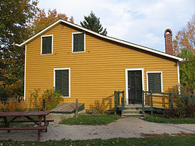
The Bradley Museum provides a window into the everyday life of early settlers in Ontario, and hosts Sunday teas, rotating exhibits, and special events. The museum grounds include the original farmhouse built in 1830 by Lewis and Elizabeth Bradley, a United Loyalist couple who lived in the house with their seven children. The Anchorage, a Regency-style cottage built in 1837, was moved from its original location on the shores of Lake Ontario to the Bradley grounds in 1978. The Anchorage was the retirement home of Royal Navy Officer John Skynner (1762-1846), and remained derelict after being moved to the museum grounds until sufficient funds for its rehabilitation were raised in 1991. In December of 2007 the Log Cabin was opened at Bradley after extensive fundriaising efforts which saw the cabin moved from its location in Port Credit and repaired to its former glory. The Log Cabin is a popular choice for meetings and provides a popular overnight program for Girl Guides and Boy Scouts.
Benares House, located on the border between Clarkson and the neighbouring community of Lorne Park, was inhabited by four generations of the Harris and Sayers families. Rumored to be the inspiration for Canadian author Mazo de la Roche's famous "Whiteoak Chronicles" (or "Jalna series") novels, the Benares estate and most of its contents were donated to the Ontario Heritage Foundation by the great-grandchildren of Captain Harris. The site was fully restored and opened to the public in 1995. Benares now houses an interpretive gallery and hosts special events. Within the Clarkson/Lorne Park community, there are numerous streets dedicated to Ms. Roche, namely "Jalna Ave." and "Mazo Cres.", located in Lorne Park, and Clarkson, respectively.
In addition to discovering these historic sites, visitors may also explore Rattray Marsh. This ecologically sensitive wetland is the last remaining lakefront marsh between Burlington, Ontario and Toronto, and provides superb opportunities for bird watching while strolling along boardwalks and well-maintained trails. Amazingly abundant displays of white trilliums, the floral emblem and provincial flower of Ontario, may be seen in late April and early May.
Transportation
Clarkson is home to the Clarkson GO Station, the transportation hub of the community, located on the Lakeshore West line. Local transit service is provided by Mississauga Transit routes 13, 14, 14A, 23, 45, 45A, 43, 110, and 29, all of which feed into the GO station. Clarkson is also near the Erin Mills Parkway / Southdown Road interchange of the QEW. The main roads in the area are Lakeshore Road West, Southdown Road, and Royal Windsor Drive.
References
External links
- clarkson.ca - The Web Site on the GO - Community Web Site
Communities of Mississauga Clarkson • Cooksville • Dixie • Erindale • Erin Mills • Lakeview • Lorne Park • Malton • Meadowvale • Port Credit • StreetsvilleCategories:- Neighbourhoods in Mississauga


Wikimedia Foundation. 2010.