- Panora, Iowa
Infobox Settlement
official_name = Panora, Iowa
settlement_type =City
nickname =
motto =
imagesize =
image_caption =
image_
imagesize =
image_caption =
image_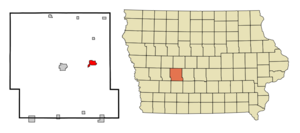
mapsize = 250x200px
map_caption = Location of Panora, Iowa
mapsize1 =
map_caption1 =subdivision_type = Country
subdivision_name =
subdivision_type1 = State
subdivision_name1 =
subdivision_type2 = County
subdivision_name2 = Guthrie
government_footnotes =
government_type =
leader_title =
leader_name =
leader_title1 =
leader_name1 =
established_title =
established_date =unit_pref = Imperial
area_footnotes =area_magnitude =
area_total_km2 = 4.7
area_land_km2 = 4.7
area_water_km2 = 0.0
area_total_sq_mi = 1.8
area_land_sq_mi = 1.8
area_water_sq_mi = 0.0population_as_of = 2000
population_footnotes =
population_total = 1175
population_density_km2 = 251.8
population_density_sq_mi = 652.1timezone = Central (CST)
utc_offset = -6
timezone_DST = CDT
utc_offset_DST = -5
elevation_footnotes =
elevation_m = 328
elevation_ft = 1076
latd = 41 |latm = 41 |lats = 32 |latNS = N
longd = 94 |longm = 21 |longs = 49 |longEW = Wpostal_code_type =
ZIP code
postal_code = 50216
area_code = 641
blank_name = FIPS code
blank_info = 19-61320
blank1_name = GNIS feature ID
blank1_info = 0460010
website =
footnotes =Panora is a city in Guthrie County,
Iowa ,United States . The population was 1,175 at the 2000 census. It is part of the Des Moines–West Des Moines Metropolitan Statistical Area. Outside of Panora is Lake Panorama, which features a resort, housing development, recreation area and golf course.Geography
Panora is located at coor dms|41|41|32|N|94|21|49|W|city (41.692158, -94.363722)GR|1, along the Middle Raccoon River.
According to the
United States Census Bureau , the city has a total area of 1.8square mile s (4.7km² ), all of it land.Demographics
As of the
census GR|2 of 2000, there were 1,175 people, 470 households, and 287 families residing in the city. Thepopulation density was 652.1 people per square mile (252.0/km²). There were 504 housing units at an average density of 279.7/sq mi (108.1/km²). The racial makeup of the city was 97.87% White, 0.43% African American, 0.09% Native American, 0.43% Pacific Islander, and 1.19% from two or more races. Hispanic or Latino of any race were 0.77% of the population.There were 470 households out of which 29.4% had children under the age of 18 living with them, 49.1% were married couples living together, 8.5% had a female householder with no husband present, and 38.9% were non-families. 33.8% of all households were made up of individuals and 19.1% had someone living alone who was 65 years of age or older. The average household size was 2.32 and the average family size was 2.97.
In the city the population was spread out with 24.5% under the age of 18, 7.4% from 18 to 24, 24.5% from 25 to 44, 19.7% from 45 to 64, and 23.9% who were 65 years of age or older. The median age was 40 years. For every 100 females there were 92.6 males. For every 100 females age 18 and over, there were 86.7 males.
The median income for a household in the city was $35,000, and the median income for a family was $41,583. Males had a median income of $28,558 versus $22,692 for females. The
per capita income for the city was $15,510. About 4.8% of families and 10.0% of the population were below thepoverty line , including 7.6% of those under age 18 and 14.9% of those age 65 or over.The current mayor is Steve Baker.
Education
Panorama Community School District provides co-ed classes for grades K–12 to the towns of Panora, Linden, Yale, Jamaica, and Bagley. Panorama Elementary School (the most recently opened) serves grades K-5, and the Panorama Middle School/High School building serves grades 6-12. Panorama's teams are known as the Panthers, and their colors are navy blue and silver. The teams compete in the West Central Activities Conference (WCAC) and are part of the Iowa High School Athletic Association and Iowa Girls High School Athletic Union. Their main rival is Guthrie Center, a town located 8 miles to the west of Panora.
Notable natives
*
Kip Janvrin , American decathlete andReferences
External links
* [http://www.panora.org City of Panora]
* [http://www.lakepanorama.org Lake Panorama]
* [http://www.guthrian.com Guthrie Center Times newspaper]
* [http://panorama.k12.ia.us Panorama Community School District]
Wikimedia Foundation. 2010.