- Scranton, Iowa
Infobox Settlement
official_name = Scranton, Iowa
settlement_type =City
nickname =
motto =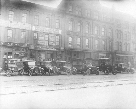
imagesize = 250px
image_caption = Scranton in 1921
image_
image_
mapsize = 250px
map_caption = Location of Scranton, Iowa
mapsize1 =
map_caption1 =subdivision_type = Country
subdivision_name =
subdivision_type1 = State
subdivision_name1 =
subdivision_type2 = County
subdivision_name2 = Greene
government_footnotes =
government_type =
leader_title =
leader_name =
leader_title1 =
leader_name1 =
established_title =
established_date =unit_pref = Imperial
area_footnotes =area_magnitude =
area_total_km2 = 4.9
area_land_km2 = 4.9
area_water_km2 = 0.0
area_total_sq_mi = 1.9
area_land_sq_mi = 1.9
area_water_sq_mi = 0.0population_as_of = 2000
population_footnotes =
population_total = 604
population_density_km2 = 124.2
population_density_sq_mi = 321.6timezone = Central (CST)
utc_offset = -6
timezone_DST = CDT
utc_offset_DST = -5
elevation_footnotes =
elevation_m = 359
elevation_ft = 1178
latd = 42 |latm = 1 |lats = 20 |latNS = N
longd = 94 |longm = 32 |longs = 46 |longEW = Wpostal_code_type =
ZIP code
postal_code = 51462
area_code = 712
blank_name = FIPS code
blank_info = 19-71310
blank1_name = GNIS feature ID
blank1_info = 0461492
website =
footnotes =Scranton is a city in Greene County,
Iowa ,United States . The population was 604 at the 2000 census.History
Scranton's
water tower , built in 1897, is the oldest working water tower in the state.fact|date=August 2007Geography
Scranton is located along
U.S. Route 30 at coor dms|42|1|20|N|94|32|46|W|city (42.022197, -94.546047),GR|1 in the valley of the North Raccoon River.According to the
United States Census Bureau , the city has a total area of 1.9square mile s (4.9km² ), all of it land.Demographics
As of the
census GR|2 of 2000, there were 604 people, 258 households, and 157 families residing in the city. Thepopulation density was 321.6 people per square mile (124.0/km²). There were 285 housing units at an average density of 151.8/sq mi (58.5/km²). The racial makeup of the city was 96.52% White, 0.17% Asian, 2.65% from other races, and 0.66% from two or more races. Hispanic or Latino of any race were 5.13% of the population.There were 258 households out of which 28.7% had children under the age of 18 living with them, 50.0% were married couples living together, 7.8% had a female householder with no husband present, and 38.8% were non-families. 34.9% of all households were made up of individuals and 17.8% had someone living alone who was 65 years of age or older. The average household size was 2.34 and the average family size was 3.05.
In the city the population was spread out with 26.5% under the age of 18, 7.8% from 18 to 24, 22.4% from 25 to 44, 24.2% from 45 to 64, and 19.2% who were 65 years of age or older. The median age was 39 years. For every 100 females there were 93.6 males. For every 100 females age 18 and over, there were 90.6 males.
The median income for a household in the city was $29,375, and the median income for a family was $38,542. Males had a median income of $27,411 versus $17,188 for females. The
per capita income for the city was $13,836. About 10.6% of families and 13.1% of the population were below thepoverty line , including 13.8% of those under age 18 and 9.1% of those age 65 or over.Community
Annual events in Scranton include the Mid-Summer Festival, held in July, and a Christmas celebration.fact|date=August 2007
Every 5 years the town holds an all school reunion. Next reunion will be in 2010.
Four churches exist in Scranton: one congregation each of the Friends,
St. Paul's Catholic Church , and of theUnited Methodist Church , along with a Church of Christ.fact|date=August 2007References
External links
Wikimedia Foundation. 2010.