- Almolonga
-
Almolonga volcano (Cerro Quemado) 
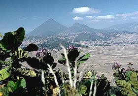
The rounded hills in the middle, are part of a chain of lava domes of the Almolonga volcanic fieldElevation 3,197 m (10,489 ft) Location  Guatemala (Quetzaltenango)
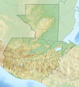
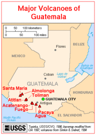
Range Sierra Madre Coordinates 14°48′0″N 91°31′12″W / 14.8°N 91.52°WCoordinates: 14°48′0″N 91°31′12″W / 14.8°N 91.52°W Geology Type Stratovolcano Last eruption 1818 The Almolonga volcano, sometimes also called "Cerro Quemado" (Burned Mountain), is an andesitic stratovolcano in the south-western department of Quetzaltenango in Guatemala. The volcano is located near the town of Almolonga, just south of Quetzaltenango, Guatemala's second largest city.
The Volcano is set along the Zunil fault zone and has a central caldera surrounded by several dacitic and rhyolitic lava domes. Cerro Quemado is the largest and youngest lava dome complex and is the only one that has erupted (1818). The northern and eastern flanks of Cerro Quemado have hot springs.
See also
Guatemala Acatenango · Agua · Almolonga · Atitlán · Fuego · Jumay · Moyuta · Pacaya · Santa María/Santiaguito · San Pedro · Santo Tomás · Siete Orejas · Tacaná · Tajumulco · Tecuamburro · TolimánEl Salvador Nicaragua Cosigüina · San Cristóbal · Telica · Cerro Negro · Momotombo · Apoyeque · Masaya · Mombacho · Concepción · MaderasCosta Rica Panama Note: volcanoes are ordered from north-west to south-east.References
- "Almolonga". Global Volcanism Program, Smithsonian Institution. http://www.volcano.si.edu/world/volcano.cfm?vnum=1402-04=.
Categories:- Stratovolcanoes
- Subduction volcanoes
- Volcanoes of Guatemala
- Mountains of Guatemala
- Guatemala geography stubs
Wikimedia Foundation. 2010.


