- Okoboji, Iowa
-
Okoboji, Iowa — City — Location of Okoboji, Iowa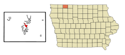
Coordinates: 43°23′15″N 95°8′17″W / 43.3875°N 95.13806°WCoordinates: 43°23′15″N 95°8′17″W / 43.3875°N 95.13806°W Country  United States
State  Iowa
IowaCounty Dickinson Area – Total 1.8 sq mi (4.6 km2) – Land 1.8 sq mi (4.6 km2) – Water 0.0 sq mi (0.0 km2) Elevation 1,421 ft (433 m) Population (2000) – Total 820 – Density 460.0/sq mi (177.6/km2) Time zone Central (CST) (UTC-6) – Summer (DST) CDT (UTC-5) ZIP code 51355 Area code(s) 712 FIPS code 19-58710 GNIS feature ID 0459815 Okoboji is a city in Dickinson County, Iowa, United States, along the eastern shore of West Okoboji Lake in the Iowa Great Lakes region. The population was 820 at the 2000 census. Pikes Point State Park is located within the city limits. Okoboji is served by KUOO-FM and KUQQ-FM.
Contents
Geography
Okoboji is located at 43°23′15″N 95°8′17″W / 43.3875°N 95.13806°W (43.387620, -95.138025)[1].
According to the United States Census Bureau, the city has a total area of 1.8 square miles (4.7 km2), all of it land.
Demographics
As of the census[2] of 2000, there were 820 people, 427 households, and 240 families residing in the city. The population density was 460.0 people per square mile (177.9/km²). There were 944 housing units at an average density of 529.6 per square mile (204.8/km²). The racial makeup of the city was 98.66% White, 0.12% African American, 0.73% Native American, 0.12% from other races, and 0.37% from two or more races. Hispanic or Latino of any race were 0.73% of the population.
There were 427 households out of which 16.2% had children under the age of 18 living with them, 50.6% were married couples living together, 3.5% had a female householder with no husband present, and 43.6% were non-families. 38.6% of all households were made up of individuals and 17.1% had someone living alone who was 65 years of age or older. The average household size was 1.92 and the average family size was 2.50.
In the city the population was spread out with 14.3% under the age of 18, 7.2% from 18 to 24, 20.9% from 25 to 44, 30.0% from 45 to 64, and 27.7% who were 65 years of age or older. The median age was 49 years. For every 100 females there were 100.0 males. For every 100 females age 18 and over, there were 100.9 males.
The median income for a household in the city was $37,500, and the median income for a family was $54,659. Males had a median income of $32,500 versus $24,018 for females. The per capita income for the city was $29,297. About 2.6% of families and 5.3% of the population were below the poverty line, including 5.0% of those under age 18 and 3.8% of those age 65 or over.
Tourism
Okoboji is a major summer tourism area. A growing number of resorts around the Iowa Great Lakes and the proximity of other tourist-friendly sites, such as Arnolds Park and Spirit Lake, have contributed to its growing popularity. Okoboji has also become a recognizable name around the country due to the sales of many products that proudly display the town name in bold letters. It is not uncommon to spot an Okoboji t-shirt or sweatshirt on nearly every college campus in the Midwest. Visitors to Okoboji will immediately notice bumper stickers, mugs and sweatshirts touting the fictitious University of Okoboji where many locals claim to have received an education.
References
- ^ "US Gazetteer files: 2010, 2000, and 1990". United States Census Bureau. 2011-02-12. http://www.census.gov/geo/www/gazetteer/gazette.html. Retrieved 2011-04-23.
- ^ "American FactFinder". United States Census Bureau. http://factfinder.census.gov. Retrieved 2008-01-31.
External links
Municipalities and communities of Dickinson County, Iowa Cities Arnolds Park | Lake Park | Milford | Okoboji | Orleans | Spirit Lake | Superior | Terril | Wahpeton | West Okoboji

Townships Center Grove | Diamond Lake | Excelsior | Lakeville | Lloyd | Milford | Okoboji | Richland | Silver Lake | Spirit Lake | Superior | Westport
Unincorporated
communityCategories:- Populated places in Dickinson County, Iowa
- Cities in Iowa

Wikimedia Foundation. 2010.