- Millhousen, Indiana
-
Millhousen, Indiana — Town — Location of Millhousen in the state of Indiana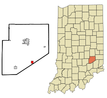
Coordinates: 39°12′39″N 85°26′1″W / 39.21083°N 85.43361°WCoordinates: 39°12′39″N 85°26′1″W / 39.21083°N 85.43361°W Country United States State Indiana County Decatur Township Marion Area – Total 1.0 sq mi (2.6 km2) – Land 1.0 sq mi (2.6 km2) – Water 0.0 sq mi (0.0 km2) Elevation 896 ft (273 m) Population (2010) – Total 127 – Density 134.3/sq mi (51.9/km2) Time zone Eastern (EST) (UTC-5) – Summer (DST) EDT (UTC-4) ZIP code 47261 Area code(s) 812 FIPS code 18-49662[1] GNIS feature ID 0439237[2] Millhousen is a town in Marion Township, Decatur County, Indiana, United States. The population was 127 at the 2010 census. Millhousen is perhaps best known for being the home of the Immaculate Conception Church, one of only four Roman Catholic churches in Decatur County, and Stone's Tavern, one of the best known restaurants in Decatur County.
Geography
Millhousen is located at 39°12′39″N 85°26′1″W / 39.21083°N 85.43361°W (39.210931, -85.433678)[3].
According to the United States Census Bureau, the town has a total area of 1.0 square miles (2.6 km²), all of it land.
Demographics
As of the census[1] of 2000, there were 136 people, 55 households, and 38 families residing in the town. The population density was 134.3 people per square mile (52.0/km²). There were 63 housing units at an average density of 62.2 per square mile (24.1/km²). The racial makeup of the town was 100.00% White.
There were 55 households out of which 30.9% had children under the age of 18 living with them, 60.0% were married couples living together, 3.6% had a female householder with no husband present, and 29.1% were non-families. 25.5% of all households were made up of individuals and 20.0% had someone living alone who was 65 years of age or older. The average household size was 2.47 and the average family size was 3.00.
In the town the population was spread out with 24.3% under the age of 18, 9.6% from 18 to 24, 26.5% from 25 to 44, 19.1% from 45 to 64, and 20.6% who were 65 years of age or older. The median age was 34 years. For every 100 females there were 100.0 males. For every 100 females age 18 and over, there were 94.3 males.
The median income for a household in the town was $39,250, and the median income for a family was $41,250. Males had a median income of $33,333 versus $33,333 for females. The per capita income for the town was $17,646. There were 5.0% of families and 2.7% of the population living below the poverty line, including no under eighteens and 12.5% of those over 64.
References
- ^ a b "American FactFinder". United States Census Bureau. http://factfinder.census.gov. Retrieved 2008-01-31.
- ^ "US Board on Geographic Names". United States Geological Survey. 2007-10-25. http://geonames.usgs.gov. Retrieved 2008-01-31.
- ^ "US Gazetteer files: 2010, 2000, and 1990". United States Census Bureau. 2011-02-12. http://www.census.gov/geo/www/gazetteer/gazette.html. Retrieved 2011-04-23.
Municipalities and communities of Decatur County, Indiana City 
Towns Townships Adams | Clay | Clinton | Fugit | Jackson | Marion | Salt Creek | Sand Creek | Washington
Unincorporated
communitiesAdams | Alert | Burney | Clarksburg | Craig | Downeyville | Ewington | Forest Hill | Gaynorsville | Germantown | Harper | Harris City | Horace | Kingston | Knarr Corner | Letts | Letts Corner | McCoy | Mechanicsburg | Middle Branch | Milford | New Pennington | Pinhook | Rossburg | Saint Maurice | Saint Omer | Sandusky | Sardinia | Slabtown | Smyrna | Waynesburg | Williamstown
Footnotes ‡This populated place also has portions in an adjacent county or counties
Categories:- Populated places in Decatur County, Indiana
- Towns in Indiana

Wikimedia Foundation. 2010.