- Athol, Idaho
Infobox Settlement
official_name = Athol, Idaho
other_name =
native_name =
nickname =
settlement_type =City
motto =
imagesize =
image_caption =
flag_size =
image_
seal_size =
image_shield =
shield_size =
image_blank_emblem =
blank_emblem_type =
blank_emblem_size =
imagesize =
image_caption =
flag_size =
image_
seal_size =
image_shield =
shield_size =
image_blank_emblem =
blank_emblem_type =
blank_emblem_size =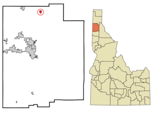
mapsize =
map_caption = Location in Kootenai County and the state ofIdaho
mapsize1 =
map_caption1 =
image_dot_
dot_mapsize =
dot_map_caption =
dot_x =
dot_y =
pushpin_
pushpin_label_position =
pushpin_map_caption =
pushpin_mapsize =
subdivision_type = Country
subdivision_name =United States
subdivision_type1 = State
subdivision_name1 =Idaho
subdivision_type2 = County
subdivision_name2 = Kootenai
subdivision_type3 =
subdivision_name3 =
subdivision_type4 =
subdivision_name4 =
government_footnotes =
government_type =
leader_title =
leader_name =
leader_title1 =
leader_name1 =
leader_title2 =
leader_name2 =
leader_title3 =
leader_name3 =
leader_title4 =
leader_name4 =
established_title =
established_date =
established_title2 =
established_date2 =
established_title3 =
established_date3 =
area_magnitude =
unit_pref = Imperial
area_footnotes =
area_total_km2 = 2.0
area_land_km2 = 2.0
area_water_km2 = 0.0
area_total_sq_mi = 0.8
area_land_sq_mi = 0.8
area_water_sq_mi = 0.0
area_water_percent =
area_urban_km2 =
area_urban_sq_mi =
area_metro_km2 =
area_metro_sq_mi =
area_blank1_title =
area_blank1_km2 =
area_blank1_sq_mi =
population_as_of = 2000
population_footnotes =
population_note =
population_total = 676
population_density_km2 = 331.3
population_density_sq_mi = 857.9
population_metro =
population_density_metro_km2 =
population_density_metro_sq_mi =
population_urban =
population_density_urban_km2 =
population_density_urban_sq_mi =
population_blank1_title =
population_blank1 =
population_density_blank1_km2 =
population_density_blank1_sq_mi =
timezone = Pacific (PST)
utc_offset = -8
timezone_DST = PDT
utc_offset_DST = -7
latd = 47
latm = 56
lats = 46
latNS = N
longd = 116
longm = 42
longs = 26
longEW = W
elevation_footnotes =
elevation_m = 729
elevation_ft = 2392
postal_code_type =ZIP code
postal_code = 83801
area_code = 208
blank_name = FIPS code
blank_info = 16-03700
blank1_name = GNIS feature ID
blank1_info = 0376763
website =
footnotes = Athol is a city in Kootenai County,Idaho ,United States . The population was 676 at the 2000 census. It is notable for the nearby Silverwoodtheme park . Several miles east of town isFarragut State Park at the southern end ofLake Pend Oreille .The U.S. Navy's [http://www.dt.navy.mil/about_us/division_sites/acoustic_research_detachment/acoustic_research_detachment.html Acoustic Research Detachment] in nearby Bayview conducts research with large-scalesubmarine models in the deepwater lake.Geography
Athol is located at coor dms|47|56|46|N|116|42|26|W|city (47.946024, -116.707349)GR|1.
According to the
United States Census Bureau , the city has a total area of 0.8square mile s (2.0km² ), all of it land.Demographics
As of the
census GR|2 of 2000, there were 676 people, 255 households, and 186 families residing in the city. Thepopulation density was 857.9 people per square mile (330.4/km²). There were 287 housing units at an average density of 364.2/sq mi (140.3/km²). The racial makeup of the city was 95.41% White, 2.37% Native American, 0.15% from other races, and 2.07% from two or more races. Hispanic or Latino of any race were 2.07% of the population.There were 255 households out of which 36.9% had children under the age of 18 living with them, 54.9% were married couples living together, 12.2% had a female householder with no husband present, and 26.7% were non-families. 20.8% of all households were made up of individuals and 7.5% had someone living alone who was 65 years of age or older. The average household size was 2.64 and the average family size was 2.98.
In the city the population was spread out with 29.6% under the age of 18, 6.5% from 18 to 24, 31.5% from 25 to 44, 20.4% from 45 to 64, and 12.0% who were 65 years of age or older. The median age was 34 years. For every 100 females there were 106.1 males. For every 100 females age 18 and over, there were 103.4 males.
The median income for a household in the city was $30,595, and the median income for a family was $31,875. Males had a median income of $28,438 versus $17,813 for females. The
per capita income for the city was $13,632. About 11.0% of families and 14.5% of the population were below thepoverty line , including 10.3% of those under age 18 and 23.7% of those age 65 or over.References
External links
Wikimedia Foundation. 2010.