- Drummond, Idaho
-
Drummond, Idaho — City — Location in Fremont County and the state of Idaho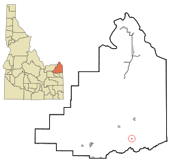
Coordinates: 43°59′57″N 111°20′38″W / 43.99917°N 111.34389°WCoordinates: 43°59′57″N 111°20′38″W / 43.99917°N 111.34389°W Country United States State Idaho County Fremont Area – Total 0.1 sq mi (0.3 km2) – Land 0.1 sq mi (0.3 km2) – Water 0.0 sq mi (0.0 km2) Elevation 5,610 ft (1,710 m) Population (2000) – Total 15 – Density 139.9/sq mi (54.0/km2) Time zone Mountain (MST) (UTC-7) – Summer (DST) MDT (UTC-6) ZIP code 83420 Area code(s) 208 FIPS code 16-22780 GNIS feature ID 0380768 Drummond is a city in Fremont County, Idaho, United States. The population was 15 at the 2000 census. It is part of the Rexburg, Idaho Micropolitan Statistical Area.
Geography
Drummond is located at 43°59′57″N 111°20′38″W / 43.99917°N 111.34389°W (43.999147, -111.343769).[1]
According to the United States Census Bureau, the city has a total area of 0.1 square miles (0.26 km2), all of it land.
Drummond is east of U.S. Highway 20 on State Highway 32.
Demographics
As of the census[2] of 2000, there were 15 people, 7 households, and 3 families residing in the city. The population density was 139.9 people per square mile (52.7/km²). There were 12 housing units at an average density of 111.9 per square mile (42.1/km²). The racial makeup of the city was 100.00% White. Hispanic or Latino of any race were 6.67% of the population.
There were 7 households out of which none had children under the age of 18 living with them, 28.6% were married couples living together, 14.3% had a female householder with no husband present, and 57.1% were non-families. 42.9% of all households were made up of individuals and none had someone living alone who was 65 years of age or older. The average household size was 2.14 and the average family size was 3.00.
In the city the population was spread out with 6.7% under the age of 18, 20.0% from 18 to 24, 33.3% from 25 to 44, 26.7% from 45 to 64, and 13.3% who were 65 years of age or older. The median age was 42 years. For every 100 females there were 114.3 males. For every 100 females age 18 and over, there were 133.3 males.
The median income for a household in the city was $12,500, and the median income for a family was $52,917. Males had a median income of $36,250 versus $0 for females. The per capita income for the city was $15,164. There were no families and 35.7% of the population living below the poverty line, including no under eighteens and none of those over 64.
References
- ^ "US Gazetteer files: 2010, 2000, and 1990". United States Census Bureau. 2011-02-12. http://www.census.gov/geo/www/gazetteer/gazette.html. Retrieved 2011-04-23.
- ^ "American FactFinder". United States Census Bureau. http://factfinder.census.gov. Retrieved 2008-01-31.
Municipalities and communities of Fremont County, Idaho Cities Ashton | Drummond | Island Park | Newdale | Parker | St. Anthony | Teton | Warm River

Unincorporated
communitiesCategories:- Cities in Idaho
- Populated places in Fremont County, Idaho
- Rexburg micropolitan area

Wikimedia Foundation. 2010.