- Moyie Springs, Idaho
-
Moyie Springs, Idaho — City — Location in Boundary County and the state of Idaho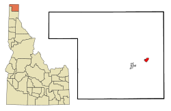
Coordinates: 48°43′29″N 116°11′37″W / 48.72472°N 116.19361°WCoordinates: 48°43′29″N 116°11′37″W / 48.72472°N 116.19361°W Country United States State Idaho County Boundary Area - Total 1.5 sq mi (3.9 km2) - Land 1.5 sq mi (3.9 km2) - Water 0.0 sq mi (0.0 km2) Elevation 2,215 ft (675 m) Population (2010) - Total 718 - Density 432.5/sq mi (167.0/km2) Time zone Pacific (PST) (UTC-8) - Summer (DST) PDT (UTC-7) ZIP code 83845 Area code(s) 208 FIPS code 16-55270 GNIS feature ID 0396934 Moyie Springs is a city in Boundary County, Idaho, United States. The population was 718 at the 2010 census.
Geography
Moyie Springs is located at 48°43′29″N 116°11′37″W / 48.72472°N 116.19361°W (48.724599, -116.193585).[1]
According to the United States Census Bureau, the city has a total area of 1.5 square miles (3.9 km2), all of it land.
Moyie Springs is located near the confluence of the Moyie River with the Kootenai River.
Demographics
As of the census[2] of 2000, there were 656 people, 240 households, and 177 families residing in the city. The population density was 432.5 people per square mile (166.6/km²). There were 254 housing units at an average density of 167.5 per square mile (64.5/km²). The racial makeup of the city was 98.02% White, 0.76% Native American, 0.15% Asian, 0.61% from other races, and 0.46% from two or more races. Hispanic or Latino of any race were 2.44% of the population.
There were 240 households out of which 38.3% had children under the age of 18 living with them, 60.8% were married couples living together, 9.6% had a female householder with no husband present, and 26.3% were non-families. 18.3% of all households were made up of individuals and 5.0% had someone living alone who was 65 years of age or older. The average household size was 2.73 and the average family size was 3.14.
In the city the population was spread out with 32.8% under the age of 18, 6.9% from 18 to 24, 27.9% from 25 to 44, 20.7% from 45 to 64, and 11.7% who were 65 years of age or older. The median age was 32 years. For every 100 females there were 88.0 males. For every 100 females age 18 and over, there were 90.9 males.
The median income for a household in the city was $35,781, and the median income for a family was $36,042. Males had a median income of $32,788 versus $30,500 for females. The per capita income for the city was $15,516. About 13.6% of families and 17.6% of the population were below the poverty line, including 21.9% of those under age 18 and 6.1% of those age 65 or over.
References
- ^ "US Gazetteer files: 2010, 2000, and 1990". United States Census Bureau. 2011-02-12. http://www.census.gov/geo/www/gazetteer/gazette.html. Retrieved 2011-04-23.
- ^ "American FactFinder". United States Census Bureau. http://factfinder.census.gov. Retrieved 2008-01-31.
Municipalities and communities of Boundary County, Idaho Cities Bonners Ferry | Moyie Springs

Unincorporated
communitiesCategories:- Populated places in Boundary County, Idaho
- Cities in Idaho

Wikimedia Foundation. 2010.