- Kualapuu, Hawaii
Infobox Settlement
official_name = Kualapuu, Hawaii
other_name =
native_name =
nickname =
settlement_type = CDP
motto =
imagesize =
image_caption =
flag_size =
image_
seal_size =
image_shield =
shield_size =
image_blank_emblem =
blank_emblem_type =
blank_emblem_size =
imagesize =
image_caption =
flag_size =
image_
seal_size =
image_shield =
shield_size =
image_blank_emblem =
blank_emblem_type =
blank_emblem_size =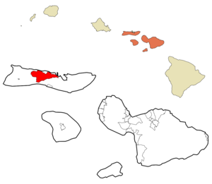
mapsize =
map_caption = Location in Maui County and the state ofHawaii
mapsize1 =
map_caption1 =
image_dot_
dot_mapsize =
dot_map_caption =
dot_x =
dot_y =
pushpin_
pushpin_label_position =
pushpin_map_caption =
pushpin_mapsize =
subdivision_type = Country
subdivision_name =United States
subdivision_type1 = State
subdivision_name1 =Hawaii
subdivision_type2 = County
subdivision_name2 = Maui
subdivision_type3 =
subdivision_name3 =
subdivision_type4 =
subdivision_name4 =
government_footnotes =
government_type =
leader_title =
leader_name =
leader_title1 =
leader_name1 =
leader_title2 =
leader_name2 =
leader_title3 =
leader_name3 =
leader_title4 =
leader_name4 =
established_title =
established_date =
established_title2 =
established_date2 =
established_title3 =
established_date3 =
area_magnitude =
unit_pref = Imperial
area_footnotes =
area_total_km2 = 79.5
area_land_km2 = 78.9
area_water_km2 = 0.6
area_total_sq_mi = 30.7
area_land_sq_mi = 30.5
area_water_sq_mi = 0.2
area_water_percent =
area_urban_km2 =
area_urban_sq_mi =
area_metro_km2 =
area_metro_sq_mi =
area_blank1_title =
area_blank1_km2 =
area_blank1_sq_mi =
population_as_of = 2000
population_footnotes =
population_note =
population_total = 1936
population_density_km2 = 24.5
population_density_sq_mi = 63.5
population_metro =
population_density_metro_km2 =
population_density_metro_sq_mi =
population_urban =
population_density_urban_km2 =
population_density_urban_sq_mi =
population_blank1_title =
population_blank1 =
population_density_blank1_km2 =
population_density_blank1_sq_mi =
timezone = Hawaii-Aleutian
utc_offset = -10
timezone_DST =
utc_offset_DST =
latd = 21
latm = 9
lats = 38
latNS = N
longd = 157
longm = 4
longs = 0
longEW = W
elevation_footnotes =
elevation_m = 257
elevation_ft = 843
postal_code_type =ZIP code
postal_code = 96757
area_code = 808
blank_name = FIPS code
blank_info = 15-39500
blank1_name = GNIS feature ID
blank1_info = 0361457
website =
footnotes = Kualapuokinau is acensus-designated place (CDP) on the island ofMolokai in Maui County, Hawaiokinai,United States . The population was 1,936 at the 2000 census. Kualapuokinau can be literally translated as "hill overturned", but is thought to be a corruption of Puokinauokinauala: "sweet potato hill". The present settlement is a former pineapple cannery village once associated withDel Monte Foods .Geography
Kualapuokinau is located at coor dms|21|9|38|N|157|3|60|W|city (21.160641, -157.066553)GR|1.
According to the
United States Census Bureau , the CDP has a total area of 30.7 square miles (79.5 km²), of which, 30.5 square miles (78.9 km²) of it is land and 0.2 square miles (0.6 km²) of it (0.75%) is water.Demographics
As of the
census GR|2 of 2000, there were 1,936 people, 564 households, and 465 families residing in the CDP. Thepopulation density was 63.5 people per square mile (24.5/km²). There were 592 housing units at an average density of 19.4/sq mi (7.5/km²). The racial makeup of the CDP was 7.70% White, 0.52% Native American, 16.74% Asian, 43.49% Pacific Islander, 0.36% from other races, and 31.20% from two or more races. Hispanic or Latino of any race were 4.75% of the population.There were 564 households out of which 35.5% had children under the age of 18 living with them, 59.9% were married couples living together, 14.0% had a female householder with no husband present, and 17.4% were non-families. 14.5% of all households were made up of individuals and 4.4% had someone living alone who was 65 years of age or older. The average household size was 3.43 and the average family size was 3.78.
In the CDP the population was spread out with 33.5% under the age of 18, 7.1% from 18 to 24, 25.1% from 25 to 44, 21.4% from 45 to 64, and 12.9% who were 65 years of age or older. The median age was 34 years. For every 100 females there were 101.0 males. For every 100 females age 18 and over, there were 99.8 males.
The median income for a household in the CDP was $37,422, and the median income for a family was $37,895. Males had a median income of $30,833 versus $21,595 for females. The
per capita income for the CDP was $15,373. About 11.2% of families and 15.1% of the population were below thepoverty line , including 19.9% of those under age 18 and 12.3% of those age 65 or over.References
External links
Wikimedia Foundation. 2010.