- Crimdon
-
Coordinates: 54°43′41″N 1°15′18″W / 54.728°N 1.255°W
Crimdon 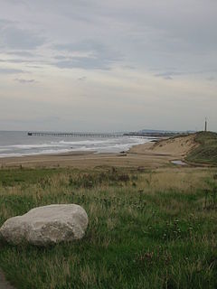
Crimdon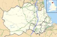
 Crimdon
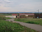
Crimdon shown within County DurhamOS grid reference NZ480372 Shire county County Durham Region North East Country England Sovereign state United Kingdom Post town TEESSIDE Postcode district TS27 Police Durham Fire County Durham and Darlington Ambulance North East EU Parliament North East England List of places: UK • England • County Durham Crimdon is a village in County Durham, England. It is situated on the North Sea coast, between Blackhall Rocks and Hartlepool on the A1086 road. Crimdon was formerly a popular holiday resort for miners and their families from nearby towns and villages, on account of its affordability for low-income workers. During the 1960s Butlins took an interest in buying the caravan park there from Easington District Council, but the sale was declined as Butlins intended to charge people to use the beach. The 1970s and 80s saw Crimdon's decline as a resort as the popularity of foreign travel increased. The caravan park still exists, but there are few facilities as was the case in the past, when there was a fairground and pavilion. Terns now nest on the beach at Crimdon, and the area has become popular with birdwatchers as tourism has waned.
 Crimdon
References
External links
Categories:- Villages in County Durham
- County Durham geography stubs


Wikimedia Foundation. 2010.