- Watkinsville, Georgia
Infobox Settlement
official_name = Watkinsville, Georgia
other_name =
native_name =
nickname =
settlement_type =Town
motto =
imagesize =
image_caption =
flag_size =
image_
seal_size =
image_shield =
shield_size =
image_blank_emblem =
blank_emblem_type =
blank_emblem_size =
imagesize =
image_caption =
flag_size =
image_
seal_size =
image_shield =
shield_size =
image_blank_emblem =
blank_emblem_type =
blank_emblem_size =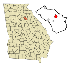
mapsize = 250px
map_caption = Location in Oconee County and the state of Georgia
mapsize1 =
map_caption1 =
image_dot_
dot_mapsize =
dot_map_caption =
dot_x =
dot_y =
pushpin_
pushpin_label_position =
pushpin_map_caption =
pushpin_mapsize =
subdivision_type = Country
subdivision_name =United States
subdivision_type1 = State
subdivision_name1 = Georgia
subdivision_type2 = County
subdivision_name2 = Oconee
subdivision_type3 =
subdivision_name3 =
subdivision_type4 =
subdivision_name4 =
government_footnotes =
government_type =
leader_title =
leader_name =
leader_title1 =
leader_name1 =
leader_title2 =
leader_name2 =
leader_title3 =
leader_name3 =
leader_title4 =
leader_name4 =
established_title =
established_date =
established_title2 =
established_date2 =
established_title3 =
established_date3 =
area_magnitude =
unit_pref = Imperial
area_footnotes =
area_total_km2 = 8.3
area_land_km2 = 8.3
area_water_km2 = 0
area_total_sq_mi = 3.2
area_land_sq_mi = 3.2
area_water_sq_mi = 0
area_water_percent =
area_urban_km2 =
area_urban_sq_mi =
area_metro_km2 =
area_metro_sq_mi =
area_blank1_title =
area_blank1_km2 =
area_blank1_sq_mi =
population_as_of = 2000
population_footnotes =
population_note =
population_total = 2097
population_density_km2 = 252.7
population_density_sq_mi = 655.3
population_metro =
population_density_metro_km2 =
population_density_metro_sq_mi =
population_urban =
population_density_urban_km2 =
population_density_urban_sq_mi =
population_blank1_title =
population_blank1 =
population_density_blank1_km2 =
population_density_blank1_sq_mi =
timezone = Eastern (EST)
utc_offset = -5
timezone_DST = EDT
utc_offset_DST = -4
latd = 33 |latm = 51 |lats = 46 |latNS = N
longd = 83 |longm = 24 |longs = 29 |longEW = W
elevation_footnotes =
elevation_m = 219
elevation_ft = 719
postal_code_type =ZIP code
postal_code = 30677
area_code = 706
blank_name = FIPS code
blank_info = 13-80788GR|2
blank1_name = GNIS feature ID
blank1_info = 0333373GR|3
website =
footnotes =Watkinsville is a
town in Oconee County, Georgia,United States . As of the 2000census , the town had a totalpopulation of 2,097. The city is thecounty seat of Oconee CountyGR|6. It was the seat of Clarke County until 1872 when thecounty seat of that county was moved to Athens, a move which ultimately led to the creation of Oconee County in 1875. The mayor is Jim Luken and the city is governed by a city council featuring five other posts. The Police Chief is Lee O'Dillon.Geography
Watkinsville is located at coor dms|33|51|46|N|83|24|29|W|city (33.862818, -83.408094)GR|1.
According to the
United States Census Bureau , the town has a total area of 3.2square mile s (8.4km² ), of which, 3.2 square miles (8.3 km²) of it is land and 0.31% is water.Demographics
As of the
census GR|2 of 2000, there were 2,097 people, 827 households, and 578 families residing in the town. Thepopulation density was 650.6 people per square mile (251.4/km²). There were 862 housing units at an average density of 267.4/sq mi (103.4/km²). The racial makeup of the town was 89.08% White, 7.34% African American, 0.05% Native American, 1.62% Asian, 0.48% Pacific Islander, 0.86% from other races, and 0.57% from two or more races. Hispanic or Latino of any race were 1.96% of the population.There were 827 households out of which 36.5% had children under the age of 18 living with them, 53.6% were married couples living together, 12.7% had a female householder with no husband present, and 30.1% were non-families. 24.4% of all households were made up of individuals and 8.5% had someone living alone who was 65 years of age or older. The average household size was 2.51 and the average family size was 2.99.
In the town the population was spread out with 26.8% under the age of 18, 8.6% from 18 to 24, 33.0% from 25 to 44, 22.7% from 45 to 64, and 8.9% who were 65 years of age or older. The median age was 34 years. For every 100 females there were 92.7 males. For every 100 females age 18 and over, there were 91.5 males.
The median income for a household in the town was $45,729, and the median income for a family was $55,170. Males had a median income of $32,295 versus $26,168 for females. The
per capita income for the town was $20,968. About 3.8% of families and 5.0% of the population were below thepoverty line , including 5.9% of those under age 18 and 4.7% of those age 65 or over.Trivia
* Researchers for the
University of Georgia discoveredplasmodesmata in Watkinsville.
* Legend holds that the location of the Eagle Tavern (which is still standing and available for tours downtown) was the one of the reasons that the University of Georgia was located 10 miles away in Athens, over 220 years ago.
* Watkinsville celebrated its 200th birthday in 2006. The city celebrated at Eagle TavernNovember 24 ,2006 with a commemorative postal cancellation at a special substation and various re-enactment celebrations.
* Watkinsville is home to two or three weekly publications: "The Oconee Enterprise" was established in 1884 and "The Oconee Leader" was established recently. The Athens Banner-Herald newspaper publishes a weekly supplement called "Oconee Living" which was mailed to some homes.
* Watkinsville has officially adopted the slogan "The Artland of Georgia" and supports downtown business and the arts at OCAF (Oconee Cultural Arts Foundation) and Ashford Manor Bed and Breakfast. Many music and arts performances occur regularly at both locations.
* Watkinsville has undergone a recent downtown revitalization project and planted many trees around the city in commemoration of the recent bicentennial. The city maintains two parks including Harris Shoals and Rocket Field.References
External links
* [http://watkinsville.georgia.gov/ Watkinsville Web Page at georgia.gov]
Wikimedia Foundation. 2010.