- North High Shoals, Georgia
-
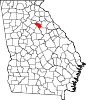
North High Shoals, Georgia — Town — Location in Oconee County and the state of Georgia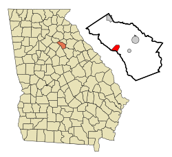
Coordinates: 33°50′3″N 83°30′4″W / 33.83417°N 83.50111°WCoordinates: 33°50′3″N 83°30′4″W / 33.83417°N 83.50111°W Country United States State Georgia County Oconee Area – Total 2.5 sq mi (6.5 km2) – Land 2.5 sq mi (6.5 km2) – Water 0 sq mi (0 km2) Elevation 640 ft (195 m) Population (2000) – Total 439 – Density 175.6/sq mi (67.5/km2) Time zone Eastern (EST) (UTC-5) – Summer (DST) EDT (UTC-4) FIPS code 13-56308[1] GNIS feature ID 1699883[2] North High Shoals is a town in Oconee County, Georgia, United States. The population was 439 at the 2000 census.
Contents
Geography
North High Shoals is located at 33°50′3″N 83°30′4″W / 33.83417°N 83.50111°W (33.834159, -83.501055)[3].
According to the United States Census Bureau, the town has a total area of 2.5 square miles (6.5 km2), all of it land.
Government
The town's government consists of a Town Council made up of a Mayor and 5 Council Members. As of March 22, 2010 these were: Mayor Kim Kraeling, Violet Dawe, Steve Holzman, David Lawrence, Stephen Arnold, and Jason Wisniewski
Meetings are held on the third Monday of the month at 7:30pm in the town hall.
Demographics
As of the census[1] of 2000, there were 439 people, 144 households, and 117 families residing in the town. The population density was 175.8 people per square mile (67.8/km²). There were 162 housing units at an average density of 64.9 per square mile (25.0/km²). The racial makeup of the town was 95.67% White, 1.59% African American, 0.46% Native American, 1.82% Asian, and 0.46% from two or more races. Hispanic or Latino of any race were 1.59% of the population.
There were 144 households out of which 51.4% had children under the age of 18 living with them, 72.2% were married couples living together, 6.9% had a female householder with no husband present, and 18.1% were non-families. 13.9% of all households were made up of individuals and 6.9% had someone living alone who was 65 years of age or older. The average household size was 3.05 and the average family size was 3.42.
In the town the population was spread out with 34.6% under the age of 18, 5.9% from 18 to 24, 31.4% from 25 to 44, 20.7% from 45 to 64, and 7.3% who were 65 years of age or older. The median age was 33 years. For every 100 females there were 99.5 males. For every 100 females age 18 and over, there were 96.6 males.
The median income for a household in the town was $60,208, and the median income for a family was $63,333. Males had a median income of $41,250 versus $28,750 for females. The per capita income for the town was $17,444. About 6.0% of families and 5.9% of the population were below the poverty line, including 3.0% of those under age 18 and 22.7% of those age 65 or over.
References
- ^ a b "American FactFinder". United States Census Bureau. http://factfinder.census.gov. Retrieved 2008-01-31.
- ^ "US Board on Geographic Names". United States Geological Survey. 2007-10-25. http://geonames.usgs.gov. Retrieved 2008-01-31.
- ^ "US Gazetteer files: 2010, 2000, and 1990". United States Census Bureau. 2011-02-12. http://www.census.gov/geo/www/gazetteer/gazette.html. Retrieved 2011-04-23.
External links
Municipalities and communities of Oconee County, Georgia Towns Bishop | Bogart‡ | North High Shoals | Watkinsville
Footnotes ‡This populated place also has portions in an adjacent county or counties
Categories:- Populated places in Oconee County, Georgia
- Towns in Georgia (U.S. state)
- Athens – Clarke County metropolitan area


Wikimedia Foundation. 2010.