Washington State Route 163
- Washington State Route 163
Infobox WA State Route
type=State
route=163
sec=
parent_type=WA
parent=16
length_mi=3.37
length_ref=[cite web|author=Washington State Department of Transportation|url=http://www.wsdot.wa.gov/mapsdata/tdo/PDF_and_ZIP_Files/HwyLog2006.pdf|title=State Highway Log, 2006|accessdate=2007-04-22] ]
length_round=2
formed=1992 (original, 1964)
dir2=South
dir1=North
to=
from=Point Defiance ferry terminal
previous_type=WA
previous_route=162
next_type=WA
next_route=164
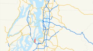
State Route 163 is a state highway in the U.S. state of Washington, running from SR 16 in Tacoma to the Point Defiance ferry terminal. It continues as the Point Defiance-Tahlequah ferry route and ends at the Tahlequah terminal.
History
Before 1992, there was another SR 163. It started at then U.S. Route 410 (now SR 410) in Sumner and ended at SR 167* in Auburn. Before 1994, the current route used the ferry.
*"Note: At the time, SR 167 was not the Valley Freeway, but a two-lane road."
Major intersections
*
*Point Defiance ferry terminal
References
Wikimedia Foundation.
2010.
Look at other dictionaries:
Washington State Route 167 — infobox WA State Route type=WA route=167 sec=330 parent=410 parent type=WA alternate name=Valley Freeway length mi=28.60 length ref= length round=2 formed=1964 dir1=South dir2=North from= junction= to= in Renton previous type=WA previous… … Wikipedia
Washington State Route 16 — Karte … Deutsch Wikipedia
California State Route 163 — Karte … Deutsch Wikipedia
Washington State Route 410 — State Route 410 Chinook Scenic Byway … Wikipedia
Washington State Route 162 — infobox WA State Route type=WA route=162 sec=315 parent=410 parent type=WA length mi=17.34 length ref= length round=2 dir1=West dir2=East from=SR 410 to=SR 165 previous type=WA previous route=161 next type=WA next route=163State Route 162,… … Wikipedia
Washington State Route 164 — Infobox WA State Route type=State route=164 sec= parent type=WA parent=16 length mi=24.82 length ref=cite web|author=Washington State Department of Transportation|url=http://www.wsdot.wa.gov/mapsdata/tdo/PDF and ZIP… … Wikipedia
Washington State Ferries — This page is about the ferry system operated by the state of Washington. Other entities operate other Ferries in Washington State Washington State Ferries is a passenger and automobile ferry service owned and operated by the Washington State… … Wikipedia
State Route 1002 (Lehigh County, Pennsylvania) — Infobox road state=PA type=QR route=1002 alternate name=Main Street; Tilghman Street; Union Boulevard maint= length mi=13.77 length round=2 length ref=cite web|url=http://www.mapquest.com/directions/main.adp?mo=ma 2si=navt un=m go=1 2gi=0… … Wikipedia
Ohio State Route 7 — State Route 7 Major highways in Ohio with OH 7 in red. Route information … Wikipedia
Ohio State Route 590 — State Route 590 Route information Maintained by ODOT Length: 25.17 mi[1 … Wikipedia
