- Denton, Georgia
-
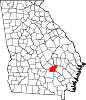
Denton, Georgia — City — Location in Jeff Davis County and the state of Georgia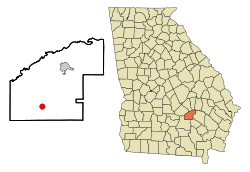
Coordinates: 31°43′22″N 82°41′47″W / 31.72278°N 82.69639°WCoordinates: 31°43′22″N 82°41′47″W / 31.72278°N 82.69639°W Country United States State Georgia County Jeff Davis Area – Total 1.5 sq mi (4 km2) – Land 1.5 sq mi (4 km2) – Water 0 sq mi (0 km2) Elevation 262 ft (80 m) Population (2000) – Total 269 – Density 179.3/sq mi (67.3/km2) Time zone Eastern (EST) (UTC-5) – Summer (DST) EDT (UTC-4) ZIP code 31532 Area code(s) 912 FIPS code 13-22388[1] GNIS feature ID 0313447[2] Denton is a city in Jeff Davis County, Georgia, United States. The population was 269 at the 2000 census.
Geography
Denton is located at 31°43′22″N 82°41′47″W / 31.72278°N 82.69639°W (31.722663, -82.696323)[3].
According to the United States Census Bureau, the city has a total area of 1.5 square miles (3.9 km2), all of it land. The Mayor of this city is Matt Mcaw.
Demographics
As of the census[1] of 2000, there were 269 people, 96 households, and 69 families residing in the city. The population density was 174.0 people per square mile (67.0/km²). There were 112 housing units at an average density of 72.5 per square mile (27.9/km²). The racial makeup of the city was 73.98% White, 18.59% African American, 6.69% from other races, and 0.74% from two or more races. Hispanic or Latino of any race were 6.69% of the population.
There were 96 households out of which 29.2% had children under the age of 18 living with them, 55.2% were married couples living together, 13.5% had a female householder with no husband present, and 28.1% were non-families. 27.1% of all households were made up of individuals and 7.3% had someone living alone who was 65 years of age or older. The average household size was 2.80 and the average family size was 3.38.
In the city the population was spread out with 30.5% under the age of 18, 8.9% from 18 to 24, 27.9% from 25 to 44, 22.3% from 45 to 64, and 10.4% who were 65 years of age or older. The median age was 33 years. For every 100 females there were 92.1 males. For every 100 females age 18 and over, there were 94.8 males.
The median income for a household in the city was $20,833, and the median income for a family was $27,250. Males had a median income of $19,000 versus $20,313 for females. The per capita income for the city was $7,649. About 28.3% of families and 24.1% of the population were below the poverty line, including 13.1% of those under the age of eighteen and 41.7% of those sixty five or over.
References
- ^ a b "American FactFinder". United States Census Bureau. http://factfinder.census.gov. Retrieved 2008-01-31.
- ^ "US Board on Geographic Names". United States Geological Survey. 2007-10-25. http://geonames.usgs.gov. Retrieved 2008-01-31.
- ^ "US Gazetteer files: 2010, 2000, and 1990". United States Census Bureau. 2011-02-12. http://www.census.gov/geo/www/gazetteer/gazette.html. Retrieved 2011-04-23.
Municipalities and communities of Jeff Davis County, Georgia Cities Denton | Hazlehurst
Unincorporated
communityTallahassee
Categories:- Cities in Georgia (U.S. state)
- Populated places in Jeff Davis County, Georgia


Wikimedia Foundation. 2010.