- Adairsville, Georgia
Infobox Settlement
official_name = Adairsville, Georgia
other_name =
native_name =
nickname =
settlement_type =City
motto =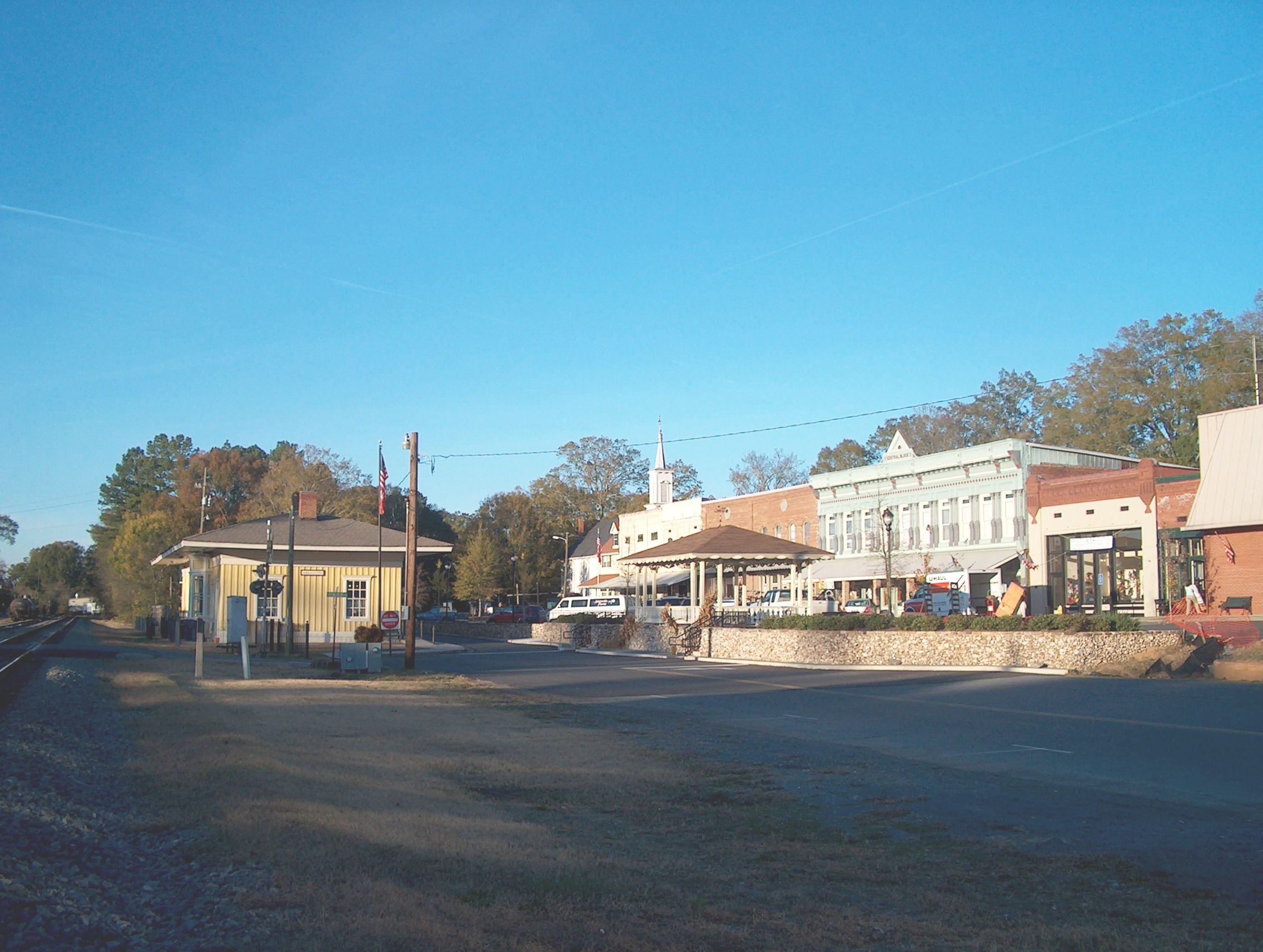
image_caption = Downtown Adairsville including original train depot used in the Great Chase.
imagesize = 250px
flag_size =
image_
seal_size =
image_shield =
shield_size =
image_blank_emblem =
blank_emblem_type =
blank_emblem_size =
flag_size =
image_
seal_size =
image_shield =
shield_size =
image_blank_emblem =
blank_emblem_type =
blank_emblem_size =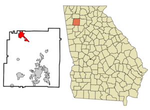
mapsize = 250px
map_caption = Location in Bartow County and the state of Georgia
mapsize1 =
map_caption1 =
image_dot_
dot_mapsize =
dot_map_caption =
dot_x =
dot_y =
pushpin_
pushpin_label_position =
pushpin_map_caption =
pushpin_mapsize =
subdivision_type = Country
subdivision_name =United States
subdivision_type1 = State
subdivision_name1 = Georgia
subdivision_type2 = County
subdivision_name2 = Bartow
subdivision_type3 =
subdivision_name3 =
subdivision_type4 =
subdivision_name4 =
government_footnotes =
government_type =
leader_title =
leader_name =
leader_title1 =
leader_name1 =
leader_title2 =
leader_name2 =
leader_title3 =
leader_name3 =
leader_title4 =
leader_name4 =
established_title =
established_date =
established_title2 =
established_date2 =
established_title3 =
established_date3 =
area_magnitude =
unit_pref = Imperial
area_footnotes =
area_total_km2 = 16
area_land_km2 = 16
area_water_km2 = 0
area_total_sq_mi = 6.2
area_land_sq_mi = 6.2
area_water_sq_mi = 0
area_water_percent =
area_urban_km2 =
area_urban_sq_mi =
area_metro_km2 =
area_metro_sq_mi =
area_blank1_title =
area_blank1_km2 =
area_blank1_sq_mi =
population_as_of = 2000
population_footnotes =
population_note =
population_total = 2542
population_density_km2 = 158.9
population_density_sq_mi = 410
population_metro =
population_density_metro_km2 =
population_density_metro_sq_mi =
population_urban =
population_density_urban_km2 =
population_density_urban_sq_mi =
population_blank1_title =
population_blank1 =
population_density_blank1_km2 =
population_density_blank1_sq_mi =
timezone = Eastern (EST)
utc_offset = -5
timezone_DST = EDT
utc_offset_DST = -4
latd = 34 |latm = 22 |lats = 8 |latNS = N
longd = 84 |longm = 55 |longs = 42 |longEW = W
elevation_footnotes =
elevation_m = 219
elevation_ft = 719
postal_code_type =ZIP code
postal_code = 30103
area_code = 770
blank_name = FIPS code
blank_info = 13-00436GR|2
blank1_name = GNIS feature ID
blank1_info = 0310389GR|3
website =
footnotes =Adairsville is a city in Bartow County, Georgia,
United States . The population was 2,542 at the 2000 census. As of the 2005 census Adairsville's population rose to 3,416, making Adairsville the 3rd largest city in the county. Adairsville is convert|11.81|mi|km south of Calhoun, convert|18.21|mi|km northeast of Rome and convert|61.11|mi|km north of Atlanta.Geography
Adairsville is located at coor dms|34|22|6|N|84|55|42|W|city (34.368925, -84.928212)GR|1.According to the United States Census Bureau, the city has a total area of 6.2 square miles (16.0 km²), all land.
History
Adairsville used to be a small
Cherokee village named after Chief Walter (John) S. Adair, a Scottish settler who married a Cherokee Indian woman before the removal of the Cherokee in 1838. It was part of the Cherokee territory along with Calhoun and including New Echota "(seeNew Echota , Calhoun andTrail of Tears for more information on Cherokee removal)".After the removal of the Cherokees, the village became part of Georgia, and the residents built the town keeping the name Adairsville. One of the developers was William Watts who had a lot of railroad business interest in this town. He had brought the Western and Atlantic Railroad from Atlanta (still in use). He deeded land to the railroad, surveyed business lots including hotels, mills, and blacksmith shops around the town where the railroad ran by the 1847 train depot. Watt's plan was successful and brought the town the nickname: "Granary of the State" and led to its incorporation in 1854. He was also a town resident and he had a home that was built around the foundation of an Indian cabin which is on a hill overlooking the town.
During the
American Civil War , Adairsville was involved on the side of theConfederate States of America in 1861 against the Union. On April 12, 1862, the steam locomotive "General" was pursued from Atlanta and passed through Adairsville as its people witnessed the incident during theGreat Locomotive Chase . After this happened, Adairians set their own three day street festival in remembrance of the Chase. The Civil War came to the town on May 17, 1864 in full force where the Confederate army failed to defeat Sherman and his Union army during theAtlanta Campaign . This battle is known as theBattle of Adairsville . After the Civil War ended in 1865, Adairsville rebuilt and became a hub for the carpet and textile industries, and for farm and transportation services, including its famous railroad. Some historical buildings still intact in the town include the original train depot which was involved in "The Great Locomotive Chase".Adairsville is also well known for Barnsley Gardens, which is now a golf resort. Barnsley Gardens is situated southwest of the city center of Adairsville. The home was built by Sir Godfrey Barnsley of
Derbyshire ,England in the late 1840s for his wife Julia. She died before the house could be completed, but it is said that her ghost appeared to Sir Godfrey, telling him to complete the work. It was brought the visions ofAndrew Jackson Downing , the architect who designed the grounds of theU.S. Capitol andWhite House . The ruins of the great main house remain. Almost lost to time and the elements, the land, including all of the ruins, was bought in 1988 by Prince Hubertus Fugger who restored the gardens and renovated the grounds into an upscale golf resort.Demographics
As of the
census GR|2 of 2000, there were 2,542 people, 991 households, and 702 families residing in the city. Thepopulation density was 411.9 people per square mile (159.1/km²). There were 1,103 housing units at an average density of 178.7/sq mi (69.0/km²). The racial makeup of the city was 72.58% White, 22.54% African American, 0.31% Native American, 1.38% Asian, 1.49% from other races, and 1.69% from two or more races. Hispanic or Latino of any race were 2.01% of the population.There were 991 households out of which 35.2% had children under the age of 18 living with them, 47.3% were married couples living together, 19.0% had a female householder with no husband present, and 29.1% were non-families. 25.7% of all households were made up of individuals and 9.7% had someone living alone who was 65 years of age or older. The average household size was 2.57 and the average family size was 3.08.
In the city the population was spread out with 29.2% under the age of 18, 8.7% from 18 to 24, 29.7% from 25 to 44, 20.4% from 45 to 64, and 12.0% who were 65 years of age or older. The median age was 33 years. For every 100 females there were 85.1 males. For every 100 females age 18 and over, there were 82.4 males.
The median income for a household in the city was $31,114, and the median income for a family was $34,828. Males had a median income of $31,123 versus $21,899 for females. The
per capita income for the city was $14,828. About 16.4% of families and 18.9% of the population were below thepoverty line , including 24.4% of those under age 18 and 22.1% of those age 65 or over.Notable natives and residents
Pretty Boy Floyd , American bank robber was born there.Bobby Cox , Atlanta Braves manager.Orlando Wilson , a famous TV fisherman.
Wally Fowler, Founder of the Oak Ridge Boys
Victor Beasley, American football player (Auburn University)References
External links
* [http://www.adairsville-ga.com/ City of Adairsville, Ga official web site]
* [http://adairsvilledepot.garlandlink.com/ Adairsville Rail Depot Museum web site]
* [http://www.barnsleyinn.com/ Barnsley Gardens web site]
* [http://notatlanta.org/adairsville.html Cartersville-Bartow County Convention and Visitors Bureau: Adairsville]
* [http://www.bartow.k12.ga.us/aes Adairsville Elementary web site]
* [http://www.bartow.k12.ga.us/ahs Adairsville High School web site]
Wikimedia Foundation. 2010.