- Maysville, Georgia
-
Maysville, Georgia — Town — Location in Banks County and the state of Georgia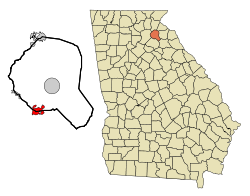
Coordinates: 34°15′20″N 83°33′30″W / 34.25556°N 83.55833°WCoordinates: 34°15′20″N 83°33′30″W / 34.25556°N 83.55833°W Country United States State Georgia Counties Banks, Jackson Area - Total 3.6 sq mi (9.3 km2) - Land 3.6 sq mi (9.3 km2) - Water 0 sq mi (0 km2) Elevation 907 ft (276 m) Population (2000) - Total 1,663 - Density 346.4/sq mi (134.1/km2) Time zone Eastern (EST) (UTC-5) - Summer (DST) EDT (UTC-4) ZIP code 30558 Area code(s) 706 FIPS code 13-50484[1] GNIS feature ID 0332342[2] Maysville is a town in Banks and Jackson Counties in the U.S. state of Georgia. The population was 1,663 at the 2000 census.
Geography
Maysville is located at 34°15′20″N 83°33′30″W / 34.25556°N 83.55833°W (34.255518, -83.558222)[3].
According to the United States Census Bureau, the town has a total area of 3.6 square miles (9.3 km2), all of it land.
Demographics
As of the census[1] of 2000, there were 1,663 people, 689 households, and 573 families residing in the town. The population density was 346.1 people per square mile (133.7/km²). There were 737 housing units at an average density of 146.8 per square mile (56.7/km²). The racial makeup of the town was 95.11% White, 2.57% African American, 0.08% Native American, 0.24% Asian, 0.96% from other races, and 1.04% from two or more races. Hispanic or Latino of any race were 1.52% of the population.
There were 481 households out of which 35.8% had children under the age of 18 living with them, 61.7% were married couples living together, 9.6% had a female householder with no husband present, and 24.1% were non-families. 21.6% of all households were made up of individuals and 8.9% had someone living alone who was 65 years of age or older. The average household size was 2.58 and the average family size was 2.99.
In the town the population was spread out with 26.3% under the age of 18, 6.9% from 18 to 24, 32.7% from 25 to 44, 22.5% from 45 to 64, and 11.5% who were 65 years of age or older. The median age was 36 years. For every 100 females there were 93.6 males. For every 100 females age 18 and over, there were 85.3 males.
The median income for a household in the town was $51,857, and the median income for a family was $58,511. Males had a median income of $45,206 versus $35,758 for females. The per capita income for the town was $28,296. About 4.5% of families and 6.6% of the population were below the poverty line, including 3.6% of those under age 18 and 21.4% of those age 65 or over.
References
- ^ a b "American FactFinder". United States Census Bureau. http://factfinder.census.gov. Retrieved 2008-01-31.
- ^ "US Board on Geographic Names". United States Geological Survey. 2007-10-25. http://geonames.usgs.gov. Retrieved 2008-01-31.
- ^ "US Gazetteer files: 2010, 2000, and 1990". United States Census Bureau. 2011-02-12. http://www.census.gov/geo/www/gazetteer/gazette.html. Retrieved 2011-04-23.
Municipalities and communities of Banks County, Georgia Cities Baldwin‡ | Gillsville‡ | Lula‡

Towns Unincorporated
communitiesFootnotes ‡This populated place also has portions in an adjacent county or counties
Municipalities and communities of Jackson County, Georgia Cities 
Towns Footnotes ‡This populated place also has portions in an adjacent county or counties
Categories:- Populated places in Banks County, Georgia
- Populated places in Jackson County, Georgia
- Towns in Georgia (U.S. state)


Wikimedia Foundation. 2010.