- Stock Island, Florida
Infobox Settlement
official_name = Stock Island, Florida
other_name =
native_name =
nickname =
settlement_type = CDP
motto =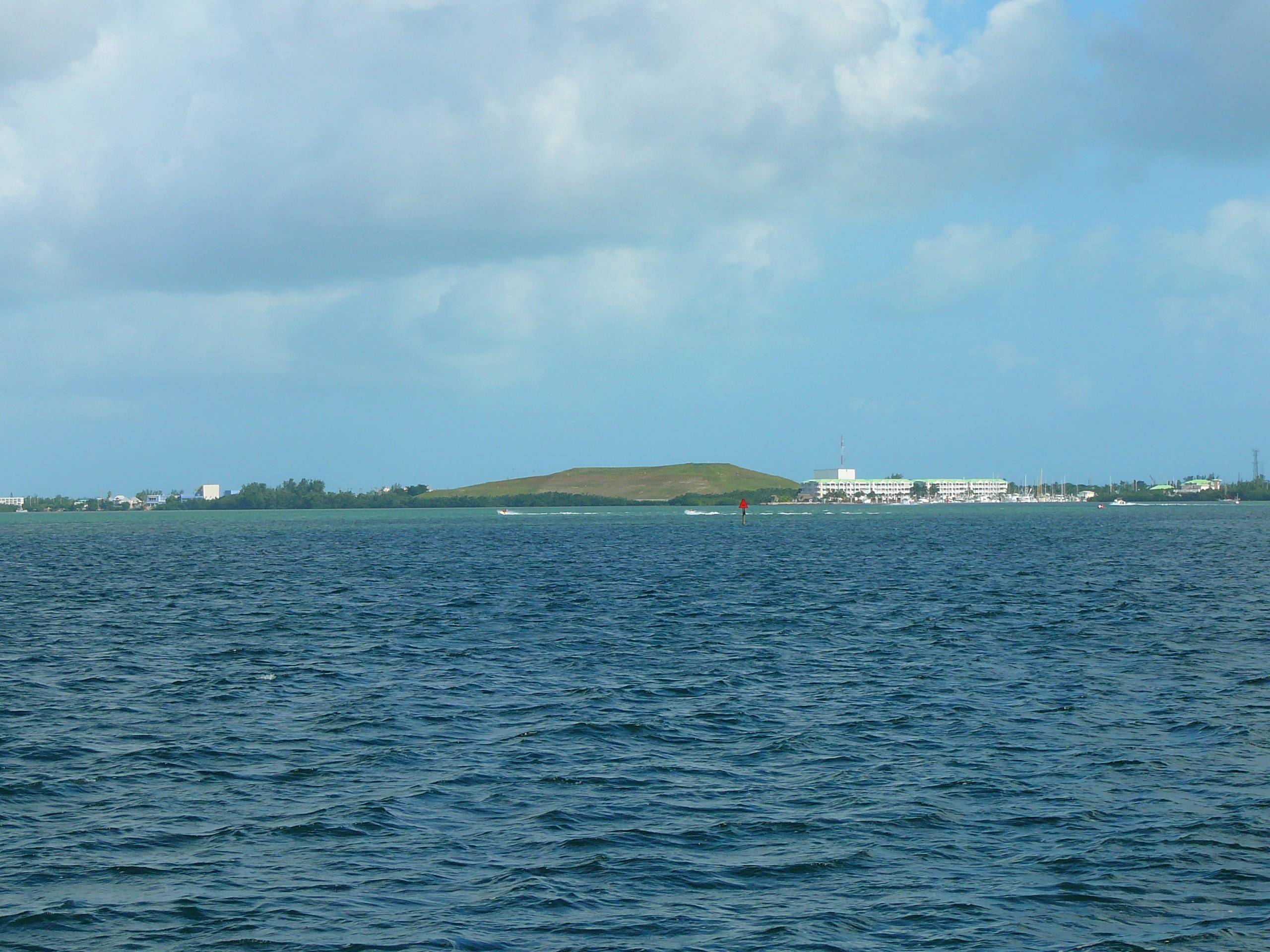
imagesize = 250px
image_caption = Stock Island from the north.Florida Keys Community College can be seen to the far left. A largeland fill is in the center, and amarina /resort is on the right.
flag_size =
image_
seal_size =
image_shield =
shield_size =
image_blank_emblem =
blank_emblem_type =
blank_emblem_size =
flag_size =
image_
seal_size =
image_shield =
shield_size =
image_blank_emblem =
blank_emblem_type =
blank_emblem_size =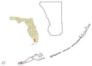
mapsize = 250x200px
map_caption = Location in Monroe County and the state ofFlorida 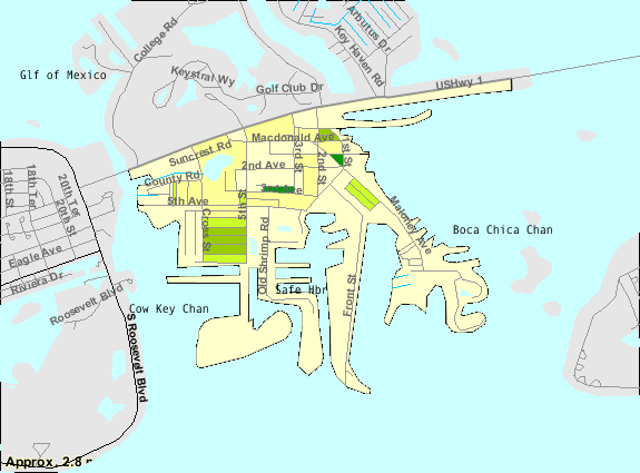
mapsize1 = 250x200px
map_caption1 = U.S. Census Bureau map showing CDP boundaries
image_dot_
dot_mapsize =
dot_map_caption =
dot_x =
dot_y =
pushpin_
pushpin_label_position =
pushpin_map_caption =
pushpin_mapsize =
subdivision_type = Country
subdivision_name = flag|United States
subdivision_type1 = State
subdivision_name1 = flag|Florida
subdivision_type2 = County
subdivision_name2 = noflag|Monroe
subdivision_type3 =
subdivision_name3 =
subdivision_type4 =
subdivision_name4 =
government_footnotes =
government_type =
leader_title =
leader_name =
leader_title1 =
leader_name1 =
leader_title2 =
leader_name2 =
leader_title3 =
leader_name3 =
leader_title4 =
leader_name4 =
established_title =
established_date =
established_title2 =
established_date2 =
established_title3 =
established_date3 =
area_magnitude =
unit_pref = Imperial
area_footnotes =
area_total_km2 = 2.3
area_land_km2 = 2.3
area_water_km2 = 0
area_total_sq_mi = 0.9
area_land_sq_mi = 0.9
area_water_sq_mi = 0
area_water_percent =
area_urban_km2 =
area_urban_sq_mi =
area_metro_km2 =
area_metro_sq_mi =
area_blank1_title =
area_blank1_km2 =
area_blank1_sq_mi =
population_as_of = 2000
population_footnotes =
population_note =
population_total = 4410
population_density_km2 = 1917.4
population_density_sq_mi = 4900
population_metro =
population_density_metro_km2 =
population_density_metro_sq_mi =
population_urban =
population_density_urban_km2 =
population_density_urban_sq_mi =
population_blank1_title =
population_blank1 =
population_density_blank1_km2 =
population_density_blank1_sq_mi =
timezone = Eastern (EST)
utc_offset = -5
timezone_DST = EDT
utc_offset_DST = -4
latd = 24 |latm = 34 |lats = 12 |latNS = N
longd = 81 |longm = 44 |longs = 15 |longEW = W
elevation_footnotes =
elevation_m = 1
elevation_ft = 3
postal_code_type =ZIP code s
postal_code = 33040-33041
area_code = 305
blank_name = FIPS code
blank_info = 12-68800GR|2
blank1_name = GNIS feature ID
blank1_info = 1867211GR|3
website =
footnotes =Stock Island is an island in the lower
Florida Keys immediately east ofKey West (separated from Key West by Cow Key Channel, which is only about 75 yards (70 m) wide). Immediately northwest isKey Haven (official name "Raccoon Key"), from which it is connected by causeway with US 1 (theOverseas Highway ). The part north of U.S. 1 is part of the City of Key West, while the southern part is acensus-designated place (CDP) in Monroe County,Florida ,United States . [ [http://www.keywestcity.com/egov/docs/1161957236_949066.pdf Zoning Map] . "City of Key West". AccessedSeptember 21 ,2008 .] The population of the CDP was 4,410 at the 2000 census. Supposedly named for herds of livestock formerly kept there. Alternatively, some local historians suggest that it may be named for an early settler. [http://keys.fiu.edu/gazetteer/00000611.htm "Key Names" Florida Keys Gazetteer]Geography
Stock Island is located at coor dms|24|34|12|N|81|44|15|W|city (24.570075, -81.737376)GR|1.
U.S. 1 (or the
Overseas Highway ) crosses the key at approximately mile markers 4--6, immediately east of Key West.According to the
United States Census Bureau , the CDP has a total area of 0.9 mi² (2.4km² ). 0.9 mi² (2.3 km²) of it is land and 1.10% is water.Demographics
As of the
census GR|2 of 2000, there were 4,410 people, 1,713 households, and 1,050 families residing in the CDP. Thepopulation density was 1,891.9/km² (4,919.1/mi²). There were 1,855 housing units at an average density of 795.8/km² (2,069.2/mi²). The racial makeup of the CDP was 79.95% White, 10.45% African American, 0.36% Native American, 1.09% Asian, 0.05% Pacific Islander, 4.76% from other races, and 3.33% from two or more races. Hispanic or Latino of any race were 43.33% of the population.There were 1,713 households out of which 29.6% had children under the age of 18 living with them, 39.5% were married couples living together, 15.4% had a female householder with no husband present, and 38.7% were non-families. 26.0% of all households were made up of individuals and 5.4% had someone living alone who was 65 years of age or older. The average household size was 2.57 and the average family size was 3.12.
In the CDP the population was spread out with 23.5% under the age of 18, 8.3% from 18 to 24, 33.2% from 25 to 44, 26.5% from 45 to 64, and 8.5% who were 65 years of age or older. The median age was 37 years. For every 100 females there were 118.6 males. For every 100 females age 18 and over, there were 118.8 males.
The median income for a household in the CDP was $31,537, and the median income for a family was $38,029. Males had a median income of $23,714 versus $20,182 for females. The
per capita income for the CDP was $14,346. About 19.2% of families and 20.5% of the population were below thepoverty line , including 28.9% of those under age 18 and 16.2% of those age 65 or over.The northern side of stock island is home to the Key West Golf Course and the Monroe County Detention Center. The southern side of the island is home to numerous mobile homes and marinas.
Education
Monroe County School District operates public schools serving Stock Island.
Three schools in the City of Key West, [http://gra.monroe.k12.fl.us/ Glynn R. Archer Elementary School] on Stock Island and [http://hob.monroe.k12.fl.us/ Horace O'Bryant Middle School] and
Key West High School [http://kwh.monroe.k12.fl.us/] , located on Key West Island, serve Stock Island.References
External links
Wikimedia Foundation. 2010.