- Auckland CBD
-
Auckland Central Business District 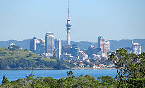
The Auckland Central Business District (CBD) as seen from Rangitoto Island.Basic information Local authority Auckland Council Date established 1840 Land area 433 ha Population ~ 40,000[1] (~ 2010) Facilities Train station(s) Britomart Transport Centre Ferry terminal(s) Auckland Ferry Terminal Surrounds North (Waitemata Harbour) East Parnell Southeast Grafton South Mount Eden Southwest Newton West Freemans Bay Northwest Viaduct Basin 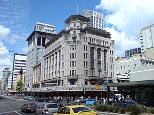
The Auckland CBD (the Central Business District, sometimes referred to as 'Central City' or 'Downtown', and as the 'City Centre' in recent planning documents) is the geographical and economic heart of the Auckland metropolitan area. Bounded by several major motorways and by the harbour coastline in the north, it is surrounded further out by mostly suburban areas. It is one of the most densely built-up areas of New Zealand.
Contents
Geography
Located on the northern shore of a narrow isthmus, the CBD extends from the Auckland waterfront on the Waitemata Harbour southwards along Queen Street and a number of other parallel-running streets. The CBD is generally considered to be bounded by the main motorways that surround all non-harbour sides, with State Highway 1 forming the southern and western boundaries, and State Highway 16 / Grafton Gully forming the eastern boundary.[2]
The size of the CBD is 433 ha, similar to the Sydney CBD, and twice as large as the CBDs of Wellington and Christchurch.[2] The CBD is to a substantial part located on reclaimed land of the Waitemata Harbour. For a closer discussion of this aspect, see the Commercial Bay and Auckland waterfront articles.
History
The Auckland CBD started to become a defined (if slightly less extensive) area from early on, starting in the 1840s with the first European colonisation of the area. This was mainly due to the increasing concentration of businesses, and especially retail, along Queen Street, which still to this day forms the 'spine' of the area. In 1841, just one year after the European founding, the census counted approximately 2,000 people, with "mechanics" the largest group at 250, and other groups of note being 150 agricultural labourers, 100 shopkeepers, 100 domestic servants, and 125 "upper class members".[3]
Initially the area also contained many manufacturing businesses, though these started to move to other areas later on, the flight becoming especially marked around the 1950s. A beginning exodus of retailers to suburban shopping malls was halted by increased construction of parking buildings and a concentration on specialty services and retail over the type of supermarket and mall shopping that was created in places like Pakuranga from 1965 onwards.[4]
Residential numbers in the inner city (including the inner suburbs) were also declining in the 20th century from as early as the 1920s. In the two-mile zone surrounding the CBD, there were approximately 70,000 people in 1926, with only around 50,000 in 1966 - a change made even more marked by the development of the remainder of Auckland's population, which grew more than fourfold in the same timeframe.[4] In the 1990s, only a token population of around 1,400 was still residing within the actual CBD, though this was to grow substantially with a boom of new apartment buildings around the turn of the millennium.[5] Around 24,000 apartment units exist as of 2010.[1]
Characteristics
Overview
The CBD of Auckland has been the leading centre of New Zealand's business and economic development for nearly two centuries. The area of today's CBD was the site of the original European settlement of Auckland, oriented along the coastline and then Queen Street, in a southward direction. From those origins, it has grown progressively, and become much more densely built-up, now being an area of high-rise buildings mainly used for commercial and retail uses. It has the highest concentration of arts, culture and higher education institutions and venues in the country.[6]
Some commentators have noted that the recent decades have not been kind to the aesthetics and the community values of the inner city. The demolishing of many older buildings, often the prerequisite for low-quality or uninspired new office and residential developments, is considered by them to be due to a combination of developers uninterested in long-term outcomes as well as due to Council planning direction being too weak.[7]
In an attempt to reverse the decline of aesthetics in the CBD, previous Auckland City Councils and the current unitary Auckland Council have instigated several urban regeneration schemes. These include the recent redevelopment of Aotea Square in 2010[8] and the upgrade of Saint Patrick's Square in 2009.[9] The area east of the Britomart Transport Centre is currently undergoing major changes, with the development of new commercial buildings, development of public spaces and restoration of several heritage buildings. Another major regeneration scheme currently underway is the redevelopment of Wynyard Quarter, which involves replacing industrial facilities covering a large portion of the CBD waterfront with residential or commercial buildings and public spaces.
The Auckland CBD is one of the few places in New Zealand that has skyscraper-sized buildings, such as the Vero Centre, ANZ Centre or the Metropolis, with the Sky Tower rising above them.
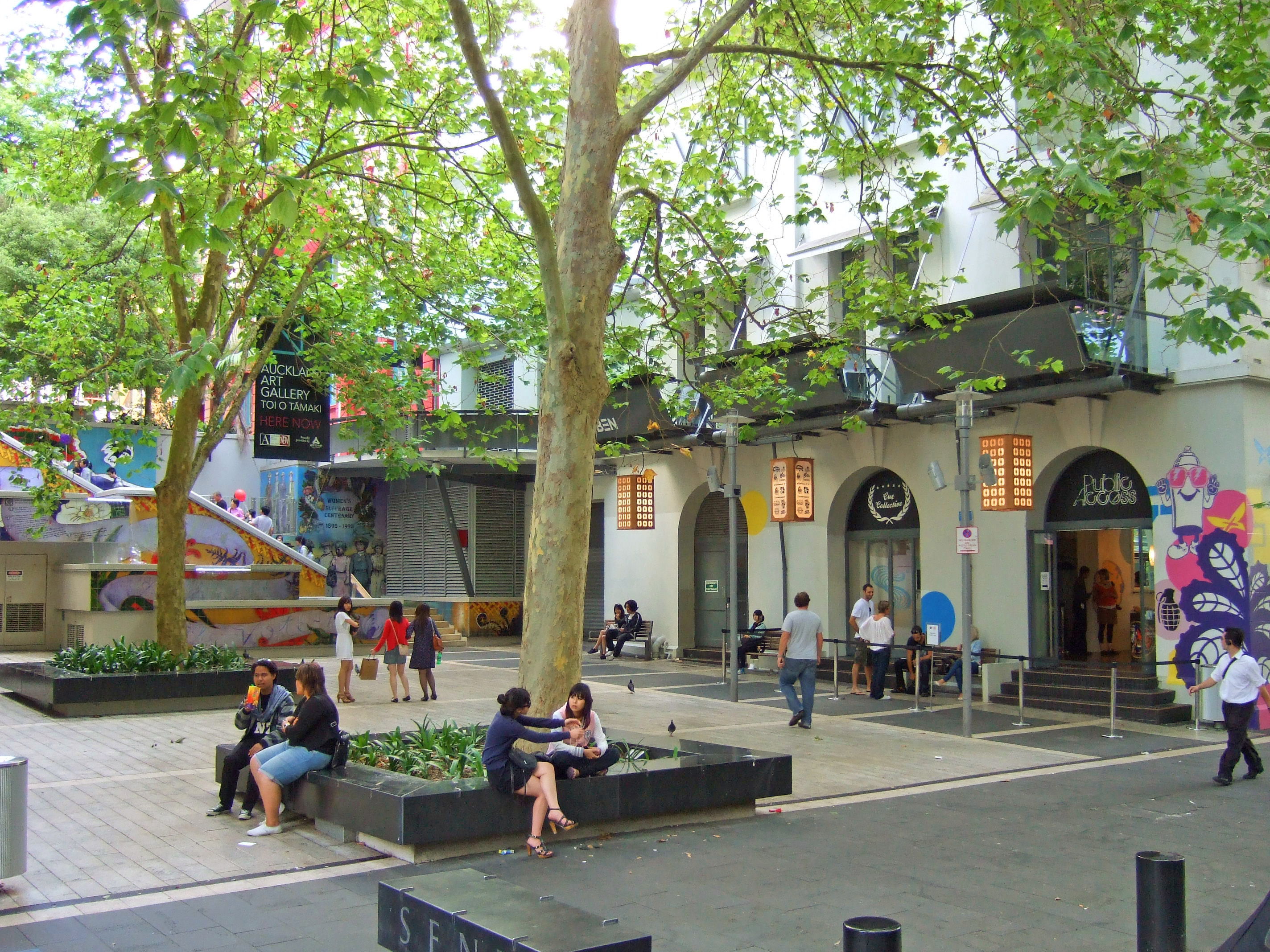
 Khartoum Place, a pedestrian square in the central CBD.
Population
Residential high-density buildings constructed within the last decade have helped to increase the population actually living in the CBD to around 40,000 (2010 estimate) from earlier 16,000 (2004 estimate), all being a massive growth from only 1,400 in 1991.[1][2][6] Much of this growth has been driven by immigration to New Zealand, particularly from Asia, and the CBD is the area in New Zealand with the highest percentage share (32%) of the Asian ethnic group in New Zealand.[10] Also striking is the high number of students (both tertiary education and overseas students studying English in one of the many institutes), making up 27% of all residents (2001 Census) and contributing to the relative youth of the city residents.[11]
With increasing population, available services have also changed - from only about one superette in the early 2000s, this has ballooned to one supermarket and 38 superettes by 2011. However, the population remains highly focused on ethnically diverse, mostly young and childless residents.[3]
According to an in-depth study of security perception in the Auckland CBD undertaken in 2005, most visitors and locals feel safe visiting and living in the CBD. Police and the Council have in part ascribed these positive feelings to over a dozen safety initiatives undertaken by authorities (from alcohol bans in parts of the CBD to CCTV surveillance and street lighting measures). However, in spite of the general perception of the CBD being safe, there was a feeling that crime had risen somewhat in the last five years (whereas in fact numbers had declined). This was considered to be mostly due to a media-driven public image.[12]
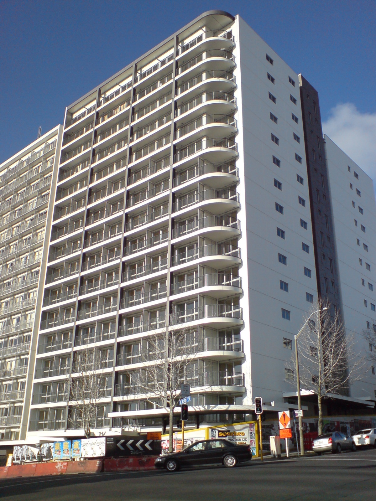
 Late 2000s apartment block on Nelson Street. Many of these buildings saw strong criticism - and sometimes lack of tenant interest - due to perceived problems with building quality, lack of urban design and too-small unit sizes (with a bylaw banning very small units coming in only in 2005).[13]
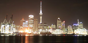 The CBD economy is dominated by Ports of Auckland and by business and financial support services.
Economy
With 8,500 businesses, the CBD accounts for 18% of all businesses in Auckland City, with the largest being Ports of Auckland, and the largest employment sectors being financial services, business and ICT services. The CBD is also the largest employment centre in New Zealand, with around 65,000 jobs, representing 13% of the regional workforce, and 25% of the Auckland City workforce. Around 73,000 people enter the CBD every morning between 7 am and 9 am, 60% of these by car,[2] while the total 'turnover' is around 270,000 people per day.[14] In 2003 many large corporations were housed in the Auckland CBD. During the same year, an Auckland City report stated that the Auckland CBD, compared to several central business districts in Australia, had "a broader and more dominant role in its regional economy" compared to the economies of the Australian central business districts.[15]
The CBD remains attractive to shops, partially due to the very high pedestrian numbers on the main shopping streets like Queen Street, where footfalls are estimated to be up to 10 times as high as on Broadway in Newmarket, seen as Queen Street's closest rival.[3]
Auckland CBD has a higher share of employment in large firms than other areas in Auckland. Over half of the large firms in Auckland CBD are in office-based sectors (such as property and business services and finance and insurance) and are in the Downtown and Waterfront areas of the CBD. In 2004 Auckland CBD had 72,540 employees and 9125 businesses. 2006 Auckland CBD had 78,444 employees and 9,461 businesses.[16]
Air New Zealand was formerly headquartered in Auckland CBD. In 2006, from late September to early October, the airline moved employees out of the four buildings it occupied in Auckland CBD and relocated them to the new headquarters located in Auckland City.[17] In September 2003 Air New Zealand was the only one of the very largest corporations in New Zealand to have its headquarters within the Auckland CBD.[15]
Education
There are significant educational institutions located in the Auckland CBD, notably the University of Auckland and the Auckland University of Technology. The CBD also has many of the English language schools for foreigners which form a significant part of Auckland's education business.[18][19]
The Ministry of Education operates state-operated schools throughout the area. Private secondary schools within the CBD include ACG New Zealand International College,[20] ACG Senior College,[21] and Auckland International College.[22]
Transport
The CBD, with its substantial employment, and increasing amount of residents, contains the main public transport hubs of the city. These services are concentrated around the Britomart Transport Centre (rail and buses) and the nearby Auckland Ferry Terminal, both near the Auckland waterfront. Many bus services do however also travel the length of the CBD along the main streets, in particular via the bus lanes on Albert Street and the Central Connector bus priority route. Nearly 33,000 people enter the CBD via public transport every day.[23]
Much of the transport to and around the CBD is however also by private vehicles, partly because the CBD provides numerous parking buildings[4] and parking spaces associated with office buildings, as well as due to being an area almost totally surrounded (and thus relatively easily accessible) by motorways.
The current (as of 2011) Auckland Council considers that Auckland should construct the CBD tunnel, partly to further boost and revitalise the city centre, and also to reduce the car-dependancy in terms of access to the CBD.
The main street of the CBD is Queen Street, which was upgraded between 2006 and 2008 to modernise it and make it more pedestrian friendly. In 2009, the former Auckland City Council proposed the redevelopment of several CBD streets into shared spaces, with the goal of improving pedestrian and cyclist amenity by slowing down vehicle traffic while retaining the possibility for car access - compared to a pedestrian mall which allows no motor vehicles.[24] The new unitary Auckland Council is continuing this project. The conversion of Darby Street into a shared space was completed in April 2011,[25] while several other streets (Fort Street, Elliot Street and Lorne Street) are also currently being converted into shared spaces, with more shared spaces being discussed.[26]
See also
- Auckland City
- Auckland waterfront
- Karangahape Road, southern boundary mainstreet
- Queen Street, north-south mainstreet of the CBD
- Grand Hotel (Auckland), Princes Street, the leading hotel in Auckland from 1889 until 1966, its facade still standing
References
- ^ a b c "Future looking up for high-rises". The New Zealand Herald. 8 March 2010. http://www.nzherald.co.nz/business/news/article.cfm?c_id=3&objectid=10630717. Retrieved 29 September 2010.
- ^ a b c d Auckland's CBD at a glance (CBD website of the Auckland City Council)
- ^ a b c "Auckland Central". Property Report - insert to The New Zealand Herald: p. 23. 5 September 2011.
- ^ a b c New Zealand Historical Atlas - McKinnon, Malcolm (Editor); David Bateman, 1997, Plate 75
- ^ See 'Population' section in this article.
- ^ a b About the CBD (CBD website of the Auckland City Council)
- ^ Michael Stevens: Leaders stand by as city is desecrated - The New Zealand Herald, Thursday, 03 May 2007
- ^ http://www.aucklandcity.govt.nz/council/projects/aoteasquare/default.asp
- ^ http://www.aucklandcity.govt.nz/council/projects/cbdproject/stpatrickssquare.asp
- ^ Auckland City CBD PESTE analysis (CBD website of the Auckland City Council)
- ^ Residents of Auckland's CBD (CBD website of the Auckland City Council)
- ^ Most feel Auckland CBD safe, survey shows (from a New Zealand Police press release, Tuesday 04 October 2006. Accessed 2008-02-18.)
- ^ "Tenants shun CBD’s shoebox apartments". The New Zealand Herald1. 1 November 2005. http://www.nzherald.co.nz/nz/news/article.cfm?c_id=1&objectid=10352969. Retrieved 18 June 2011.
- ^ A day in the life of Auckland's CBD (CBD website of the Auckland City Council. Accessed 2008-02-18.)
- ^ a b "The Economy of Auckland’s Central Business District." City of Auckland. September 2003. Executive Summary (5/77). Retrieved on 7 September 2009.
- ^ "CBD facts and figures." City of Auckland. Retrieved on 26 August 2009.
- ^ Gibson, Anne. "Air NZ readies for headquarters shift." The New Zealand Herald. Monday 14 August 2006. Retrieved on 26 August 2009.
- ^ Survey of English Language Providers - Year ended March 2006 (from Statistics New Zealand. Auckland is assumed to follow national pattern)
- ^ English Language Schools in New Zealand - Auckland (list linked from the Immigration New Zealand website)
- ^ "ACG New Zealand International College." Ministry of Education. Retrieved on 5 March 2010.
- ^ "ACG Senior College." Ministry of Education. Retrieved on 5 March 2010.
- ^ "Auckland International College." Ministry of Education. Retrieved on 5 March 2010.
- ^ "Report looks into the state of our city". CityScene. Auckland City Council. 29 August 2010.
- ^ Auckland: the new Copenhagen? - The National Business Review, Monday 25 May 2009
- ^ http://www.aucklandcity.govt.nz/council/projects/elliottdarby/default.asp
- ^ http://www.aucklandcity.govt.nz/council/projects/cbdproject/sharedspace.asp
External links
- Auckland's CBD Into the Future (CBD website of the Auckland City Council)
Coordinates: 36°50′50″S 174°45′54″E / 36.8471567°S 174.7649395°E
Categories:- Suburbs of Auckland
- Central business districts


Wikimedia Foundation. 2010.