- Timnath, Colorado
Infobox Settlement
elevation_footnotes = GR|3
official_name = Town of Timnath, Colorado
settlement_type =Town
nickname =
motto =
postal_code_type =ZIP code cite web|url = http://zip4.usps.com/zip4/citytown.jsp | title = ZIP Code Lookup| format =JavaScript /HTML | publisher =United States Postal Service | accessdate=2008-01-06]
postal_code = 80547 (PO Box )
imagesize = 270px
image_caption = "Old Town Timnath" in 2005. Structures, from left to right (north to south) are the town hall, fire station, and an empty storefront.
image_
image_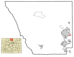
mapsize = 250px
map_caption = Location of Timnath shown withinColorado
mapsize1 =
map_caption1 =
subdivision_type = Country
subdivision_name = USA
subdivision_type1 = State
subdivision_name1 = flag|Colorado
subdivision_type2 = Countycite web | url = http://www.dola.state.co.us/dlg/local_governments/municipalities.html | title = Active Colorado Municipalities | format =HTML | publisher = State of Colorado, Department of Local Affairs | accessdate = 2007-09-01]
subdivision_name2 = Larimer County
government_type = Statutory Town
leader_title =Mayor
leader_name =Donna Benson
established_title = Settled
established_date = 1869
established_title2 = Established
established_date2 = 1882
established_title3 = Incorporated
established_date3 =July 6 ,1920 cite web | url = http://www.colorado.gov/dpa/doit/archives/muninc.html | title = Colorado Municipal Incorporations | format =HTML | publisher = State of Colorado, Department of Personnel & Administration, Colorado State Archives | date =2004-12-01 | accessdate = 2007-09-02]
area_magnitude =
area_total_km2 = 0.6
area_total_sq_mi = 0.2
area_land_km2 = 0.6
area_land_sq_mi = 0.2
area_water_km2 = 0.0
area_water_sq_mi = 0.0
area_water_percent = 0.0
area_urban_km2 =
area_urban_sq_mi =
area_metro_km2 =
area_metro_sq_mi =
population_as_of = 2000
population_note =
population_total = 223
population_density_km2 = 374.4
population_density_sq_mi = 960.2
population_metro =
population_density_metro_km2 =
population_density_metro_sq_mi =
population_urban =
timezone = MST
utc_offset = -7
timezone_DST = MDT
utc_offset_DST = -6
latd = 40 |latm = 31 |lats = 47 |latNS = N
longd = 104 |longm = 58 |longs = 54 |longEW = W
elevation_m = 1483
elevation_ft = 4867
website = [http://www.timnathcolorado.org/ Town of Timnath]
area_code = 970
blank_name = FIPS code
blank_info = 08-77510
blank1_name = GNIS feature ID
blank1_info = [http://geonames.usgs.gov/pls/gnispublic/f?p=gnispq:3:::NO::P3_FID:0180510 0180510]
named_for = Biblical city of Timnath
footnotes =The Town of Timnath is a Statutory Town located in Larimer County,
Colorado ,United States . Founded in 1882, Timnath is a small agricultural/farming community located southeast ofFort Collins, Colorado , approximately one-half mile east of the Harmony Road/Interstate 25 interchange, on a small bluff east of theCache la Poudre River . The surrounding farmlands have been used primarily forpotato es,alfalfa ,sugar beet s, andcattle . Although the town has remained virtually unchanged in recent decades, the encroaching growth of both Fort Collins to the west and Windsor to the south have placed the town in an area considered favorable to development. The population was 223 at the 2000 census.Description
Other structures lining Main Street (a section of County Road 5) include an elementary school (in the
Poudre School District ), a one-story modern post-office, and several other historic buildings. Most residences are single-family homes.History
The area was first homesteaded by white settlers in 1869. The first schoolhouse was constructed that year, approximately one-half mile west of the current town, and was named "Fairview". By 1880, the community had outgrown the schoolhouse, and new "Fairview" school was built just north of the current town. The school also served as an early meeting place for the
Presbyterian Church . The turning point in the early history of the community was in 1882, with the arrival of theGreeley, Salt Lake and Pacific Railroad (controlled by the Union Pacific) linking Greeley and Fort Collins. The following year, the Presbyterian Church, petitioned by local residents, sent a missionary to found a congregation. The current structure along Main Street dates from that year.A post office was established in 1884, headed by Reverend Charles A. Taylor, the local Presbyterian minister. When the post office was formed, Taylor bestowed the current name of the town from the 14th chapter of the
Book of Judges , as the place whereSamson went to obtain a Philistine wife. In 1900 the second school became outdated and a new one was built, dropping the name "Fairview" permanently. This structure currently stands as an out-building to the current elementary school. A larger school was built in 1918 (which burned in 1935 and was rebuilt the following year). The school district was consolidated with that of Fort Collins in 1960.During WWII Japan experimented with "Balloon Bombs" that floated across the pacific to the U.S. The only bomb to successfully reach land was one that floated all the way to Colorado when the balloon finally popped over the Town of Timnath making it the only town on the continental United States to be bombed in WWII.
Geography
Timnath is located at 40°31'47" North, 104°58'54" West (40.529718, -104.981654)GR|1.
According to the
United States Census Bureau , as of the 2000 census, the town has a total area of 0.2square mile s (0.6km² ), of which, 0.2 square miles (0.6 km²) of it is land and none of it is covered by water.The historical downtown lies along County Road Five, which runs north-south parallel to Interstate 25 half a mile to the east ( [http://www.timnathcolorado.org/documents/maps/Existing%20Land%20Use.pdf Existing Land Use Map] ). Since the 2000 census, the town of Timnath has annexed several square miles of land to the east and southeast; the town [http://www.timnathcolorado.org/documents/maps/future.land.use.05.pdf Future Land Use Plan] anticipates commercial development along the east-west corridor of County Road 38 (Harmony Road). The majority of the six mile (north-south) by three mile (east-west) block of land that lies within Timnath's growth management area is low-density residential or agricultural, and is designated to remain so, with open space and parkland filling the remainder of the area, particularly near the
Poudre River and Timnath Reservoir.Government
Timnath exists as a statutory town in the state of Colorado, meaning that town officials exercise the powers allowed them by the state legislature. Under Colorado law, Timnath is governed in the
mayor-council form of government by a Board of Trustees. The mayor and the four trustees are elected at-large. The mayor and two trustees serve four-year terms, two trustees serve two-year terms.Demographics
As of the
census GR|2 of 2000, there were 223 people, 88 households, and 62 families residing in the town. Thepopulation density was 960.2 people per square mile (374.4/km²). There were 91 housing units at an average density of 391.8/sq mi (152.8/km²). The racial makeup of the town was 91.93% White, 0.00% African American, 3.14% Native American, 0.00% Asian, 0.00% Pacific Islander, 0.45% from other races, and 4.48% from two or more races. 8.07% of the population were Hispanic or Latino of any race.There were 88 households out of which 34.1% had children under the age of 18 living with them, 56.8% were married couples living together, 5.7% had a female householder with no husband present, and 29.5% were non-families. 22.7% of all households were made up of individuals and 6.8% had someone living alone who was 65 years of age or older. The average household size was 2.53 and the average family size was 3.03.
In the town the population was spread out with 30.5% under the age of 18, 0.9% from 18 to 24, 35.9% from 25 to 44, 25.6% from 45 to 64, and 7.2% who were 65 years of age or older. The median age was 39 years. For every 100 females there were 95.6 males. For every 100 females age 18 and over, there were 98.7 males.
The median income for a household in the town was $51,250, and the median income for a family was $55,000. Males had a median income of $41,250 versus $29,375 for females. The
per capita income for the town was $27,089. 10.5% of the population and 7.7% of families were below thepoverty line . 11.6% of those under the age of 18 and 0.0% of those 65 and older were living below the poverty line.ee also
*
Colorado municipalities
*Fort Collins-Loveland Metropolitan Statistical Area
*Front Range Urban Corridor
*Larimer County, Colorado
*State of Colorado References
External links
* [http://www.timnathcolorado.org/ Town of Timnath website]
** [http://www.dot.state.co.us/App_DTD_DataAccess/Downloads/CityMaps/Timnath.pdf CDOT map of the Town of Timnath]
* [http://www.timnathpres.org/ Timnath Presbyterian Church]
* [http://schoolweb.psdschools.org/timnath/ Timnath Elementary School]
Wikimedia Foundation. 2010.