- Chatyr-Kul
-
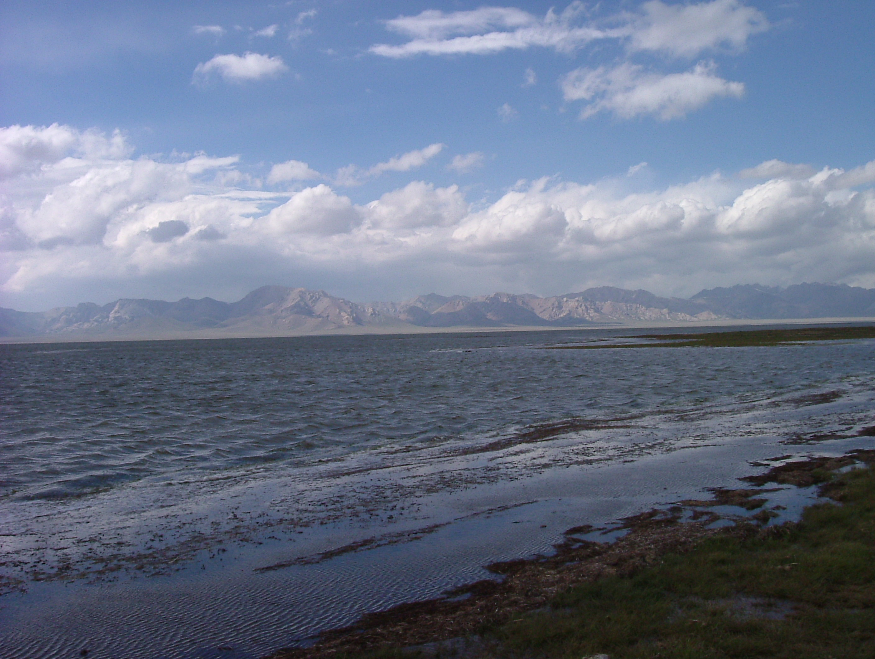
Lake Chatyr-Kul 
Location Tian Shan mountains, Naryn Province Coordinates 40°37′N 75°18′E / 40.617°N 75.3°ECoordinates: 40°37′N 75°18′E / 40.617°N 75.3°E Lake type Endorheic
Mountain lakePrimary inflows Glaciers Primary outflows Evaporation Catchment area 1,050 km2 (410 sq mi) Basin countries Kyrgyzstan Designation Ramsar site Max. length 23 km (14 mi) Max. width 10 km (6.2 mi) Surface area 181 km2 (70 sq mi) Max. depth 16.5 m (54 ft) Water volume 0.62 km3 (0.15 cu mi) Shore length1 58 km (36 mi) Surface elevation 3,530 m (11,580 ft) Islands none Settlements none 1 Shore length is not a well-defined measure. Chatyr-Kul (also Chatyr Köl, Chatyrkol, Kyrgyz: Чатыркөл) is an endorheic alpine lake in the Tian Shan mountains in At-Bashi District of Naryn Province, Kyrgyzstan; it lies in the lower part of Chatyr-Kul Depression near the Torugart Pass border crossing into China. The name of the lake means “Celestial Lake” in Kyrgyz. The lake and 2 km buffer zone around it is part of the Karatal-Japyryk State Nature Reserve. The lake is a Ramsar site of globally significant biodiversity (Ramsar Site RDB Code 2KG002).
Hydrology
The water of Chatyr Kul Lake is yellowish-green with water transparency of up to 4 metres (13 ft). The mineralization of the lake ranges from 0.5 to 1.0 milligrams per liter (chloride, hydrocarbonate, sodium and magnesium type of mineralization). The salinity of the lake is 2 ppt. Mineral sources in the south part of the lake have mineralization of from 5 to 7 grams (0.18 to 0.25 oz) per liter and pH = 5,8-6,0. Flow rate is 1,866 m3 (65,900 cu ft) in winter and 3,629 cubic metres (128,200 cu ft) during summer.
Negative water balance of the lake over the last decades causes the decline in the lake level.
References
Information about Chatyr-Kul Lake
Ala-Kul · Besh-Tash Lake · Chatyr-Kul · Issyk Kul · Jashyl Kel · Juukuchak Lake · Kara-Suu Lake · Kapka Tash Lake · Kara-Toko Lake · Kashka-Suu Lake · Kel-Ukek · Kel-Suu · Kel-Ter Lake · Kulun Lake · Kylaa-Kel · Okurgen Lake · Lake Sary-Chelek · Merzbacher Lake · Sary-Kel · Song Kol Lake · Tash-Bulak LakeCategories:- Lakes of Kyrgyzstan
- Ramsar sites in Kyrgyzstan
- Endorheic lakes of Asia
- Mountain lakes
- Kyrgyzstan geography stubs
Wikimedia Foundation. 2010.