- Red Cliff, Colorado
Infobox Settlement
official_name = Town of Red Cliff, Colorado
other_name =
native_name =
nickname =
settlement_type =Town
motto =
imagesize =
image_caption =
flag_size =
image_
seal_size =
image_shield =
shield_size =
image_blank_emblem =
blank_emblem_type =
blank_emblem_size =
imagesize =
image_caption =
flag_size =
image_
seal_size =
image_shield =
shield_size =
image_blank_emblem =
blank_emblem_type =
blank_emblem_size =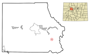
mapsize = 250px
map_caption = Location in Eagle County and the state ofColorado
mapsize1 =
map_caption1 =
image_dot_
dot_mapsize =
dot_map_caption =
dot_x =
dot_y =
pushpin_
pushpin_label_position =
pushpin_map_caption =
pushpin_mapsize =
subdivision_type = Country
subdivision_name = USA
subdivision_type1 = State
subdivision_name1 = flag|Colorado|name=State of Colorado
subdivision_type2 = Countycite web | url = http://www.dola.state.co.us/dlg/local_governments/municipalities.html | title = Active Colorado Municipalities | format =HTML | publisher = State of Colorado, Department of Local Affairs | accessdate = 2007-09-01]
subdivision_name2 = Eagle County
subdivision_type3 =
subdivision_name3 =
subdivision_type4 =
subdivision_name4 =
government_footnotes =
government_type = Statutory Town
leader_title =
leader_name =
leader_title1 =
leader_name1 =
leader_title2 =
leader_name2 =
leader_title3 =
leader_name3 =
leader_title4 =
leader_name4 =
established_title = Founded
established_date = 1879
established_title2 = Incorporated (town)
established_date2 =December 18 ,1880 cite web | url = http://www.colorado.gov/dpa/doit/archives/muninc.html | title = Colorado Municipal Incorporations | format =HTML | publisher = State of Colorado, Department of Personnel & Administration, Colorado State Archives | date =2004-12-01 | accessdate = 2007-09-02]
established_title3 =
established_date3 =
area_magnitude =
unit_pref = Imperial
area_footnotes =
area_total_km2 = 0.6
area_land_km2 = 0.6
area_water_km2 = 0
area_total_sq_mi = 0.2
area_land_sq_mi = 0.2
area_water_sq_mi = 0
area_water_percent =
area_urban_km2 =
area_urban_sq_mi =
area_metro_km2 =
area_metro_sq_mi =
area_blank1_title =
area_blank1_km2 =
area_blank1_sq_mi =
population_as_of = 2000
population_footnotes =
population_note =
population_total = 289
population_density_km2 = 481.7
population_density_sq_mi = 1445
population_metro =
population_density_metro_km2 =
population_density_metro_sq_mi =
population_urban =
population_density_urban_km2 =
population_density_urban_sq_mi =
population_blank1_title =
population_blank1 =
population_density_blank1_km2 =
population_density_blank1_sq_mi =
timezone = Mountain (MST)
utc_offset = -7
timezone_DST = MDT
utc_offset_DST = -6
latd = 39 |latm = 30 |lats = 38 |latNS = N
longd = 106 |longm = 22 |longs = 24 |longEW = W
elevation_footnotes =
elevation_m =
elevation_ft = 8750
postal_code_type =ZIP code
postal_code = 81649 (PO Box )cite web | url = http://zip4.usps.com/zip4/citytown.jsp | title = ZIP Code Lookup| format =JavaScript /HTML | publisher =United States Postal Service | accessdate = December 23 | accessyear = 2007]
area_code = 970
blank_name = FIPS code
blank_info = 08-63265
blank1_name = GNIS feature ID
blank1_info = [http://geonames.usgs.gov/pls/gnispublic/f?p=gnispq:3:::NO::P3_FID:0202362 0202362]
website =
footnotes =Red Cliff (sometimes spelled Redcliff) is a Statutory Town in Eagle County,
Colorado ,United States . The population was 289 at the 2000 census. The town is a former mining camp that has staged a modest recovery in recent years as a low-keycounterculture mountain community. It is situated in the canyon of the upper Eagle River just offU.S. Highway 24 north of Tennessee Pass. The town site is somewhat concealed from the highway (which passes over the Red Cliff Truss Bridge near the town [ [http://bridges.midwestplaces.com/co/eagle/red-cliff-truss/ Historic Bridges of the U.S. | Red Cliff Truss Bridge ] ] ) and is accessible by a side road that leads up toShrine Pass in theSawatch Range . It was founded in 1879 during the early days of theColorado Silver Boom by miners from Leadville who came over Tennessee Pass scouting for better prospects. The name derives from the redquartzite cliffs surrounding the town. As the first white community in the Eagle Valley, it served temporarily as the first county seat of Eagle County (formed out of Summit County in 1883) until the relocation of the county seat to Eagle in 1921.The town today consists of a cluster of older homes and converted trailers on the flanks of the canyon around the river, as well as a post office, a historic church and numerous older wooden structures along the main street of the town. Several of the older structures have been converted in recent years into modern businesses, including a restaurant. The town is located within easy driving distance of nearby ski areas and the revival of the town has given rise to a new inn housed in one of the downtown structures.
In winter, the town also serves as a popular access point to Shrine Pass for cross-country skiers. In recent years, a car shuttle has operated between the town and nearby Vail, allowing visitors to Vail easy access to the pass.
Geography
Red Cliff is located at coor dms|39|30|38|N|106|22|24|W|city (39.510570, -106.373458)GR|1 and is sited at elevation 8,750.
According to the
United States Census Bureau , the town has a total area of 0.2square mile s (0.6km² ), all of it land.Demographics
As of the
census GR|2 of 2000, there were 289 people, 109 households, and 68 families residing in the town. Thepopulation density was 1,256.4 people per square mile (485.1/km²). There were 122 housing units at an average density of 530.4/sq mi (204.8/km²). The racial makeup of the town was 62.98% White, 0.69% African American, 0.69% Native American, 0.35% Pacific Islander, 32.87% from other races, and 2.42% from two or more races. Hispanic or Latino of any race were 61.94% of the population.There were 109 households out of which 26.6% had children under the age of 18 living with them, 49.5% were married couples living together, 9.2% had a female householder with no husband present, and 36.7% were non-families. 22.9% of all households were made up of individuals and 4.6% had someone living alone who was 65 years of age or older. The average household size was 2.65 and the average family size was 3.16.
In the town the population was spread out with 20.8% under the age of 18, 13.8% from 18 to 24, 36.7% from 25 to 44, 18.7% from 45 to 64, and 10.0% who were 65 years of age or older. The median age was 33 years. For every 100 females there were 124.0 males. For every 100 females age 18 and over, there were 126.7 males.
The median income for a household in the town was $50,104, and the median income for a family was $44,219. Males had a median income of $35,694 versus $30,750 for females. The
per capita income for the town was $19,864. About 6.8% of families and 9.8% of the population were below thepoverty line , including 8.5% of those under the age of eighteen and 31.6% of those sixty five or over.ee also
*
Colorado municipalities
*Eagle County, Colorado
*Edwards Micropolitan Statistical Area
*State of Colorado References
External links
* [http://www.cmca.gen.co.us/Municipality.cfm?MunicipalityID=283 Town of Red Cliff contacts]
** [http://www.dot.state.co.us/App_DTD_DataAccess/Downloads/CityMaps/Red%20Cliff.pdf CDOT map of the Town of Red Cliff]
* [http://www.eaglecounty.us/lifestyle/new/history.cfm Eagle County History]
Wikimedia Foundation. 2010.