- Mahtowa, Minnesota
-
Mahtowa — Unincorporated community — 
 Mahtowa
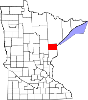
Coordinates: 46°34′26″N 92°37′55″W / 46.57389°N 92.63194°WCoordinates: 46°34′26″N 92°37′55″W / 46.57389°N 92.63194°W Country United States State Minnesota County Carlton County Township Mahtowa Township Elevation 1,152 ft (351 m) ZIP code 55707 Area code(s) 218 GNIS feature ID 0647392 Mahtowa is an unincorporated community in Mahtowa Township, Carlton County, Minnesota, United States.
The community is located between Cloquet and Moose Lake, near the junction of Interstate 35 and Carlton County Road 4.
County Road 4 and County Road 61 are two of the main routes in the community.
Further reading
- Minnesota DOT map of Carlton County (2006)
Municipalities and communities of Carlton County, Minnesota County seat: Carlton Cities Barnum | Carlton | Cloquet | Cromwell | Kettle River | Moose Lake | Scanlon | Thomson | Wrenshall | Wright
Townships Atkinson | Automba | Barnum | Beseman | Blackhoof | Eagle | Holyoke | Kalevala | Lakeview | Mahtowa | Moose Lake | Perch Lake | Silver | Silver Brook | Skelton | Split Rock | Thomson | Twin Lakes | Wrenshall
Unorganized
territoriesUnincorporated
communitiesAtkinson | Automba | Duesler | Esko | Harney | Holyoke | Iverson | Mahtowa | Nemadji | Otter Creek | Pleasant Valley | Sawyer | Scotts Corner
Indian
reservationsFootnotes ‡This populated place also has portions in an adjacent county or counties
Categories:- Populated places in Carlton County, Minnesota
- Unincorporated communities in Minnesota
- Arrowhead region geography stubs


Wikimedia Foundation. 2010.