- Neoga Township, Cumberland County, Illinois
-
Neoga Township — Township — Location in Cumberland County Cumberland County's location in Illinois
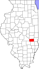
Coordinates: 39°19′24″N 88°24′06″W / 39.32333°N 88.40167°WCoordinates: 39°19′24″N 88°24′06″W / 39.32333°N 88.40167°W Country  United States
State  Illinois
County Cumberland Established November 6, 1860 Area – Total 55.54 sq mi (143.85 km2) – Land 54.73 sq mi (141.74 km2) – Water 0.82 sq mi (2.11 km2) 1.47% Elevation 676 ft (206 m) Population (2000) – Total 3,291 – Density 60.1/sq mi (23.2/km2) Time zone CST (UTC-6) – Summer (DST) CDT (UTC-5) ZIP codes 62447, 62468, 62469 GNIS feature ID 0429425 Neoga Township is one of eight townships in Cumberland County, Illinois, USA. As of the 2000 census, its population was 3,291[1].
Contents
Geography
According to the United States Census Bureau, Neoga Township covers an area of 55.54 square miles (143.8 km2); of this, 54.73 square miles (141.8 km2) (98.53 percent) is land and 0.82 square miles (2.1 km2) (1.47 percent) is water.
Cities, towns, villages
Unincorporated towns
Cemeteries
The township contains these eight cemeteries: Concord, Drummond, Illinois Central Railroad, Lockhart, Long Point, Neoga, Neoga Railroad Crossing and Zion.
Major highways
Airports and landing strips
- Cumberland Air Park
- Williamson Airport
School districts
- Cumberland Community Unit School District 77
- Mattoon Community Unit School District 2
- Neoga Community Unit School District 3
Political districts
- State House District 109
- State Senate District 55
References
- "Neoga Township, Cumberland County, Illinois". Geographic Names Information System, U.S. Geological Survey. http://geonames.usgs.gov/pls/gnispublic/f?p=gnispq:3:::NO::P3_FID:0429425. Retrieved 2010-01-17.
- United States Census Bureau 2009 TIGER/Line Shapefiles
- United States National Atlas
External links
Municipalities and communities of Cumberland County, Illinois Cities 
Villages Townships Cottonwood | Crooked Creek | Greenup | Neoga | Spring Point | Sumpter | Union | Woodbury
Unincorporated
communitiesBradbury | Dees | Hazel Dell | Janesville‡ | Johnstown | Liberty Hill | Lillyville | Maple Point | Neal | Roslyn | Timothy | Union Center | Vevay Park | Walla Walla | Woodbury
Footnotes ‡This populated place also has portions in an adjacent county or counties
Categories:- Townships in Cumberland County, Illinois
- Charleston-Mattoon micropolitan area
- 1860 establishments


Wikimedia Foundation. 2010.