- Dollern
-
Dollern 
 DollernLocation of Dollern within Stade district
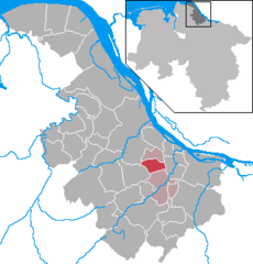
Coordinates 53°32′20″N 9°33′0″E / 53.53889°N 9.55°ECoordinates: 53°32′20″N 9°33′0″E / 53.53889°N 9.55°E Administration Country Germany State Lower Saxony District Stade Municipal assoc. Horneburg Mayor Wilfried Ehlers (SPD) Basic statistics Area 11.96 km2 (4.62 sq mi) Elevation 17 m (56 ft) Population 1,809 (31 December 2010)[1] - Density 151 /km2 (392 /sq mi) Other information Time zone CET/CEST (UTC+1/+2) Licence plate STD Postal code 21739 Area code 04163 Website horneburg.de Dollern is a municipality in the district of Stade, Lower Saxony, Germany. In 2006 the population was 1,747.
Contents
History
Dollern belonged to the Prince-Archbishopric of Bremen, established in 1180. In 1648 the Prince-Archbishopric was transformed into the Duchy of Bremen, which was first ruled in personal union by the Swedish Crown - interrupted by a Danish occupation (1712-1715) - and from 1715 on by the Hanoverian Crown. In 1807 the ephemeric Kingdom of Westphalia annexed the Duchy, before France annexed it in 1810. In 1813 the Duchy was restored to the Electorate of Hanover, which - after its upgrade to the Kingdom of Hanover in 1814 - incorporated the Duchy in a real union and the Ducal territory, including Dollern, became part of the new Stade Region, established in 1823.
Demography
In 2006 the population was 1,747.[2]
Transport
The rapid transit system of Hamburg S-Bahn serves Dollern at the railway station with the trains of the line S3.[3]
References
- ^ "Bevölkerungsfortschreibung" (in German). Landesbetrieb für Statistik und Kommunikationstechnologie Niedersachsen. 31 December 2009. http://www1.nls.niedersachsen.de/statistik/html/parametereingabe.asp?DT=K1000014&CM=Bev%F6lkerungsfortschreibung.
- ^ Selectable database. "NLS-Online, die größte regionalstatistische Datenbank Deutschlands Statistik-Regional-Niedersachsen" (in German). Landesbetrieb für Statistik und Kommunikationstechnologie Niedersachsen. http://www1.nls.niedersachsen.de/statistik/. Retrieved 2009-10-09.
- ^ Staff (2009-10-07), Rapid Transit/Regional Rail (Network plan, pdf), Hamburger Verkehrsverbund, http://www.hvv.de/pdf/fahrplaene/usar/hvv_usar_regio.pdf, retrieved 2009-02-07
External links
- Website of municipality Horneburg with section Dollern. Retrieved 2009-10-09. (German).
Agathenburg | Ahlerstedt | Apensen | Balje | Bargstedt | Beckdorf | Bliedersdorf | Brest | Burweg | Buxtehude | Deinste | Dollern | Drochtersen | Düdenbüttel | Engelschoff | Estorf | Fredenbeck | Freiburg | Großenwörden | Grünendeich | Guderhandviertel | Hammah | Harsefeld | Heinbockel | Himmelpforten | Hollern-Twielenfleth | Horneburg | Jork | Kranenburg | Krummendeich | Kutenholz | Mittelnkirchen | Neuenkirchen | Nottensdorf | Oederquart | Oldendorf | Sauensiek | Stade | Steinkirchen | Wischhafen Categories:
- Municipalities in Lower Saxony
- Stade district
- Lüneburg region geography stubs


Wikimedia Foundation. 2010.