- Taylor, Arizona
Infobox Settlement
official_name = Taylor, Arizona
settlement_type =Town
imagesize =
image_caption =
image_
imagesize =
image_caption =
image_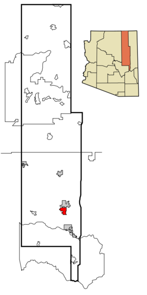
mapsize = 250x250px
map_caption = Location inNavajo County and the state ofArizona
mapsize1 =
map_caption1 =
subdivision_type = Country
subdivision_type1 = State
subdivision_type2 = County
subdivision_name =United States
subdivision_name1 =Arizona
subdivision_name2 = Navajo
government_type =
leader_title = Mayor
leader_name = John Cole
established_date =
area_magnitude =
area_total_km2 = 63.7
area_total_sq_mi = 24.6
area_land_km2 = 63.7
area_land_sq_mi = 24.6
area_water_km2 = 0.0
area_water_sq_mi = 0.0
elevation_ft = 5630
elevation_m = 1716
population_as_of = 2007
population_footnotes =cite web|url=http://www.census.gov/popest/cities/tables/SUB-EST2007-04-04.csv|title=Annual Estimates of the Population for Incorporated Places in Arizona|publisher=United States Census Bureau |date=2008-07-10|accessdate=2008-07-14]
population_total = 4063
population_metro =
population_density_km2 = 49.9
population_density_sq_mi = 129.1
timezone = MST
utc_offset = -7
latd = 34 |latm = 27 |lats = 57 |latNS = N
longd = 110 |longm = 6 |longs = 16 |longEW = W
timezone_DST =
utc_offset_DST =
postal_code_type =ZIP code
postal_code = 85939
area_code = 928
GNIS_id = 35160
blank_name = FIPS code
blank_info = 04-72420
blank1_name =
blank1_info =
footnotes =
website = http://www.tayloraz.org/Taylor is a town in Navajo County,
Arizona ,United States . It was founded by Mormon settlers in January 1878, several months before the neighboring community ofSnowflake, Arizona . Taylor straddles Silver Creek, flowing from the nearby White Mountains to theLittle Colorado River on Arizona'sColorado Plateau .According to 2006 Census Bureau estimates, the population of the town is 3,807.cite web | date =
June 21 2006 | url = http://www.census.gov/popest/cities/tables/SUB-EST2005-04-04.csv | title = Annual Estimates of the Population for All Incorporated Places in Arizona | format = CSV | work = 2005 Population Estimates | publisher = U.S. Census Bureau, Population Division | accessmonthday = November 15 | accessyear = 2006]Geography
Taylor is located at coor dms|34|27|57|N|110|6|16|W|city (34.465762, -110.104385).GR|1
According to the
United States Census Bureau , the town has a total area of 24.6square mile s (63.7km² ), all of it land.Demographics
As of the
census GR|2 of 2000, there were 3,176 people, 946 households, and 771 families residing in the town. Thepopulation density was 129.1 people per square mile (49.8/km²). There were 1,041 housing units at an average density of 42.3/sq mi (16.3/km²). The racial makeup of the town was 88.98% White, 0.54% Black or African American, 5.29% Native American, 0.13% Asian, 0.06% Pacific Islander, 2.74% from other races, and 2.27% from two or more races. 9.19% of the population were Hispanic or Latino of any race.There were 946 households out of which 48.8% had children under the age of 18 living with them, 68.6% were married couples living together, 9.1% had a female householder with no husband present, and 18.4% were non-families. 16.9% of all households were made up of individuals and 7.3% had someone living alone who was 65 years of age or older. The average household size was 3.36 and the average family size was 3.81.
In the town the population was spread out with 40.1% under the age of 18, 9.2% from 18 to 24, 24.7% from 25 to 44, 17.7% from 45 to 64, and 8.2% who were 65 years of age or older. The median age was 26 years. For every 100 females there were 99.1 males. For every 100 females age 18 and over, there were 93.0 males.
The median income for a household in the town was $32,577, and the median income for a family was $36,518. Males had a median income of $33,750 versus $20,243 for females. The
per capita income for the town was $11,918. About 13.9% of families and 15.0% of the population were below thepoverty line , including 18.2% of those under age 18 and 8.8% of those age 65 or over.Education
Taylor is a part of the
Snowflake Unified School District .Two schools, Taylor Elementary School and Taylor Intermediate School, are located in Taylor.
Snowflake Junior High School and
Snowflake High School , in Snowflake, serve Taylor.Railroads
Taylor was once served by the
Apache Railway . The tracks were constructed between 1917-1920 and extended from theSanta Fe Railway atHolbrook, Arizona to Snowflake and then via Taylor to the forests at McNary. The Snowflake to McNary line was abandoned in 1984.References
External links
* [http://www.tayloraz.org Town website]
Wikimedia Foundation. 2010.