- Snowflake, Arizona
Infobox Settlement
official_name = Snowflake, Arizona
settlement_type =Town
imagesize =
image_caption =
image_
imagesize =
image_caption =
image_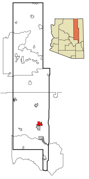
mapsize = 250x250px
map_caption = Location inNavajo County and the state ofArizona
mapsize1 =
map_caption1 =
subdivision_type = Country
subdivision_type1 = State
subdivision_type2 = County
subdivision_name =United States
subdivision_name1 =Arizona
subdivision_name2 = Navajo
government_type =
leader_title = Mayor
leader_name = Kelly Willis
established_date =
area_magnitude =
area_total_km2 = 80
area_total_sq_mi = 30.9
area_land_km2 = 79.8
area_land_sq_mi = 30.8
area_water_km2 = 0.1
area_water_sq_mi = 0.1
elevation_ft = 5579
elevation_m = 1700
population_as_of = 2007
population_footnotes =cite web|url=http://www.census.gov/popest/cities/tables/SUB-EST2007-04-04.csv|title=Annual Estimates of the Population for Incorporated Places in Arizona|publisher=United States Census Bureau |date=2008-07-10|accessdate=2008-07-14]
population_total = 5343
population_metro =
population_density_km2 = 55.9
population_density_sq_mi = 144.8
timezone = MST
utc_offset = -7
latd = 34 |latm = 30 |lats = 40 |latNS = N
longd = 110 |longm = 4 |longs = 59 |longEW = W
timezone_DST =
utc_offset_DST =
postal_code_type =ZIP code s
postal_code = 85937, 85942
area_code = 928
GNIS_id = 34591
blank_name = FIPS code
blank_info = 04-67800
blank1_name =
blank1_info =
footnotes =
website = http://www.ci.snowflake.az.us/Snowflake is a town in Navajo County,
Arizona ,United States . It was founded in 1878 by William Jordan Flake andErastus Snow ,Mormon pioneers and colonizers. [ [http://www.jerrystewart.org/snowflakeaz/history.html History of Snowflake, AZ ] ] According to 2006 Census Bureau estimates, the population of the town is 4,958.cite web | date =June 21 2006 | url = http://www.census.gov/popest/cities/tables/SUB-EST2005-04-04.csv | title = Annual Estimates of the Population for All Incorporated Places in Arizona | format = CSV | work = 2005 Population Estimates | publisher = U.S. Census Bureau, Population Division | accessdate = November 15 | accessyear = 2006]Snowflake is nestled in the juniper tree and grass-covered foothills of Arizona's White Mountains, which gradually give way to the windswept
Colorado Plateau just north of town. Snowflake is 25 miles south of Interstate 40 (formerlyU.S. Route 66 ) via Highway 77.Snowflake features a historic downtown district with original pioneer era homes open for tours. Many of these homes are well-preserved examples of nineteenth-century Mormon architecture. These are easily identified by the numerous bedrooms that were obviously add-ons to the original building. These rooms were generally added to accommodate multiple wives and the children that resulted from the former polygamous practice of the LDS Church. One of these homes on Main Street has been converted into a Bed and Breakfast.
Recently, the town and surrounding area have experienced steady growth, primarily to the east, west and south. A 27-hole golf course has been established near the
Snowflake Arizona Temple , built byThe Church of Jesus Christ of Latter-day Saints in 2002. To the east of town, a substantial community of individuals suffering frommultiple chemical sensitivity syndrome has grown since the 1980s.Snowflake experiences a four season climate with a warm (sometimes hot) Summer, mild Autumn, mild to cold Winter and cool, windy Spring. Typical high temperatures hover around 90 during July and August and 30 to 55 in December/January.
Geography
Snowflake is located at coor dms|34|30|40|N|110|4|59|W|city (34.511187, -110.082974)GR|1.
According to the
United States Census Bureau , the town has a total area of 30.9square mile s (79.9km² ), of which, 30.8 square miles (79.8 km²) of it is land and 0.1 square miles (0.1 km²) of it (0.16%) is water.Demographics
As of the
census GR|2 of 2000, there were 4,460 people, 1,312 households, and 1,070 families residing in the town. Thepopulation density was 144.8 people per square mile (55.9/km²). There were 1,536 housing units at an average density of 49.9/sq mi (19.2/km²). The racial makeup of the town was 87.24% White, 0.27% Black or African American, 6.93% Native American, 0.49% Asian, 0.07% Pacific Islander, 3.00% from other races, and 2.00% from two or more races. 8.05% of the population were Hispanic or Latino of any race.There were 1,312 households out of which 46.5% had children under the age of 18 living with them, 69.5% were married couples living together, 9.1% had a female householder with no husband present, and 18.4% were non-families. 15.8% of all households were made up of individuals and 6.7% had someone living alone who was 65 years of age or older. The average household size was 3.37 and the average family size was 3.81.
In the town the population was spread out with 37.9% under the age of 18, 9.8% from 18 to 24, 21.8% from 25 to 44, 19.8% from 45 to 64, and 10.7% who were 65 years of age or older. The median age was 28 years. For every 100 females there were 99.7 males. For every 100 females age 18 and over, there were 95.3 males.
The median income for a household in the town was $37,439, and the median income for a family was $42,500. Males had a median income of $30,517 versus $21,164 for females. The
per capita income for the town was $13,391. About 10.4% of families and 15.0% of the population were below thepoverty line , including 18.7% of those under age 18 and 14.1% of those age 65 or over.History of the name
The name comes not from
snowflake s, though it does snow, but is aportmanteau of the names of its founders:Erastus Snow , theLatter-day Saint apostle in charge of the colonization of Arizona, andWilliam J. Flake (whose great-grandson,Jeff Flake , would later serve in Congress). Keeping with its history, most of the residents of Snowflake belong to The Church of Jesus Christ of Latter-day Saints.Fact|date=January 2008Events
Snowflake celebrates "Pioneer Days" the weekend on or before the 24th of July each year, the date that
Mormon settlers, led byBrigham Young entered theSalt Lake Valley . Having settled in Utah, the town's founders were sent byBrigham Young to establish a settlement in Northern Arizona. A rodeo, parade, barbecue and other festivities mark the July 24th celebration. In early December, the town celebrates the holiday scene evoked by its name with Twelve Days of Christmas. Concerts, sleigh rides and other events are held each evening from December 1st to the 12th. Main street is decked in poinsettias and brightly lit white snowflakes for the event. Usually, the real thing covers the ground as well.The logging crew involved in the
Travis Walton abduction incident lived in this town, and several events surrounding that incident happened here. These events were dramatized in the 1993 science fiction film "Fire in the Sky ".Fact|date=January 2008Education
Snowflake is a part of the
Snowflake Unified School District . Highland Primary School, Snowflake Intermediate School, andSnowflake High School serve Snowflake. Snowflake is called the "Home of the Lobos", the high school's mascot.References
* Bernstein, Fred (2005). "In One Arizona Community, an Oasis in a Toxic World". "The New York Times", July 10.
* References to Snowflake are made in the movies "Saints and Soldiers" and "Brigham City". Both are 'Mormon' movies. The town is also prominent in "Fire in the Sky."External links
* [http://www.ci.snowflake.az.us Town website]
* [http://www.jerrystewart.org/snowflakeaz/history.html History of Snowflake, AZ]
Wikimedia Foundation. 2010.