- Del Bonita, Alberta
-
Hamlet of Del Bonita — Hamlet — Location of Del Bonita in Alberta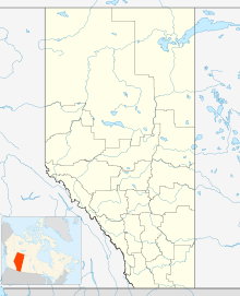

Coordinates: 49°01′46″N 112°47′26″W / 49.0294°N 112.7906°WCoordinates: 49°01′46″N 112°47′26″W / 49.0294°N 112.7906°W Country  Canada
Province  Alberta
Census division No. 3 Municipality Cardston County Government - Type Unincorporated - Governing body Cardston County Council Elevation 1,305 m (4,281 ft) Time zone MST (UTC-7) Del Bonita is a hamlet in southern Alberta, Canada within Cardston County.[1] It is located at the junction of Highway 62 and Highway 501, 3 km (1.9 mi) north of the United States border and approximately 49 km (30 mi) south of Magrath.
Del Bonita lies at an elevation of 1,305 m (4,281 ft), on Shanks Creek, which flows into Shanks Lake and further east into the Milk River.
Del Bonita/Whetstone International Airport (IATA: N/A, ICAO: CEQ4) is located 4 kilometres (2.5 mi) south of the settlement, on the United States/Canada border.
Contents
Attractions
Various buildings and artifacts from the Whiskey Gap ghost town have been moved to Del Bonita,[2] including the Whiskey Gap Oil Shed, the Fisher Store and the Red & White Store.
Demographics
Statistics Canada has not recently published a population for Del Bonita.
However, Industry Canada shows that Del Bonita's greater rural area had a total population of 651 living in 143 dwellings in 2001. With a land area of 630.5 km2 (243.4 sq mi), its greater rural area has a population density of 3.0 /km2 (7.8 /sq mi).[3]
See also
- List of communities in Alberta
- List of hamlets in Alberta
- List of ghost towns in Alberta
References
- ^ Alberta Municipal Affairs (2010-04-01). "Specialized and Rural Municipalities and Their Communities". http://municipalaffairs.gov.ab.ca/documents/msb/2010-ruralmun.pdf. Retrieved 2010-06-21.
- ^ Del Bonita Ghost Town
- ^ Industry Canada/Web Archive (2006-11-04). "Del Bonita - Community demographics (2001 census)". http://www.collectionscanada.gc.ca/webarchives/20061104084225/http://broadband.gc.ca/maps/province.html?prov=48. Retrieved 2010-02-07.

Cardston Magrath Milk River Waterton Lakes National Park 
Coutts  Del Bonita

Browning Cut Bank  Subdivisions of Alberta
Subdivisions Regions · Census divisions · Municipal districts (counties) · Specialized municipalities · School districts · Regional health authoritiesCommunities Cities · Towns · Villages · Summer villages · Hamlets · Indian reserves · Métis settlements · Ghost towns · Designated placesCities and Urban
Service AreasAirdrie · Brooks · Calgary · Camrose · Cold Lake · Edmonton (capital) · Fort McMurray · Fort Saskatchewan · Grande Prairie · Lacombe · Leduc · Lethbridge · Lloydminster · Medicine Hat · Red Deer · Sherwood Park · Spruce Grove · St. Albert · Wetaskiwin Category ·
  Portal ·
  WikiProjectCategories:
- Hamlets in Alberta
- Cardston County, Alberta
- Southern Alberta geography stubs

Wikimedia Foundation. 2010.