Cubley, Derbyshire

Cubley, Derbyshire

Coordinates: 52°56′28″N 1°45′47″W / 52.941°N 1.763°W / 52.941; -1.763

Cubley
Cubley 045079 3d77d42b.jpg
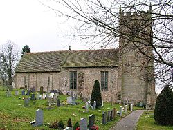
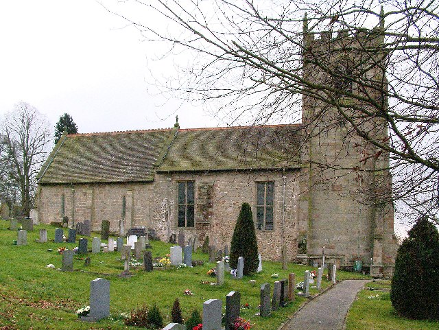
St Andrews Church, from the north.
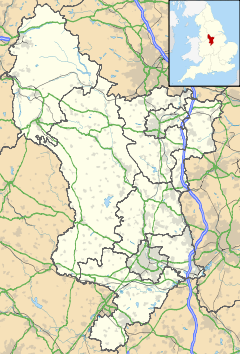
Cubley is located in Derbyshire
Cubley

 Cubley shown within Derbyshire
OS grid reference SK160382
District Derbyshire Dales
Shire county Derbyshire
Region East Midlands
Country England
Sovereign state United Kingdom
Post town ASHBOURNE
Postcode district DE6
Police Derbyshire
Fire Derbyshire
Ambulance East Midlands
EU Parliament East Midlands
List of places: UK • England • Derbyshire

Cubley is a parish of two closely linked villages six miles (10 km) south of Ashbourne in Derbyshire. St Andrews Church is in Cubley parish. Great Cubley and Little Cubley are known collectively as Cubley. The church lies roughly equidistant from the two, but is technically in Great Cubley.

Contents

History

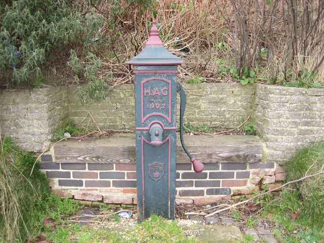
The Village pump dated 1902 in Great Cubley

Cubley is mentioned in the Domesday book where it is spelt Cobelei. The book says [1] under the title of “The lands of Henry de Ferrers[2]

”In Cubley Siward had two carucates of land to the geld. There is land for two ploughs. There are now two ploughs in demesne and four villans and four bordars and one slave having one plough. There is a priest and a church and one mill rendering 12 pence and eight acres of meadow and woodland pasture one league long and one league broad. TRE[3] worth 100 shillings now 40 shillings. Ralph holds it.“

Notable people

  • John Flower, a theologian was born here in the seventeenth century.
  • Michael Johnson the father of Samuel Johnson (author of the first English dictionary) was born here[4].

References

  1. ^ Domesday Book: A Complete Translation. London: Penguin, 2003. ISBN 0-14-143994-7 p.747
  2. ^ Henry held a considerable number of manors including several in Derbyshire given to him by the King. These included obviously Cubley, but also included lands in Brailsford, Dalbury and Twyford.
  3. ^ TRE in Latin is Tempore Regis Edwardi. This means in the time of King Edward before the Battle of Hastings.
  4. ^ Henry Hitchings “Dr Johnson's Dictionary:The extraordinary story of the book that defined the World” Pub. John Murray 2005 P.7

External links


Wikimedia Foundation. 2010.

Игры ⚽ Нужен реферат?

Look at other dictionaries:

  • Cubley — may refer to: Cubley, Derbyshire Cubley, South Yorkshire This disambiguation page lists articles about distinct geographical locations with the same name. If an internal link led you here, you may wish to change the …   Wikipedia

  • Cubley — This interesting and unusual name is of Medieval English origin and is a dialectal variant of a locational name Cubley. From a place so called in Derbyshire. The earliest recording of this place name is to be found in the Domesday Book of 1086 as …   Surnames reference

  • List of civil parishes in Derbyshire — poly 70 249 70 233 88 235 90 222 97 222 109 225 109 234 113 239 125 246 127 250 135 253 142 250 143 244 147 240 156 242 165 249 151 259 144 274 137 274 134 284 125 290 121 289 113 292 111 298 111 306 104 311 92 312 87 305 81 299 98 283 86 288 101 …   Wikipedia

  • Linton, Derbyshire — Infobox UK place country = England static static image caption=The Holly Bush pub located on High Street,Linton latitude = 52.748 longitude = 1.598 map type = Derbyshire official name = Linton population = shire district = South Derbyshire shire… …   Wikipedia

  • List of Grade I listed buildings in Derbyshire — There are over 6000 Grade I listed buildings in England. This page is a list of these buildings in the county of Derbyshire, sub divided by district.Amber Valley* North Mill, Belper * Church of St Mary, Crich * Church of St Mary, Denby * Church… …   Wikipedia

  • John Flower (cleric) — Infobox Person name = John Flower image size = caption = birth date = 1624Dictionary of National Biography now in the public domain] birth place = Cubley, Derbyshire death date = after 1658 death place = education = St Peter s College, Oxford… …   Wikipedia

  • Lichfield Cathedral — Infobox UK cathedral building name =Lichfield Cathedral infobox width = image size = caption =The West Front of Lichfield Cathedral map type = map size = map caption = location =Lichfield full name =Cathedral Church of the Blessed Virgin Mary and …   Wikipedia

  • Cathédrale de Lichfield — Vue de la façade  Les photos de la cathéd …   Wikipédia en Français

  • Doveridge — Coordinates: 52°54′15″N 1°49′28″W / 52.9042°N 1.8244°W / 52.9042; 1.8244 …   Wikipedia

  • Marston Montgomery — Coordinates: 52°56′15″N 1°48′02″W / 52.9374°N 1.8006°W / 52.9374; 1.8006 …   Wikipedia

Share the article and excerpts

Direct link
Do a right-click on the link above
and select “Copy Link”