- Nacimiento-Fergusson Road
-
Nacimiento-Fergusson Road is the only road across the Santa Lucia Range in the Central Coast of California, connecting California State Route 1 and the Big Sur coast to U.S. Route 101 and the Salinas Valley.[1]
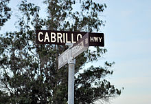
The road starts on Highway 1 four miles south of Lucia, approximately 55 miles south of Carmel and 35 miles north of the Hearst San Simeon State Historical Monument, just at the south end of the Cabrillo Highway (Highway 1) bridge over Kirk Creek. At the north end of the bridge is the Kirk Creek Campground, operated by Parks Management Company, a U.S. Forest Service contractor. It heads east from the Pacific Ocean into the high country of Big Sur for 24.5 miles, passing through Fort Hunter Liggett and ending at Mission Road in Jolon.
The road is well-paved and maintained over its length, but is winding and has precipitous drops at almost every turn. The eastern slope is heavily forested allowing few vistas.
Nacimiento-Fergusson Road reaches its summit (2780 feet) seven miles from Highway 1 and crosses Cone Peak Road, which heads northward along the crest towards the summit of Cone Peak. Several of the better trails within the Ventana Wilderness are accessible from this road. Cone Peak Road is closed from approximately November to May due to weather. Motorists should contact Big Sur Station or Pacific Valley Station for road status if planning to drive the road during these months.
On the south side of this summit South Coast Ridge Road leads along the ridge to McKern Road.
Fort Hunter Liggett is an Army Reserve training base. The road is occasionally closed for brief periods during tank, artillery, and other firing exercises. Entering the base on Nacimiento-Fergusson Road from the west one encounters a check-point, where drivers formerly were asked to show their identification, vehicle registration, and proof of insurance. The check-point has been closed since May 2010.
There are two campgrounds along the road: Nacimiento Campground and Ponderosa Campground. Both of these campgrounds are on the eastern slope of the Santa Lucia range within Los Padres National Forest. The Nacimiento Campground, nestled beneath Douglas fir trees alongside the Nacimiento River, is adjacent to Nacimiento-Fergusson Road and provides less privacy. Ponderosa Campground, known on some maps as "Camp Nacimiento", provides a private setting within a valley off the main road along the Negro Fork of the Nacimiento River.
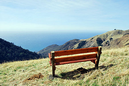
In October, 2009, the Mano Seca Group installed a bench near the top of the western slope of Nacimiento-Fergusson Road. A large turnout on the road provides easy parking; an opening in the roadside fence provides a path down to the bench. The exact location of the bench may be found on both the Panoramio and Google Earth websites. [1]
Nacimiento-Fergusson Road is widely regarded as one of the best motorcycling roads in central California due to the premier ocean views and forest setting.[citation needed]
References
- ^ Bisbort, Alan; Puterbaugh, Parke (2009), Moon California Beaches: The Best Places to Swim, Play, Eat, and Stay (4th ed.), Avalon Travel, p. 305, ISBN 9781566916141; Schulte-Peevers, Andrea (2003), California (3rd ed.), Lonely Planet, p. 665, ISBN 9781864503319.
See also
Categories:- Roads in Monterey County, California
- Monterey Ranger District, Los Padres National Forest
Wikimedia Foundation. 2010.


