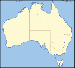
Family Islands National Park

Family Islands National Park
IUCN Category II (National Park)
Nearest town/city Tully
Coordinates 17°55′33″S 146°08′07″E / 17.92583°S 146.13528°E / -17.92583; 146.13528
Area 8.69 km²
Established 1994
Managing authorities Queensland Parks and Wildlife Service
Official site Family Islands National Park

The Family Islands are a group of continental islands lying a short distance off the coast, about mid-way between Cairns and Townsville, in Queensland, Australia. Most of the area has been designated as a national park. The islands were given their collective name and also English names by Captain Cook when he sailed through the area in 1770.

The Islands

The largest of the Family Islands, their aboriginal names, and their position in the "family" are:

There are also a number of smaller islands:

  • Kumboola, which is connected to Dunk Island on particularly low tides
  • Mound Island (Purtaboi), which is protected as a sea bird nesting habitat
  • Woln Garin, a small island off Dunk Island's south east corner, known locally as "40ft Rock"
  • Battleship Rock (Pee-Rahm-Ah), named because of its distinctive shape when seen from the north.
  • Thorpe Island (Ti mana), which is privately owned with one residence. This is the only Australian island which is owned Freehold to the Low Water Line.

Camp grounds are available on Dunk, Coombe and Wheeler Islands, with permits available from Queensland Parks and Wildlife. Resorts operate on Dunk and Bedarra Islands.

See also


Wikimedia Foundation. 2010.

Игры ⚽ Поможем написать курсовую

Look at other dictionaries:

  • Family Islands National Park — noun a national park consisting of islands off the far north coast of Qld between Tully Heads and Mission Beach; includes Hinchinbrook and Dunk islands …  

  • Smith Islands National Park — Smith Islands is a national park in Queensland (Australia), 862 km northwest of Brisbane.Fact sheet* Area: 18.70 km² * Coordinates : coord|20|35|21|S|149|06|38|E|type:landmark region:AU * Date of establishment: ? * Managing authorities:… …   Wikipedia

  • National Park Service — Arrowhead Agency overview Formed August 25, 1916 Jurisdiction …   Wikipedia

  • List of areas in the United States National Park System — National Park Service logo. The National Park System of the United States is the collection of physical properties owned or administered by the National Park Service. This includes all areas designated National Parks and most National Monuments,… …   Wikipedia

  • National Register of Historic Places listings in Grand Teton National Park — This is a list of the National Register of Historic Places listings in Grand Teton National Park. Main article: Historical buildings and structures of Grand Teton National Park This is intended to be a complete list of the properties and… …   Wikipedia

  • National Register of Historic Places listings in Hawaii Volcanoes National Park — This is a list of the National Register of Historic Places listings in Hawaii Volcanoes National Park. This is intended to be a complete list of the properties and districts on the National Register of Historic Places in Hawaii Volcanoes National …   Wikipedia

  • Mammoth Cave National Park — Mammoth Cave redirects here. For other uses, see Mammoth Cave (disambiguation). Mammoth Cave National Park IUCN Category II (National Park) The Rotund …   Wikipedia

  • Mesa Verde National Park — Mesa Verde redirects here. For other uses, see Mesa Verde (disambiguation). Mesa Verde National Park IUCN Category II (National Park) …   Wikipedia

  • Cuyahoga Valley National Park — IUCN Category II (National Park) Bedrock outcrops, such as this one, can be found throughout the park …   Wikipedia

  • Dry Tortugas National Park — Fort Jefferson redirects here. For the fortification in Ohio, see Fort Jefferson (Ohio). Dry Tortugas National Park IUCN Category II (National Park) …   Wikipedia

Share the article and excerpts

Direct link
Do a right-click on the link above
and select “Copy Link”