- Pennsylvania Route 832
-
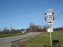
PA Route 832
Route information Maintained by PennDOT Length: 11.15 mi[1] (17.94 km) Existed: 1929 – present Major junctions South end:  PA 98 in Fairview Township
 I-90 in McKean Township
 US 20 in Millcreek Township
 PA 5 in Millcreek Township
North end: Presque Isle State Park Location Counties: Erie Highway system Roads in Pennsylvania
Interstate • US • State • Legislative←  PA 831
PA 833  →
→Pennsylvania Route 832 (PA 832; officially SR 832), known locally as Sterrettania Road and Peninsula Drive, is a state highway located in Erie County, Pennsylvania. Its northern terminus is at the entrance to Presque Isle State Park in Erie. The southern terminus is at Pennsylvania Route 98, two miles (3 km) west of Sterrettania in Fairview Township. PA 832 has junctions with U.S. Route 20, Pennsylvania Route 5 and Pennsylvania Route 5 Alternate. PA 832 is exit 18 off Interstate 90.
Contents
Route description
 Route 98 in Fairview Township approaching the intersection with Route 832's southern terminus
PA 832 begins at an intersection with PA 98 south of I-90 exit 16 in Fairview Township. The route continues east as Sterrettania Road, paralleling I-90 through Sterrettania before turning to the northeast and interchanging with I-90 at exit 18. PA 832 continues to the northeast, entering the city of Erie from the southwest. Within Erie, PA 832 intersects West 38th Street and West 32nd Street, among other roadways, before intersecting U.S. Route 20 (West 26th Street). At US 20, PA 832 switches names from Sterrettania Road to Peninsula Drive and turns to the northwest toward the Lake Erie shoreline.[2]
North of US 20, PA 832 crosses the mainlines of both CSX Transportation and the Norfolk Southern Railway via the Arthur F. Deitsch Memorial Bridge prior to junctions with PA 5 (West 12th Street) and PA 5 Alternate (West 8th Street/West Lake Road) near the lakeshore. Unlike most north–south state routes in Erie, which terminate at PA 5 Alternate, PA 832 continues north to the lakeshore, connecting Erie to the Presque Isle State Park, located on a peninsula protruding into Lake Erie north of the city. While Peninsula Road continues north onto the peninsula and into the park, the PA 832 designation terminates at the entrance to the park.
History
PA 832 was formed in the 1930s, stretching from Pennsylvania Route 99 (now PA 5 ALT) to Presque Isle.[3] By 1940, the southern terminus of the route was at PA 5 ALT in Erie.[4][5]
By 1960, PA 832 was lengthened southward to the newly constructed Interstate 90. By 1970, the southern terminus was moved to its current location.[6][7]
Major intersections
The entire route is in Erie County.
Location Mile[2][1] Destinations Notes Fairview Township 0.00 PA 98 (Avonia Road)McKean Township 3.16 I-90 – Erie, ClevelandExit 18 (I-90). Millcreek Township 8.97 US 20 (West 26th Street)9.87  PA 5 (West 12th Street) / LECT
10.19 

PA 5 Alt. (West 8th Street)11.15 Peninsula Drive – Presque Isle State Park 1.000 mi = 1.609 km; 1.000 km = 0.621 mi References
- ^ a b Pennsylvania State Roads - 2010. Harrisburg, Pennsylvania: Pennsylvania Department of Tranpsortation. 2010.
- ^ a b Yahoo! Inc. Yahoo! Maps (Map). Cartography by NAVTEQ. http://maps.yahoo.com/#mvt=m&lat=42.069761&lon=-80.155178&zoom=12&q1=41.997005%2C-80.234604&q2=42.114569%2C-80.152678. Retrieved May 27, 2010.
- ^ Pennsylvania Department of Highways (1930). Pennsylvania State Map (front side) (Map). ftp://ftp.dot.state.pa.us/public/pdf/BPR_pdf_files/Maps/Statewide/Historic_OTMs/1930fr.pdf. Retrieved 2007-09-12.
- ^ Pennsylvania Department of Highways (1941). Erie County Map (Map). ftp://ftp.dot.state.pa.us/public/pdf/BPR_PDF_FILES/Maps/Type_10_GHS_Historical_Scans/Erie_1941.pdf. Retrieved 2007-09-12.
- ^ Pennsylvania Department of Highways (1940). Pennsylvania State Map (front side) (Map). ftp://ftp.dot.state.pa.us/public/pdf/BPR_pdf_files/Maps/Statewide/Historic_OTMs/1940fr.pdf. Retrieved 2007-09-12.
- ^ Pennsylvania Department of Highways (1960). Pennsylvania State Map (front side) (Map). ftp://ftp.dot.state.pa.us/public/pdf/BPR_pdf_files/Maps/Statewide/Historic_OTMs/1960fr.pdf. Retrieved 2007-09-12.
- ^ Pennsylvania Department of Highways (1970). Pennsylvania State Map (front side) (Map). ftp://ftp.dot.state.pa.us/public/pdf/BPR_pdf_files/Maps/Statewide/Historic_OTMs/1970fr.pdf. Retrieved 2007-09-12.
External links
- Adam Prince's Highway Beginnings and Endings in Pennsylvania
- Central PA/MD Roads at mplex.com
- Pennsylvania Highways
Transportation in Erie, Pennsylvania Numbered routes Other roads 12th Street • 26th Street • 38th Street • Bayfront Parkway • Bayfront Connector • Peach Street • State StreetAir Public Transit Rail Transportation Center Erie Intermodal Transportation CenterWater Erie-Western Pennsylvania Port AuthorityCategories:- Transportation in Erie, Pennsylvania
- State highways in Pennsylvania


Wikimedia Foundation. 2010.