- Óc Eo
-
Óc Eo — Commune —  Location in Vietnam
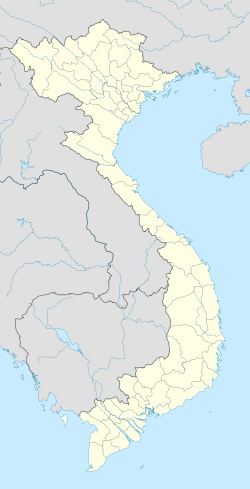
 Óc Eo
Óc EoCoordinates: 10°15′17″N 105°9′6″E / 10.25472°N 105.15167°ECoordinates: 10°15′17″N 105°9′6″E / 10.25472°N 105.15167°E Country  Vietnam
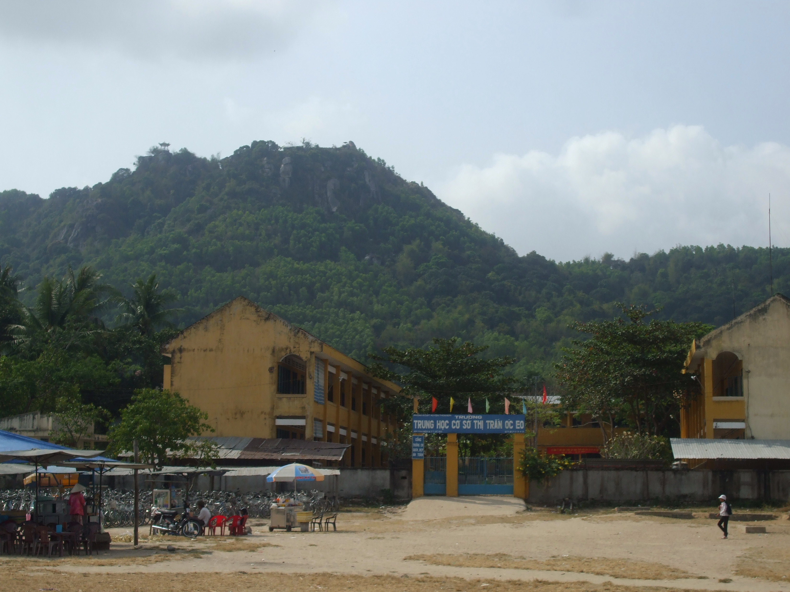
Province An Giang Province District Thoại Sơn District Time zone UTC+7 (UTC+7) Óc Eo (from the Khmer "O'keo" អូរកែវ, meaning "Glass canal") is an archaeological site in Thoại Sơn District in southern An Giang Province, Vietnam, in the Mekong River Delta region of Vietnam. It is also one of the modern day communes of Vietnam. Óc Eo may have been a busy port of the kingdom of Funan between the 1st and 7th centuries AD. Scholars use the term "Óc Eo Culture" to refer to the ancient material culture of the Mekong Delta region that is typified by the artifacts recovered at Óc Eo through archeological investigation.
Contents
The Archeological Site
Excavation at Óc Eo began on February 10, 1942 after French archaeologists had discovered the site through the use of aerial photography. The first excavations were led by Louis Mallaret. The site covers 450 ha.
Óc Eo is situated within a network of ancient canals that crisscross the low flatland of the Mekong Delta. One of the canals connects Óc Eo to the town's seaport while another goes 42 miles north-northeast to Angkor Borei. Óc Eo is longitudinally bisected by a canal, and there are four transverse canals along which pile-supported houses were perhaps ranged.[1]
Archeological sites reflecting the material culture of Óc Eo are spread throughout southern Vietnam, but are most heavily concentrated in the area of the Mekong Delta to the south and west of Ho Chi Minh City. The most significant site, aside from Óc Eo itself, is at Tháp Muời north of the Tien Giang River, where among other remains a stele with a 6th-century Sanskrit text has been discovered.
The Remains
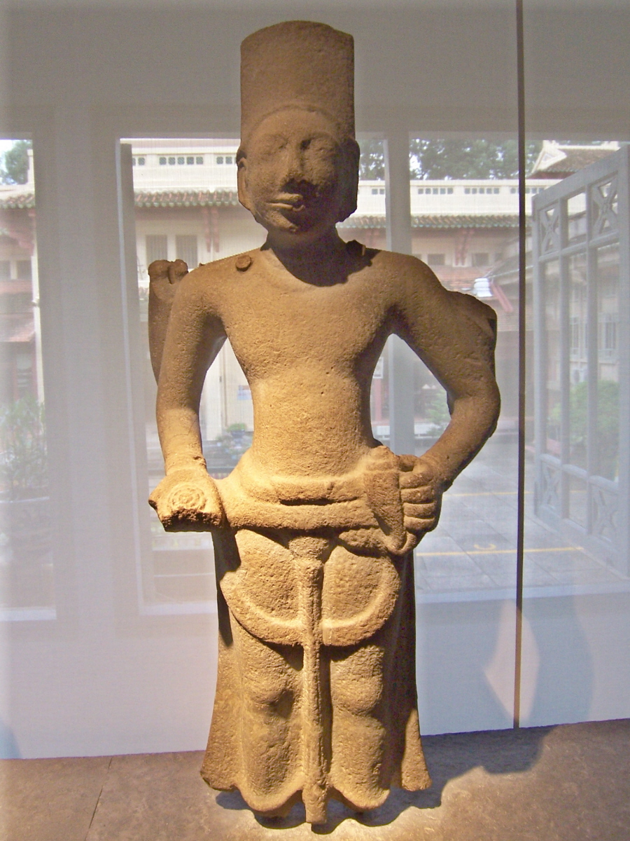
 This statue of Visnu from the 6th or 7th century A.D. was found in Óc Eo and is now housed in the Museum of Vietnamese History.
The remains found at Óc Eo include pottery, tools, jewelry, casts for making jewelry, coins (including coins from the Roman Empire), and religious statues. Many of the remains have been collected and are on exhibition in Museum of Vietnamese History in Ho Chi Minh City.
Óc Eo and Funan
See also: FunanÓc Eo has been regarded as belonging to the historical kingdom of Funan (扶南) that flourished in the Mekong Delta between the 1st and the 6th century CE. The kingdom of Funan is known to us from the works of ancient Chinese historians, especially writers of dynastic histories, who in turn drew from the testimony of Chinese diplomats and travellers, and of foreign (including Funanese) embassies to the Chinese imperial courts. Indeed, the name "Funan" itself is an artifact of the Chinese histories, and does not appear in the paleographic record of ancient Vietnam or Cambodia. From the Chinese sources, however, it can be determined that a polity called "Funan" by the Chinese was the dominant polity located in the Mekong Delta region. As a result, archeological discoveries in that region that can be dated to the period of Funan have been identified with the historical polity of Funan. The discoveries at Óc Eo and related sites are our primary source for the material culture of Funan.
The Vietnamese historian Ha Van Tan has questioned whether the vestiges excavated at Óc Eo belonged to Funan, in view of the complete lack of any Khmer records relating to a kingdom of this name: he argues that Óc Eo gradually emerged as an economic and cultural centre of the Mekong Delta and, with an important position on the Southeast Asian sea routes, became a meeting place for craftsmen and traders, which provided adequate conditions for urbanization, receiving foreign influences which in turn stimulated internal development.[2]
Oc Eo as the Kattigara of Ptolemy
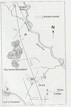 The ancient canal linking Oc Eo to Angkor Borei
Óc Eo may have been the port known to the Romans as Kattigara.[3] Kattigara was the name given by the 2nd century AD Alexandrian geographer Claudius Ptolemy to the land on the easternmost shore of the Mare Indicum at (due to a scribal error) eight and a half degrees South of the Equator.[4] Scholarship has now determined that Ptolemy's Kattigara was at eight and a half degrees North of the Equator, and was the forerunner of Saigon.[5]
John Caverhill deduced in 1767 that Cattigara was the Mekong Delta port Banteaymeas (now Hà Tiên), not far from Óc Eo.[6] The plea in 1979 by Jeremy H.C.S. Davidson for “a thorough study of Hà-tiên in its historical context and in relation to Óc-eo” as indispensable for accurate understanding and interpretation of the site, still remains unanswered.[7]
The name "Kattigara" was probably derived from the Sanskrit Kirti-nagara “Renowned City” or Kotti-nagara “Strong City”.[8] The “father of Early Southeast Asian History”, George Coedès, has said: “By the middle of the 3rd century Fu-nan had already established relations with China and India, and it is doubtless on the west coast of the Gulf of Siam that the furthest point reached by Hellenistic navigators is to be found, that is the harbour of Kattigara mentioned by Ptolemy”.[9] Judging from the sailing directions given by the seafarer Alexander, Bjorn Landström concluded that Cattigara lay at the mouth of the Mekong.[10] A.H. Christie said in 1979 that “the presence of objects, however few in number, from the Roman Orient” added some weight to the conjecture that Óc-eo was the Ptolemaic Kattigara.[11] The distinguished German classical scholar, Albrecht Dihle, supported this view, saying:
From the account of the voyage of Alexander referred to by Ptolemy, Kattigara can actually be located only in the Mekong delta, because Alexander went first along the east coast of the Malacca peninsula, northward to Bangkok, from thence likewise only along the coast toward the south east, and so came to Kattigara. We hear nothing of any further change of course. In addition, at Oc Eo, an emporium excavated in the western Mekong delta, in the ancient kingdom of Fu-nan, Roman finds from the 2nd century after Christ have come to light.[12]
Guided by Ptolemy, the discoverers of the New World were initially trying to find their way to Kattigara. On the 1489 map of the world made by Henricus Martellus Germanus, based on Ptolemy’s work, Asia terminated in its southeastern point in a cape, the Cape of Cattigara. Writing of his 1499 voyage, Amerigo Vespucci said he had hoped to reach Malacca (Melaka) by sailing westward from Spain across the Western Ocean (the Atlantic) around the Cape of Cattigara into the Sinus Magnus, the Great Gulf that lay to the East of the Golden Chersonese (Malay Peninsula), of which the Cape of Cattigara formed the southeastern point. The Sinus Magnus, or Great Gulf, was the actual Gulf of Thailand.[13]
Columbus' search for Ciamba
Christopher Columbus, on his fourth and last voyage of 1502-1503, planned to follow the coast of Champa southward around the Cape of Cattigara and sail through the strait separating Cattigara from the New World, into the Sinus Magnus to Malacca. This was the route he thought Marco Polo had gone from China to India in 1292.[14] Columbus planned to meet up with the expedition sent at the same time from Portugal around the Cape of Good Hope under Vasco da Gama, and carried letters of credence from the Spanish monarchs to present to da Gama.[15] On reaching Cariay on the coast of Costa Rica, Columbus thought he was close the gold mines of Champa. On July 7, 1503, he wrote from Jamaica: “I reached the land of Cariay…Here I received news of the gold mines of Ciamba [Champa] which I was seeking”.[16]
References
- ^ Paul Lévy, “Recent Archaeological Researches by the École Français d’Extrême Orient, French Indo-China, 1940-1945”, in Kalidas Nag (ed.), Sir William Jones: Bicentenary of his Birth Commenoration Volume, 1746-1946, Calcutta, Royal Asiatic Society of Bengal, 1948, pp.118-19; paraphrased in R. C. Majumdar, Ancient Indian colonisation in South-East Asia, Baroda, B.J. : Sandesara, 1963, pp.12-13.
- ^ Ha Van Tan, "Óc Eo : Endogenous and Exogenous Elements", Viet Nam Social Sciences, 1-2 (7-8), 1986, pp. 91-101.
- ^ Adhir Chakravarti, “The Economic Foundations of Three Ancient Civilazations of South-eas t Asia: Borobudur, Dvararavati and Angkor: Preliminary Report of a Study Tour in some countries of South-east Asia in April–May 1985”, in Haraprasad Ray (ed.), Studies on India, China, and South East Asia: Posthumous Papers of Prof. Adhir Chakravarti, Kolkata, R.N. Bhattacharya, 2007, p.89; and Adhir Chakravarti, “International Trade and Towns of Ancient Siam”, Our Heritage: Bulletin of the Department of Post-graduate Training and Research, Sanskrit College, Calcutta, vol.XXIX, part I, January–June 1981, pp1-23, nb p.9.
- ^ Paul Schnabel, „Die Entstehungsgeschichte des kartographischen Erdbildes des Klaudios Ptolemaios“, Sitzungsberichte der Preussischen Akademie der Wissenschaften: Philosophisch-Historische Klasse, Verlag der Akademie der Wissenschaften, Bd.XIV, 1930, S.214-250, nb 239-243.
- ^ Albert Herrmann, “Der Magnus Sinus und Cattigara nach Ptolemaeus”, Comptes Rendus du 15me Congrès International de Géographie, Amsterdam, 1938, Leiden, Brill, 1938, tome II, sect. IV, Géographie Historique et Histoire de la Géographie, pp.123-8; Louis Malleret, L’Archéologie du delta du Mékong, Tome Troisiéme, La culture du Fu-nan, Paris, 1962, chap.XXV, “Oc-Èo et Kattigara”, pp.421-54.
- ^ John Caverhill, “Some Attempts to ascertain the utmost Extent of the Knowledge of the Ancients in the East Indies”, Philosophical Transactions, vol.57, 1767, pp.155-174.
- ^ Jeremy H.C.S. Davidson, “Archaeology in Southern Viet-Nam since 1954”, in R. B. Smith and W. Watson (eds.), Early South East Asia: Essays in Archaeology, History, and Historical Geography, New York, Oxford University Press, 1979, pp.215-222, see p.216.
- ^ Adhir K. Chakravarti, “Early Sino-Indian Maritime Trade and Fu-Nan”, D.C. Sircar (ed.), Early Indian Trade and Industry, Calcutta, University of Calcutta Centre of Advanced Study in Ancient Indian History and Culture, Lectures and Seminars, no.VIII-A, part I, 1972, pp. 101-117; see also India and South-East Asia Socio-econo-cultural Contacts, edited by N.N. Bhattacharyya, Kolkata, Punthi Pustak, 1998, p.413.
- ^ George Coedès, “Some Problems in the Ancient History of the Hinduized States of South-East Asia”, Journal of Southeast Asian History, vol.5, no.2, September 1964, pp.1-14.
- ^ Bjorn Landström, The quest for India : a History of Discovery and Exploration from the Expedition to the Land of Punt in 1493 B.C. to the Discovery of the Cape of Good Hope in 1488 A.D., in words and pictures, London, Allen & Unwin, 1964, p.56.
- ^ A.H. Christie, “Lin-i, Fu-nan, Java”, in R. B. Smith and W. Watson (eds.), Early South East Asia: Essays in Archaeology, History, and Historical Geography, New York, Oxford University Press, 1979, pp.281-7, see p. 286.
- ^ Albrecht Dihle, Umstrittene Daten: Untersuchenen zum Auftreten der Griechen an Roten Meer, Köln und Opladen, Westdeutsch Verlag, 1964, S.30.
- ^ Albert Herrmann, “Der Magnus Sinus und Cattigara nach Ptolemaeus”, Comptes Rendus du 15me Congrès International de Géographie, Amsterdam, 1938, Leiden, Brill, 1938, tome II, sect. IV, Géographie Historique et Histoire de la Géographie, pp. 123-8
- ^ George E. Nunn, ‘The Three Maplets attributed to Bartholomew Columbus’, Imago Mundi, vol.9, 1952, 12-22, p.15; Helen Wallis, ‘What Columbus Knew’, History Today, vol.42, May 1992, pp.17-23; Edmundo O'Gorman, The Invention of America: An Inquiry into the Historical Nature of the New World and the Meaning of its History, Bloomington, Indiana University Press, 1961, pp.106-122.
- ^ The letter, dated 14 March 1502, is published in Martin Fernandez de Navarrete, Coleccion de los Viages y Descubrimientos, 2nd. edn., Madrid, Imprenta Nacional, 1858, p.430; the covering letter to Columbus is published in A. Millares Carlo (ed.), Historia de las Indias por Fray Bartólome de las Casas, México, Fondo de Cultura Economica, 1951, Lib.2, cap.iv, pp.219-20.
- ^ Letter dated 7 July 1503; quoted in J.M. Cohen (ed.), The Four Voyages of Christopher Columbus, Harmondsworth, Penguin, 1969, p.287.
Sources
Prehistoric cultures of Vietnam 
Paleolithic Age Sơn Vi Culture (20,000-12,000 BC) Mesolithic Age Hòa Bình Culture (12,000-10,000 BC) Neolithic Age Bắc Sơn Culture (10,000-8,000 BC) Quỳnh Văn Culture (8,000-6,000 BC) Đa Bút Culture (6,000-5,000 BC) Bronze Age Phùng Nguyên Culture (5,000-4,000 BC) Đồng Đậu Culture (4,000-2,500 BC) Gò Mun Culture (2,500-2,000 BC) Iron Age Đông Sơn Culture (2,000 BC-200 AD) Sa Huỳnh Culture (1,000 BC-200 AD) Óc Eo Culture (1-630 AD) - Albert Herrmann, “Der Magnus Sinus und Cattigara nach Ptolemaeus”, Comptes Rendus du 15me Congrès International de Géographie, Amsterdam, 1938, Leiden, Brill, 1938, tome II, sect. IV, Géographie Historique et Histoire de la Géographie, pp. 123–8.
- Albert Herrmann, Das Land der Seide und Tibet in Lichte der Antike, Leipzig, 1938, pp. 80, 84.
- Louis Malleret, L’Archéologie du delta du Mékong, Tome Troisiéme, La culture du Fu-nan, Paris, 1962, chap.XXV, “Oc-Èo et Kattigara”, pp. 421–54.
- John Caverhill, “Some Attempts to ascertain the utmost Extent of the Knowledge of the Ancients in the East Indies”, Philosophical Transactions, vol.57, 1767, pp. 155–174.
- Adhir K. Chakravarti, “Early Sino-Indian Maritime Trade and Fu-Nan”, D.C. Sircar (ed.), Early Indian Trade and Industry, Calcutta, University of Calcutta Centre of Advanced Study in Ancient Indian History and Culture, Lectures and Seminars, no.VIII-A, part I, 1972, pp. 101–117.
- George Cœdès, “Fouilles en Cochinchine: Le Site de Go Oc Eo, Ancien Port du Royaume de Fou-nan”, Artibus Asiae, vol.10, no.3, 1947, pp. 193–199.
- George Coedès, review of Paul Wheatley, The Golden Khersonese (Kuala Lumpur, 1961), in T'oung Pao 通報, vol.49, parts 4/5, 1962, pp. 433–439.
- George Coedès, “Some Problems in the Ancient History of the Hinduized States of South-East Asia”, Journal of Southeast Asian History, vol.5, no.2, September 1964, pp. 1–14.
- Albrecht Dihle, “Serer und Chinesen”, in Antike und Orient: Gesammelte Aufsätze, Heidelberg, Carl Winter, 1984, S.209.
- J.W. McCrindle, Ancient India as described by Ptolemy, London, Trubner, 1885, revised edition by Ramachandra Jain, New Delhi, Today & Tomorrow’s Printers & Publishers, 1974, p. 204:
- George E. Nunn, ‘The Three Maplets attributed to Bartholomew Columbus’, Imago Mundi, 9 (1952), 12-22, page 15; and Helen Wallis, ‘What Columbus Knew’, History Today, 42 (May 1992), 17-23.
- Quoted in J.M. Cohen (ed.), The Four Voyages of Christopher Columbus, Harmondsworth, Penguin, 1969, p. 287.
- Ha Van Tan, "Oc Eo: Endogenous and Exogenous Elements", Viet Nam Social Sciences, 1-2 (7-8), 1986, pp. 91–101.
- R. Stein, “Le Lin-yi 林邑, sa localisation, sa contribution à la formation de Champa et ses liens avec la Chine”, Han-Hiue 漢學, Bulletin du Centre d’Études sinologiques de Pékin, vol.II, pts.1-3, 1948, pp. 115, 122-3.
- R. Stein, review of Albert Herrmann, Das Land der Seide und Tibet im Lichte der Antike (Leipzig, 1938), in Bulletin de l’École Française d’ Extrême-Orient, tome XL, fasc.2, 1940, p. 459.
- Paul Lévy, “Le Kattigara de Ptolémée et les Étapes d’Agastya, le Héros de l’Expansion Hindoue en Extrême-Orient”, in XXIe Congrès Internationale des Orientalistes, Paris, 1948, Actes, Paris, Société Asiatique de Paris, 1949, p. 223.
- Paul Demiéville, review of R. Stein, “Le Lin-yi 林邑”, (Han-Hiue 漢學, vol.II, pts.1-3, 1948), in T'oung Pao 通報, vol.40, livres 4/5, 1951, pp. 336–351, n.b. pp. 338, 341.
- Paul Lévy, “Recent Archaeological Researches by the École Français d’Extrême Orient, French Indo-China, 1940-1945”, in Kalidas Nag (ed.), Sir William Jones: Bicentenary of his Birth Commenoration Volume, 1746-1946, Calcutta, Royal Asiatic Society of Bengal, 1948, pp. 118–19; paraphrased in R. C. Majumdar, Ancient Indian colonisation in South-East Asia, Baroda, B.J. : Sandesara, 1963, pp. 12–13.
- Pierre-Yves Manguin, “The archaeology of Fu Nan in the Mekong River Delta: the Oc Eo culture of Viet Nam ”, in Nancy Tingley and Andreas Reinecke, Arts of ancient Viet Nam: from River Plain to Open Sea, Houston, Museum of Fine Arts, 2009, pp. 100–118.
- Paul Wheatley, prefatory essay in Albert Herrmann, An historical atlas of China, Edinburgh, Edinburgh University Press, 1966, p.xxviii.
 An Giang Province
Capital: Long Xuyên Châu Đốc Châu Đốc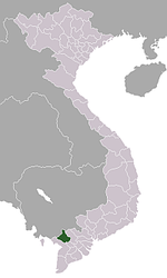
An Phú District Châu Phú District Châu Thành District An ChâuChợ Mới District Phú Tân District Tân Châu District Thoại Sơn District Núi Sập · Phú Hoà, An Giang · Óc EoTịnh Biên District Tri Tôn District Categories:- Ancient Vietnam
- An Giang Province
- Archaeology of Vietnam
- 1st millennium
- 1st-century establishments
- 7th-century disestablishments
- History of Cambodia
- Communes of An Giang Province


Wikimedia Foundation. 2010.