- Loxley, Alabama
Infobox Settlement
official_name = Loxley, Alabama
settlement_type =Town
imagesize =
image_caption =
image_
imagesize =
image_caption =
image_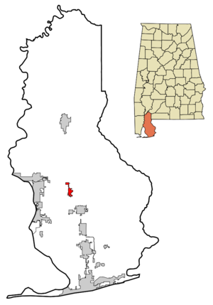
mapsize = 250px
map_caption = Location in Baldwin County and the state ofAlabama
mapsize1 =
map_caption1 =
subdivision_type = Country
subdivision_type1 = State
subdivision_type2 = County
subdivision_name =United States
subdivision_name1 =Alabama
subdivision_name2 = Baldwin
government_type =
leader_title =
leader_name =
established_date =
area_magnitude =
area_total_km2 = 6.3
area_total_sq_mi = 2.4
area_land_km2 = 6.2
area_land_sq_mi = 2.4
area_water_km2 = 0.1
area_water_sq_mi = 0
elevation_ft = 171
elevation_m = 52
population_as_of = 2000
population_footnotes =
population_total = 1348
population_metro =
population_density_km2 = 214
population_density_sq_mi = 561.7
timezone = Central (CST)
utc_offset = -6
latd = 30 |latm = 37 |lats = 25 |latNS = N
longd = 87 |longm = 45 |longs = 17 |longEW = W
timezone_DST = CDT
utc_offset_DST = -5
postal_code_type =ZIP code
postal_code = 36551
area_code = 251
blank_name = FIPS code
blank_info = 01-44608
blank1_name = GNIS feature ID
blank1_info = 0155142
footnotes =
website =Loxley is a town in Baldwin County,
Alabama ,United States . As of the 2000 census, the population of the town is 1,348.Geography
Loxley is located at 30°37'24.600" North, 87°45'17.035" West (30.623500, -87.754732)GR|1.
According to the
U.S. Census Bureau , the town has a total area of 2.4square mile s (6.3km² ), of which, 2.4 square miles (6.2 km²) of it is land and 0.04 square miles (0.1 km²) of it (1.23%) is water.Demographics
As of the
census GR|2 of 2000, there were 1,348 people, 562 households, and 375 families residing in the town. Thepopulation density was 561.0 people per square mile (216.9/km²). There were 609 housing units at an average density of 253.5/sq mi (98.0/km²). The racial makeup of the town was 90.58% White, 5.34% Black or African American, 0.82% Native American, 0.52% Asian, 1.71% from other races, and 1.04% from two or more races. 2.89% of the population were Hispanic or Latino of any race.There were 562 households out of which 31.9% had children under the age of 18 living with them, 49.5% were married couples living together, 13.7% had a female householder with no husband present, and 33.1% were non-families. 30.2% of all households were made up of individuals and 12.8% had someone living alone who was 65 years of age or older. The average household size was 2.35 and the average family size was 2.91.
In the town the population was spread out with 25.3% under the age of 18, 8.7% from 18 to 24, 29.4% from 25 to 44, 23.6% from 45 to 64, and 13.1% who were 65 years of age or older. The median age was 37 years. For every 100 females there were 86.2 males. For every 100 females age 18 and over, there were 83.8 males.
The median income for a household in the town was $33,583, and the median income for a family was $43,500. Males had a median income of $34,609 versus $22,614 for females. The
per capita income for the town was $18,099. About 11.1% of families and 15.7% of the population were below thepoverty line , including 16.3% of those under age 18 and 9.6% of those age 65 or over.History
John Loxley came to this area at the turn of the century (1900) to establish a lumber camp that included a commissary and a sawmill. A large number of men came with him, then stayed to settle and marry here. John Loxley is considered the founder of Loxley. There was a small village named Bennet here when Mr. Loxley arrived.Fact|date=October 2007
In 1920 the businesses in Loxley were an egg store, grocery store, two general merchandise stores, a train depot, drug store, telegraph office, land office, repair garage, post office, bank, hotel, butcher shop, orange packing shed, cement block plant, a blacksmith, a feed and lumber store. The main road was Highway 90; it was not paved then. Walter "Pop" Hammond had a grocery in the George Marinos building.Fact|date=October 2007
The only church in town was the Methodist Church, the Baptist Church having blown down in the 1916 hurricane. Everyone went to the Methodist Church. The Episcopal Church was considered "out in the woods" as it was located northwest of town.Fact|date=October 2007
The railroad was first opened on May 5, 1906. The only roads were the wagon roads to Bay Minette. The railroad was called the Fort Morgan Line, as it originally intended to go that far.Fact|date=October 2007
The present post office was officially opened in 1906 by Octavia Sauer. She was the official postmistress and depot agent combined.Fact|date=October 2007
The grammar school was built in 1925.Fact|date=October 2007
After the timber had been cut Mr. Loxley returned to Chicago. Real estate men tried to sell the land for $.25 an acre, but people declined rather than pay taxes on it.Fact|date=October 2007
The Town of Loxley incorporated in March, 1957.Fact|date=October 2007
In the 1870s Fred Loxley moved his sawmill operation from Michigan and set up of what we now term Loxley. There were many mills In the area of South Baldwin and the entire area of Baldwin. By 1900 when the L & N Railroad come through much of the area had been cutover and Baldwin had its start as farm land and a prosperous farming community at this time. Loxley today Is surrounded by beautiful grazing cattle land, pecan groves and forming. Like all of our communities It started with the simple cabins and grew into the fine comfortable self-sufficient farmsteads such as the Bill house.Fact|date=October 2007
The Loxley Family
John Edward Loxley was born in London Ontario Canada on Feb. 25, 1841. He moved to Michigan as a young man and on Dec. 21, 1863 in Saginaw married Mary Jeanette Cameron who was born April 7, 1843 in East Pembroke, Now York. They had three children, Fred born Jan. 18, 1871, Leonore born April 21, 1872 and Ted born Dec. 27, 1879.Fact|date=October 2007
Army records show that Mr. Loxley was enrolled on Dec. 15,1863 and mustered into service Dec. 24, 1863 as a second class private, Company T, First Regiment Michigan Engineers and Mechanics. He was wounded in battle and honorably discharged as a First Class Private July 3, 1865 at Harper U.S. General Hospital Detroit Mich. on a surgeons certificate of disability. By virtue of this service in the Civil War he became a U.S. citizen.Fact|date=October 2007
Upon discharge he entered the lumber business where at one point he had charge of all the horses used by his company in this operation. His love of horses and horse trading endured throughout his life.Fact|date=October 2007
Virgin timber was rapidly disappearing from Michigan and around 1880 he was given a contract by the Bradley Ramsey Lumber Co. to start lumbering operations in the virtually untouched pine forests of the south. Eventually his operations at various times covered Western Florida, Alabama and as far west as Texas. A number of factors, not the least of which was the mild climate, made the contract a very lucrative one and he was soon able to start his own business. His operation was fully integrated for in addition to cutting trees he also owned his own sawmills and built railroads to move the logs from, one to the other.Fact|date=October 2007
During one period he was operating in south western Alabama and constructed a line from Mobile to the logging operation. This was ' about 1890 - 1895. The railroad was mostly one track but included a siding in order that eastbound and westbound trains could pass. Eventually some business came into being in this area and became the town of Loxley.Fact|date=October 2007
Leonore Loxley eventually moved to Oregon where she married and, upon his retirement was joined by her father and mother. Mary Loxley died in Hillsborough, Oregon May 14 1916 and John Loxley at the same place July 28, 1919.Fact|date=October 2007
Government
Loxley is an incorporated town located in
Baldwin County, Alabama . It is governed by a mayor and city council both of which are elected by popular vote every four years.Education
Loxley has two schools, Central Baldwin Middle School and Loxley Elementary school, which covers grades kindergarten through 6. Students in southern parts of Loxley go to Central Baldwin for sixth grade. Students continue to Central Baldwin Middle School (6-8) and
Robertsdale High School (9-12) in Robertsdale. All schools are part of the Baldwin County school system.References
External links
* [http://www.townofloxley.org/ Town of Loxley]
Wikimedia Foundation. 2010.