- Cook, Australian Capital Territory
-
Cook
Canberra, Australian Capital Territory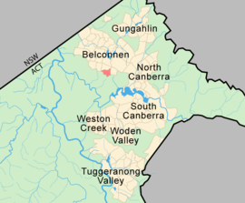
Population: 2,817 (2006 census)[1] Established: 1968 Postcode: 2614 District: Belconnen Assembly Electorate: Ginninderra Federal Division: Fraser Suburbs around Cook: Weetangera Macquarie Aranda Canberra Nature Park Cook Aranda Canberra Nature Park Canberra Nature Park Canberra Nature Park Cook is a suburb of Canberra, Australian Capital Territory, Australia. Cook is in the district of Belconnen. On Census night 2006, Cook had a population of 2,817 people.[1]
The suburb of Cook is named after Captain James Cook and the sixth Prime Minister of Australia Sir Joseph Cook. The streets in Cook are names after notable women from Australian history.
Suburb amenities
- Cook has a small shopping centre including a supermarket and Asian restaurant.
- Cook Primary School was a government run school for children in years K-6. The school was closed at the end of 2007 as part of a rationalisation of primary education across the ACT with most students moving to neighbouring schools in Aranda, Macquarie and Weetangera.
- Cook Preschool.
Geology
Greywacke from the Ordovician Pittman Formation forms a band down the east of Cook. This has been uplifted on the east side of the Deakin Fault. The fault heads in the north north west direction in Cook. A porphyry of Green-grey Dacitic intrusive containing large white feldspar crystals is found in the north east corner of Cook. Mount Painter Volcanics dark grey to grey green crystal tuff is found in the center and south and south west. Green grey rhyodacite of the Walker Volcanics underlie the north west.
Footnotes
- ^ a b Australian Bureau of Statistics (25 October 2007). "Cook (State Suburb)". 2006 Census QuickStats. http://www.censusdata.abs.gov.au/ABSNavigation/prenav/LocationSearch?collection=Census&period=2006&areacode=SSC81101&producttype=QuickStats&breadcrumb=PL&action=401. Retrieved 2009-04-06.
Coordinates: 35°15′35″S 149°03′50″E / 35.25972°S 149.06389°E
Categories:

Wikimedia Foundation. 2010.