- Normanby, Taranaki
-
Normanby 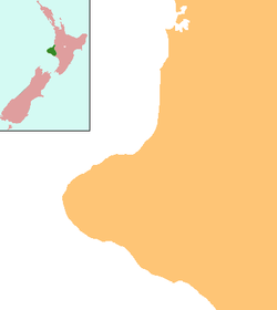
 Normanby
Coordinates: 39°32′28″S 174°16′26″E / 39.54111°S 174.27389°E Country New Zealand Region Taranaki District South Taranaki District Population (2006) – Total 849 Normanby is a small village in South Taranaki, New Zealand. It is approximately 6 km inland from Hawera along State Highway 3. Eltham is 13 km further north.[1][2] It is also situated on the Marton - New Plymouth Line railway, which has been freight-only through Normanby since the cessation of passenger railcar services between Wellington and New Plymouth on 30 July 1977.[3]
The population of Normanby and its surrounding hinterland was 849 in the 2006 Census, a decrease of 24 from 2001.[4]
The town was founded at the site of the Waihi redoubt, which was established as a field headquarters in September 1866 by colonial military forces fighting Hauhau Māori in the Second Taranaki War[5][6]
Contents
Ketemarae Pa
Located near Normanby is Ketemarae Pa, a local historic centre for Maori settlement. It is an entry point for the Whakaahurangi track to Kairoa Pa, near Lepperton. This track linked northern and southern Taranaki before British settlement.[7][8]
Education
Normanby School is a coeducational contributing primary (years 1–6) school with a decile rating of 4 and a roll of 130.[9] The school was established in 1876.[10]
References
- ^ Peter Dowling (editor) (2004), Reed New Zealand Atlas, Reed Books, pp. map 34, ISBN 0-7900-0952-8
- ^ Roger Smith, GeographX (2005), The Geographic Atlas of New Zealand, Robbie Burton, pp. map 97, ISBN 1-877333-20-4
- ^ Geoffrey B. Churchman and Tony Hurst, The Railways of New Zealand: A Journey Through History (Auckland: HarperCollins, 1991), 133.
- ^ Quickstats about Normanby
- ^ South Taranaki District Council website
- ^ The New Zealand Wars, Vol 2 by James Cowan, 1922, chapter 15.
- ^ Rumbletum.org:Ketemarae Pa
- ^ Te Ao Hou: Recent Books on the Maori, June 1959
- ^ Te Kete Ipurangi – Normanby School, Ministry of Education, http://www.tki.org.nz/e/schools/display_school_info.php?school_id=2207
- ^ Fryer, Arthur (2001), Normanby and its school 1876 – 2001, Normanby School Centennial Committee, ISBN 0-473-07470-2, http://www.pukeariki.com/en/stories/newTaranakiStories/arthurfryer.htm
External links
- Statistics NZ: Normanby Community Profile
- Map of Normanby census ward
Categories:- Populated places in New Zealand
- South Taranaki District

Wikimedia Foundation. 2010.