- Nakdong River
-
Naktong (낙동강) River  The Nakdong in Andong
Country South Korea Cities Daegu, Busan Source Taebaek Mountains - location Taebaek, South Korea Length 525 km (326 mi) 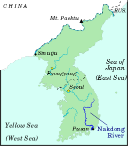 The Nakdong River
Nakdong River Hangul 낙동강 Hanja 洛東江 Revised Romanization Nakdonggang McCune–Reischauer Naktonggang The Nakdong River (Rakdong in North Korean) is the longest river in South Korea, and passes through major cities such as Daegu and Busan.
Contents
Geography
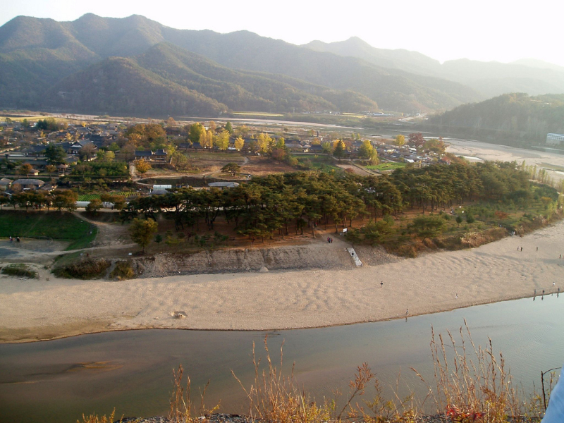
The Nakdong flows from the Taebaek Mountains to the South Sea or Korean Strait, that separates Korea from Japan. The river originates from the junction of the Cheolamcheon and Hwangjicheon streams in Dongjeom-dong, Taebaek city, Gangwon province. From there to its mouth it winds for about 506 kilometres (314 mi). The width of the river ranges from only a few metres in its upper reaches, to several hundred metres towards its estuary.
Major tributaries include the Yeong, Geumho, and Nam rivers. Together with its tributaries, the Nakdong drains most of North Gyeongsang and South Gyeongsang provinces, along with small portions of North Jeolla, South Jeolla, and Gangwon. The total watershed is 23,384 square kilometres (9,029 sq mi).
History
The Nakdong River has played an important role throughout Korean history. The river basin has been a favored dwelling-place for as long as people have inhabited the Korean peninsula. Numerous Neolithic remains have been found in the valley.
Around the 1st century, the valley is believed to have been inhabited by the Byeonhan confederacy tribes. During the Three Kingdoms period, the Gaya confederacy controlled the valley, until they were overrun by Silla in 562. These states exploited the river's potential for navigation and commerce, operating a thriving trade in armor and weapons with neighboring countries, including Yamato period Japan. Through the Silla, Goryeo, and Joseon periods, the river continued to serve as a major transportation corridor in the Gyeongsang region.
As a barrier to movement, the Nakdong River gained sudden prominence during the Korean War. The southern length of the river formed the western portion of the Pusan Perimeter, which the UN forces fought to maintain during the autumn of 1950. The bridge over the Nakdong River at Waegwan was blown up on August 3, 1950 in an effort to prevent North Korean forces from advancing on Daegu. A large number of Korean refugees were killed in the explosion. Although some North Korean forces did cross the Nakdong River in places, for the most part the river still marks their furthest advance.
Ecology
The Nakdong valley includes numerous floodplain wetlands, the most well-known of which are the Joonam Reservoirs near Changwon City and Upo Ramsar site, in Changnyeong County, South Gyeongsang. These wetlands, while significantly degraded and over-developed, still provide habitat to a significant number of rare and threatened species, most especially birds (such as the Baikal Teal, Anas formosa, and White-naped Crane, Grus vipio), fish and plants. Despite being home to the bustling Port of Busan, the Nakdong Estuary is also internationally important for waterbirds, despite recent ecologically-destructive developments including reclamation for housing and industry (e.g. the Busan New Port), the ongoing construction of a major bridge (the Miyeonji Bridge) and most recently the threatened construction of the Korean Grand Canal project.
The Nakdong and its tributaries also serve as a major source of drinking water for the inhabitants of the river basin and others nearby. However, water pollution due to domestic and agricultural wastewater remains a serious concern.
Economic role
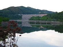 Andong dam
Although all but the southernmost reaches of the Nakdong River have ceased to serve as a major commercial waterway, the river continues to feed those dwelling near it, both directly through fishing and indirectly through irrigation. Substantial amounts of snails and catfish are taken from the waters and used in local cuisine.
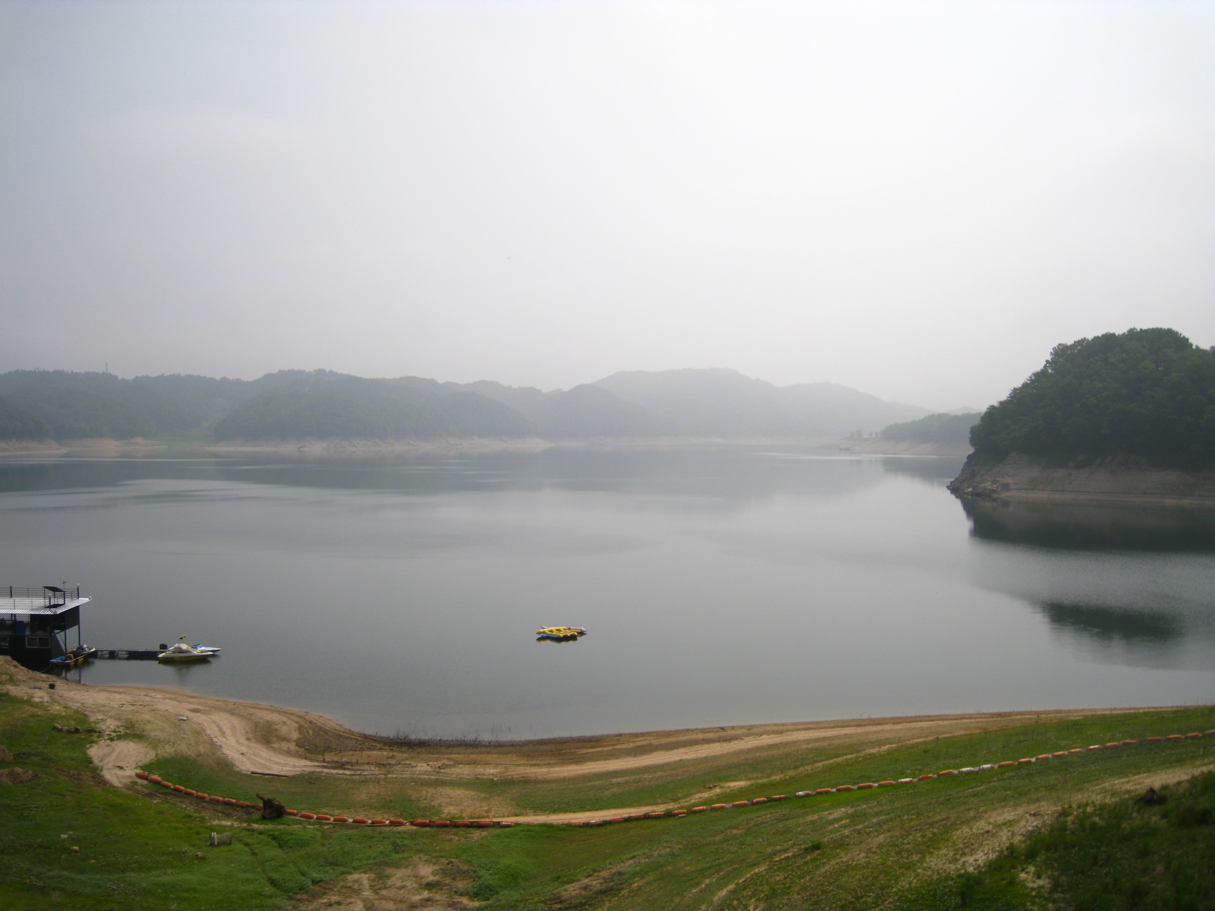
Near Andong, a series of massive hydroelectric dams have been constructed, creating a small chain of artificial lakes of which Andong Lake is the largest. These lakes also support a substantial recreational industry. Bass fishing is especially popular, since the lakes have been artificially stocked with bass.
Pushing forward with his election promise, Lee Myung Bak, the current president of South Korea, aims to include the Nakdong River in a new canal project spanning the length of the country from Seoul to Busan. Encountering some controversy, ground has not yet been broken on the Grand Korean Waterway.
See also
References
- "낙동강 (洛東江)" (in Korean). Doosan Encyclopedia. http://www.encyber.com/search_w/ctdetail.php?masterno=34615&contentno=34615.
Coordinates: 35°03′06″N 128°55′21″E / 35.05167°N 128.9225°E
Categories:- Rivers of South Korea
- Gyeongsangbuk-do
- Gyeongsangnam-do
- Geography of Busan


Wikimedia Foundation. 2010.